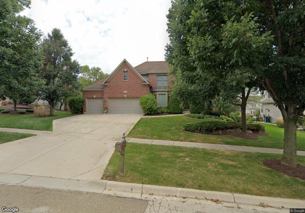
941 Knox Ln Batavia, IL 60510
Southeast Batavia NeighborhoodEstimated Value: $589,517 - $771,000
4
Beds
--
Bath
3,158
Sq Ft
$211/Sq Ft
Est. Value
About This Home
This home is located at 941 Knox Ln, Batavia, IL 60510 and is currently estimated at $666,629, approximately $211 per square foot. 941 Knox Ln is a home located in Kane County with nearby schools including J B Nelson Elementary School, Sam Rotolo Middle School, and Batavia Sr High School.
Ownership History
Date
Name
Owned For
Owner Type
Purchase Details
Closed on
Aug 16, 2022
Sold by
Olson Todd M and Olson Sheila M
Bought by
Todd M Olson And Sheila M Olson Living Trust
Current Estimated Value
Purchase Details
Closed on
Dec 21, 2001
Sold by
Mccarthy Builders Inc
Bought by
Olson Todd M and Olson Sheila M
Home Financials for this Owner
Home Financials are based on the most recent Mortgage that was taken out on this home.
Original Mortgage
$300,700
Interest Rate
7.07%
Create a Home Valuation Report for This Property
The Home Valuation Report is an in-depth analysis detailing your home's value as well as a comparison with similar homes in the area
Home Values in the Area
Average Home Value in this Area
Purchase History
| Date | Buyer | Sale Price | Title Company |
|---|---|---|---|
| Todd M Olson And Sheila M Olson Living Trust | -- | -- | |
| Olson Todd M | $447,000 | First American Title Co |
Source: Public Records
Mortgage History
| Date | Status | Borrower | Loan Amount |
|---|---|---|---|
| Previous Owner | Olson Todd M | $300,700 | |
| Closed | Olson Todd M | $56,820 |
Source: Public Records
Tax History
| Year | Tax Paid | Tax Assessment Tax Assessment Total Assessment is a certain percentage of the fair market value that is determined by local assessors to be the total taxable value of land and additions on the property. | Land | Improvement |
|---|---|---|---|---|
| 2024 | $12,433 | $165,255 | $26,539 | $138,716 |
| 2023 | $12,184 | $149,986 | $24,087 | $125,899 |
| 2022 | $11,716 | $140,174 | $22,511 | $117,663 |
| 2021 | $12,602 | $148,159 | $21,350 | $126,809 |
| 2020 | $12,295 | $145,311 | $20,940 | $124,371 |
| 2019 | $12,790 | $147,824 | $20,199 | $127,625 |
| 2018 | $12,750 | $147,309 | $19,430 | $127,879 |
| 2017 | $12,919 | $147,604 | $18,789 | $128,815 |
| 2016 | $12,652 | $143,305 | $18,242 | $125,063 |
| 2015 | -- | $140,042 | $17,827 | $122,215 |
| 2014 | -- | $135,634 | $17,266 | $118,368 |
| 2013 | -- | $142,510 | $26,452 | $116,058 |
Source: Public Records
Map
Nearby Homes
- 1136 Pine Ct
- 701 Viking Dr
- 635 Kingsbury Ct Unit 4
- 418 Churchill Ct
- 1220 Davey Dr
- 940 Orchard Ct
- Lot 4 Manchester Ave
- 1098 Cleveland Ave
- 570 Violet Ln
- 1208 Thrun Dr
- 1109 Edwards Dr
- Lot 1 Center St
- 261 Johnson Woods Dr
- 201 Violet Ln
- 860 S River St
- 1025 E Wilson St
- 492 Bond Dr
- 637 E Wilson St
- 622 Spring St
- 304 S Water St
Your Personal Tour Guide
Ask me questions while you tour the home.