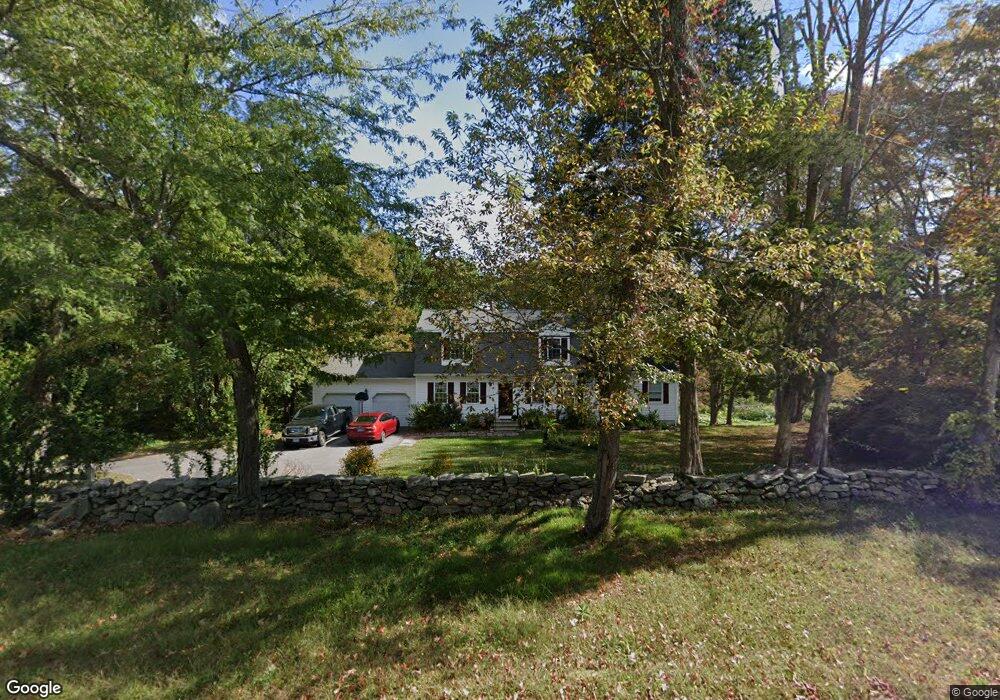
944 Colonel Ledyard Hwy Ledyard, CT 06339
Estimated Value: $492,123 - $503,000
4
Beds
4
Baths
2,208
Sq Ft
$225/Sq Ft
Est. Value
About This Home
This home is located at 944 Colonel Ledyard Hwy, Ledyard, CT 06339 and is currently estimated at $497,781, approximately $225 per square foot. 944 Colonel Ledyard Hwy is a home located in New London County with nearby schools including Ledyard Middle School and Ledyard High School.
Ownership History
Date
Name
Owned For
Owner Type
Purchase Details
Closed on
Mar 16, 2001
Sold by
Sanders Richard W and Sanders Lisa M
Bought by
Jaehn Dinah H and Jaehn Rhett R
Current Estimated Value
Purchase Details
Closed on
Nov 17, 1997
Sold by
Lenihan Michael
Bought by
Sanders Richard W and Sanders Lisa M
Purchase Details
Closed on
Mar 7, 1997
Sold by
Geer William and Geer Kenneth James
Bought by
Lenihan Michael
Create a Home Valuation Report for This Property
The Home Valuation Report is an in-depth analysis detailing your home's value as well as a comparison with similar homes in the area
Home Values in the Area
Average Home Value in this Area
Purchase History
| Date | Buyer | Sale Price | Title Company |
|---|---|---|---|
| Jaehn Dinah H | $196,000 | -- | |
| Sanders Richard W | $166,900 | -- | |
| Lenihan Michael | $38,000 | -- |
Source: Public Records
Mortgage History
| Date | Status | Borrower | Loan Amount |
|---|---|---|---|
| Open | Lenihan Michael | $125,000 | |
| Closed | Lenihan Michael | $138,000 | |
| Closed | Lenihan Michael | $10,000 |
Source: Public Records
Tax History
| Year | Tax Paid | Tax Assessment Tax Assessment Total Assessment is a certain percentage of the fair market value that is determined by local assessors to be the total taxable value of land and additions on the property. | Land | Improvement |
|---|---|---|---|---|
| 2025 | $7,344 | $197,750 | $53,620 | $144,130 |
| 2024 | $6,963 | $197,750 | $53,620 | $144,130 |
| 2023 | $6,355 | $183,890 | $53,620 | $130,270 |
| 2022 | $6,219 | $183,890 | $53,620 | $130,270 |
| 2021 | $6,179 | $183,890 | $53,620 | $130,270 |
| 2020 | $6,139 | $175,560 | $50,890 | $124,670 |
| 2019 | $6,155 | $175,560 | $50,890 | $124,670 |
| 2018 | $6,020 | $175,560 | $50,890 | $124,670 |
| 2017 | $5,713 | $175,560 | $50,890 | $124,670 |
| 2016 | $5,600 | $175,560 | $50,890 | $124,670 |
| 2015 | $5,337 | $175,560 | $50,890 | $124,670 |
| 2014 | $5,490 | $183,610 | $53,620 | $129,990 |
Source: Public Records
Map
Nearby Homes
- 16 Marlene Dr
- 14 Abbey Rd
- 25 Coachman Pike
- 16 Abbey Rd
- 36 Bittersweet Dr
- 104 Route 2a
- 118 Route 2a
- 23 Avery Hill Rd
- 24 Fairway Dr Unit 9
- 991 Shewville Rd
- 7 Halls Mill Rd
- 36 Route 2a
- 4 N Glenwoods Rd
- 15 Paster Rd
- 3 Holdsworth Rd
- 381 Route 2
- 675 Colonel Ledyard Hwy
- 43 Drawbridge Rd
- 4 Amber Cir
- 183 Whalehead Rd
- 947 Colonel Ledyard Hwy
- 942 Colonel Ledyard Hwy
- 954 Colonel Ledyard Hwy
- 936 Colonel Ledyard Hwy
- 938 Colonel Ledyard Hwy
- 962 Colonel Ledyard Hwy
- 933 Colonel Ledyard Hwy
- 961 Colonel Ledyard Hwy
- 934 Colonel Ledyard Hwy
- 943 Colonel Ledyard Hwy
- 925 Colonel Ledyard Hwy
- 969 Colonel Ledyard Hwy
- 923 Colonel Ledyard Hwy
- 919 Colonel Ledyard Hwy
- 963 Colonel Ledyard Hwy
- 965 Colonel Ledyard Hwy
- 921 Colonel Ledyard Hwy
- 27 Thomas Rd
- 915 Colonel Ledyard Hwy
- 23 Thomas Rd
Your Personal Tour Guide
Ask me questions while you tour the home.