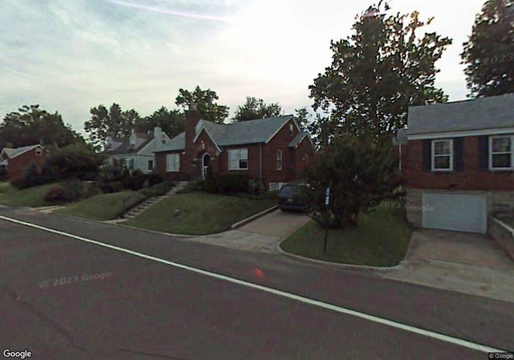
9441 Mackenzie Rd Saint Louis, MO 63123
Estimated Value: $202,000 - $228,000
2
Beds
1
Bath
1,150
Sq Ft
$187/Sq Ft
Est. Value
About This Home
This home is located at 9441 Mackenzie Rd, Saint Louis, MO 63123 and is currently estimated at $215,171, approximately $187 per square foot. 9441 Mackenzie Rd is a home located in St. Louis County with nearby schools including Mesnier Primary School, Gotsch Intermediate School, and Rogers Middle School.
Ownership History
Date
Name
Owned For
Owner Type
Purchase Details
Closed on
May 23, 2013
Sold by
Mahoney Paul
Bought by
Mahoney Paul and Mahoney Gloria
Current Estimated Value
Home Financials for this Owner
Home Financials are based on the most recent Mortgage that was taken out on this home.
Original Mortgage
$72,700
Interest Rate
3.43%
Mortgage Type
New Conventional
Purchase Details
Closed on
Sep 10, 1998
Sold by
Jones Paul Keaton & Kathy E Trs
Bought by
Mahoney Paul
Home Financials for this Owner
Home Financials are based on the most recent Mortgage that was taken out on this home.
Original Mortgage
$66,000
Interest Rate
6.95%
Create a Home Valuation Report for This Property
The Home Valuation Report is an in-depth analysis detailing your home's value as well as a comparison with similar homes in the area
Home Values in the Area
Average Home Value in this Area
Purchase History
| Date | Buyer | Sale Price | Title Company |
|---|---|---|---|
| Mahoney Paul | -- | Freedom Title Llc St Louis | |
| Mahoney Paul | -- | -- |
Source: Public Records
Mortgage History
| Date | Status | Borrower | Loan Amount |
|---|---|---|---|
| Closed | Mahoney Paul | $72,700 | |
| Closed | Mahoney Paul | $66,000 |
Source: Public Records
Tax History
| Year | Tax Paid | Tax Assessment Tax Assessment Total Assessment is a certain percentage of the fair market value that is determined by local assessors to be the total taxable value of land and additions on the property. | Land | Improvement |
|---|---|---|---|---|
| 2025 | $2,750 | $38,780 | $12,880 | $25,900 |
| 2024 | $2,750 | $33,820 | $9,200 | $24,620 |
| 2023 | $2,658 | $33,820 | $9,200 | $24,620 |
| 2022 | $2,617 | $28,520 | $9,200 | $19,320 |
| 2021 | $2,389 | $28,520 | $9,200 | $19,320 |
| 2020 | $2,318 | $25,820 | $8,870 | $16,950 |
| 2019 | $2,314 | $25,820 | $8,870 | $16,950 |
| 2018 | $2,076 | $20,450 | $6,180 | $14,270 |
| 2016 | $1,642 | $17,250 | $4,120 | $13,130 |
Source: Public Records
Map
Nearby Homes
- 9504 Brenda Ave
- 9343 Mackenzie Rd
- 9337 Mackenzie Rd
- 9319 Brenda Ave
- 9723 Crayford Rd Unit 1D
- 9838 Coventry Ln
- 9740 Bexley Station Dr Unit 7G
- 9740 Bexley Station Dr Unit 7J
- 9842 Coventry Ln
- 9755 Newham Dr Unit 10D
- 9702 Sterling Place
- 9418 Radio Dr
- 9304 Aster Ave
- 9304 Lenard Ct
- 9320 Sterling Place
- 9208 Hallock Dr
- 9744 Radio Dr
- 9200 Hallock Dr
- 9117 Tiber Ct
- 9743 Tesson Ferry Rd
- 9437 Mackenzie Rd
- 9445 Mackenzie Rd
- 9429 Mackenzie Rd
- 9451 Mackenzie Rd
- 9444 Brenda Ave
- 9438 Brenda Ave
- 9450 Brenda Ave
- 9425 Mackenzie Rd
- 9434 Brenda Ave
- 9454 Brenda Ave
- 9436 Mackenzie Rd
- 9440 Mackenzie Rd
- 9455 Mackenzie Rd
- 9430 Brenda Ave
- 9446 Mackenzie Rd
- 9458 Brenda Ave
- 9423 Mackenzie Rd
- 9556 Lydell Dr
- 9430 Mackenzie Rd
- 9465 Mackenzie Rd
Your Personal Tour Guide
Ask me questions while you tour the home.