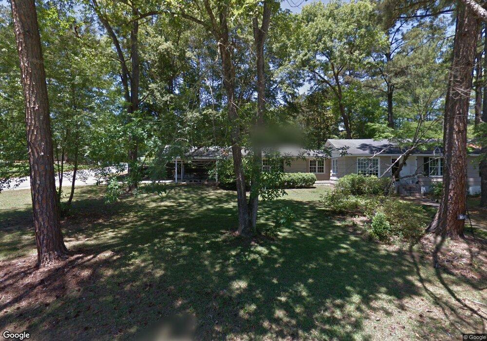
950 Glenbrook Rd Macon, GA 31210
Estimated Value: $170,000 - $185,000
3
Beds
2
Baths
1,736
Sq Ft
$102/Sq Ft
Est. Value
About This Home
This home is located at 950 Glenbrook Rd, Macon, GA 31210 and is currently estimated at $176,780, approximately $101 per square foot. 950 Glenbrook Rd is a home located in Bibb County with nearby schools including Lane Elementary School, Howard Middle School, and Howard High School.
Ownership History
Date
Name
Owned For
Owner Type
Purchase Details
Closed on
Jun 3, 2013
Sold by
Secretary Of Hud
Bought by
Phillips Tony C
Current Estimated Value
Purchase Details
Closed on
Jun 22, 2012
Sold by
Gmac Mortgage Llc
Bought by
Secretary Of Hud
Purchase Details
Closed on
May 1, 2012
Sold by
Deaver Adam W and Deaver Laurie Paige
Bought by
Gmac Mortgage Llc
Purchase Details
Closed on
Apr 2, 2009
Sold by
Deaver Adam Ward
Bought by
Deaver Laurie Paige
Purchase Details
Closed on
Jan 3, 1997
Bought by
Deaver Adam W
Create a Home Valuation Report for This Property
The Home Valuation Report is an in-depth analysis detailing your home's value as well as a comparison with similar homes in the area
Purchase History
| Date | Buyer | Sale Price | Title Company |
|---|---|---|---|
| Phillips Tony C | $41,900 | None Available | |
| Secretary Of Hud | -- | None Available | |
| Gmac Mortgage Llc | $124,297 | None Available | |
| Gmac Mortgage Llc | $124,300 | -- | |
| Deaver Laurie Paige | -- | None Available | |
| Deaver Adam W | $82,500 | -- |
Source: Public Records
Tax History
| Year | Tax Paid | Tax Assessment Tax Assessment Total Assessment is a certain percentage of the fair market value that is determined by local assessors to be the total taxable value of land and additions on the property. | Land | Improvement |
|---|---|---|---|---|
| 2025 | $988 | $47,190 | $9,500 | $37,690 |
| 2024 | $1,021 | $47,190 | $9,500 | $37,690 |
| 2023 | $271 | $35,671 | $7,600 | $28,071 |
| 2022 | $1,104 | $38,891 | $9,388 | $29,503 |
| 2021 | $1,250 | $39,905 | $9,388 | $30,517 |
| 2020 | $945 | $31,332 | $7,511 | $23,821 |
| 2019 | $952 | $31,332 | $7,511 | $23,821 |
| 2018 | $1,639 | $31,332 | $7,511 | $23,821 |
| 2017 | $882 | $30,550 | $7,135 | $23,415 |
| 2016 | $587 | $27,131 | $6,760 | $20,372 |
| 2015 | $970 | $26,380 | $6,009 | $20,372 |
| 2014 | $601 | $32,499 | $6,009 | $26,490 |
Source: Public Records
Map
Nearby Homes
- 914 Glenbrook Rd
- 122 Lundy Ct
- 1024 Normandy Rd
- 840 Balim Ct
- 636 Lokchapee Ridge
- 835 Old Lundy Rd
- 1209 Normandy Rd
- 843 Green Oak Terrace
- 166 Brookstone Way
- 673 Commanche Dr
- 715 Gay Dr
- 1161 Ousley Place
- 177 Brookstone Way
- 870 Glen Hill Ct
- 1339 Forest Hill Rd
- 556 Commanche Place
- 3678 Northside Dr
- 1422 Forest Hill Rd
- 3640 Northside Dr
- 3622 Northside Dr
- 950 Glenbrook Rd Unit 341
- 1109 Darlington Dr
- 970 Glenbrook Rd
- 953 Glenbrook Rd
- 1106 Darlington Dr
- 1115 Darlington Dr
- 965 Glenbrook Rd
- 933 Glenbrook Rd
- 1000 Glenbrook Rd
- 945 Glenbrook Rd
- 1012 Glenbrook Rd
- 975 Glenbrook Rd
- 1121 Darlington Dr
- 1124 Darlington Dr
- 924 Glenbrook Rd
- 925 Glenbrook Rd
- 1024 Glenbrook Rd
- 1127 Darlington Dr
- 1001 Glenbrook Rd
- 1070 Matthews Dr
Your Personal Tour Guide
Ask me questions while you tour the home.