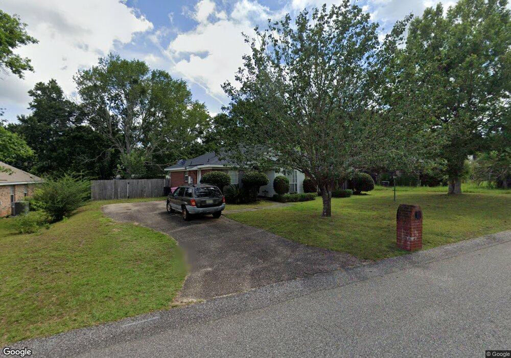
9510 Oak Forrest Dr Mobile, AL 36695
Baker NeighborhoodEstimated Value: $194,178 - $256,000
About This Home
This home is located at 9510 Oak Forrest Dr, Mobile, AL 36695 and is currently estimated at $233,795, approximately $140 per square foot. 9510 Oak Forrest Dr is a home located in Mobile County with nearby schools including Elsie Collier Elementary School, Bernice J Causey Middle School, and Baker High School.
Ownership History
We collect this data history from publicly available records. To have your information removed, we recommend requesting removal directly through your county’s website.
Purchase Details
Home Financials for this Owner
Home Financials are based on the most recent Mortgage that was taken out on this home.Purchase Details
Home Values in the Area
Average Home Value in this Area
Purchase History
We collect this data history from publicly available records. To have your information removed, we recommend requesting removal directly through your county’s website.
| Date | Buyer | Sale Price | Title Company |
|---|---|---|---|
| -- | Dst | ||
| -- | At |
Mortgage History
We collect this data history from publicly available records. To have your information removed, we recommend requesting removal directly through your county’s website.
| Date | Status | Borrower | Loan Amount |
|---|---|---|---|
| Closed | $181,500 |
Tax History
We collect this data history from publicly available records. To have your information removed, we recommend requesting removal directly through your county’s website.
| Year | Tax Paid | Tax Assessment Tax Assessment Total Assessment is a certain percentage of the fair market value that is determined by local assessors to be the total taxable value of land and additions on the property. | Land | Improvement |
|---|---|---|---|---|
| 2025 | -- | $16,660 | $4,000 | $12,660 |
| 2024 | -- | $15,530 | $4,000 | $11,530 |
| 2023 | $0 | $15,030 | $4,000 | $11,030 |
| 2022 | $0 | $13,490 | $4,000 | $9,490 |
| 2021 | $0 | $13,290 | $4,000 | $9,290 |
| 2020 | $0 | $13,640 | $3,200 | $10,440 |
| 2019 | $0 | $13,700 | $0 | $0 |
| 2018 | $0 | $13,960 | $0 | $0 |
| 2017 | $0 | $12,780 | $0 | $0 |
| 2016 | $501 | $12,900 | $0 | $0 |
| 2013 | $638 | $13,660 | $0 | $0 |
Map
- 9470 Oak Forrest Dr
- 9470 Burnt Ash Dr
- 9630 Oak Forrest Dr Unit 2
- 9650 Oak Forrest Dr
- 9355 New Neck Rd
- 0 New Neck Rd Unit 387066
- 1281 Burnt Tree Dr E
- 821 Copperfield Dr W
- 740 Copperfield Dr W
- 1170 Wellington Ct S
- 9441 Copperfield Dr N
- 10635 Burlington Estates Dr
- 11849 Airport Blvd
- 11905 Airport Blvd
- 11905 Airport Blvd Unit 3
- 1145 Dominion Dr E
- 0 Hampton Ct
- 10023 Springfield Ct
- 1333 Kilearn Dr
- 0 Creek Ct
- 9511 Ashwood Dr
- 9521 Ashwood Dr
- 9491 Ashwood Dr
- 9520 Oak Forrest Dr
- 9520 Oak Forest Dr
- 9500 Oak Forrest Dr
- 9530 Oak Forrest Dr
- 9481 Ashwood Dr
- 9510 Ashwood Dr
- 9535 Seymour Ct
- 9490 Oak Forrest Dr
- 9490 Ashwood Dr
- 10453 Heritance Rd
- 15120 Private Rd Unit 368
- 9480 Oak Forrest Dr Unit 2
- 9480 Ashwood Dr
- 9471 Ashwood Dr
- 9545 Seymour Ct
- 9521 Oak Forrest Dr
- 9511 Oak Forrest Dr
Ask me questions while you tour the home.