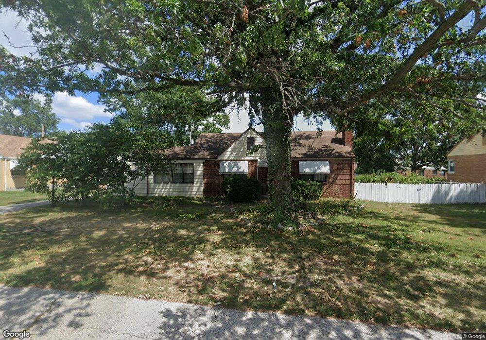
9510 Tesson Ferry Rd Saint Louis, MO 63123
Estimated Value: $244,508 - $299,000
2
Beds
1
Bath
1,680
Sq Ft
$160/Sq Ft
Est. Value
About This Home
This home is located at 9510 Tesson Ferry Rd, Saint Louis, MO 63123 and is currently estimated at $268,127, approximately $159 per square foot. 9510 Tesson Ferry Rd is a home located in St. Louis County with nearby schools including Mesnier Primary School, Gotsch Intermediate School, and Rogers Middle School.
Ownership History
Date
Name
Owned For
Owner Type
Purchase Details
Closed on
Apr 9, 2025
Sold by
Lorenz Lynda L and Lorenz Doyle W
Bought by
Doyle And Lynda Lorenz Living Trust and Lorenz
Current Estimated Value
Purchase Details
Closed on
Feb 8, 2003
Sold by
Lorenz Lynda L and Lorenz Doyle W
Bought by
Lorenz Lynda L
Home Financials for this Owner
Home Financials are based on the most recent Mortgage that was taken out on this home.
Original Mortgage
$82,800
Interest Rate
5.93%
Create a Home Valuation Report for This Property
The Home Valuation Report is an in-depth analysis detailing your home's value as well as a comparison with similar homes in the area
Home Values in the Area
Average Home Value in this Area
Purchase History
| Date | Buyer | Sale Price | Title Company |
|---|---|---|---|
| Doyle And Lynda Lorenz Living Trust | -- | None Listed On Document | |
| Lorenz Lynda L | -- | -- |
Source: Public Records
Mortgage History
| Date | Status | Borrower | Loan Amount |
|---|---|---|---|
| Previous Owner | Lorenz Lynda L | $82,800 |
Source: Public Records
Tax History
| Year | Tax Paid | Tax Assessment Tax Assessment Total Assessment is a certain percentage of the fair market value that is determined by local assessors to be the total taxable value of land and additions on the property. | Land | Improvement |
|---|---|---|---|---|
| 2025 | $3,067 | $44,370 | $15,410 | $28,960 |
| 2024 | $3,067 | $37,770 | $11,130 | $26,640 |
| 2023 | $3,067 | $37,770 | $11,130 | $26,640 |
| 2022 | $2,881 | $31,430 | $11,970 | $19,460 |
| 2021 | $2,630 | $31,430 | $11,970 | $19,460 |
| 2020 | $2,644 | $29,490 | $9,160 | $20,330 |
| 2019 | $2,638 | $29,490 | $9,160 | $20,330 |
| 2018 | $2,228 | $21,970 | $8,570 | $13,400 |
| 2017 | $2,214 | $21,970 | $8,570 | $13,400 |
| 2016 | $2,105 | $22,200 | $9,410 | $12,790 |
| 2015 | $2,114 | $22,200 | $9,410 | $12,790 |
| 2014 | $2,508 | $26,280 | $5,970 | $20,310 |
Source: Public Records
Map
Nearby Homes
- 9842 Coventry Ln
- 9838 Coventry Ln
- 8942 Eden Ave
- 9723 Crayford Rd Unit 1D
- 9504 Brenda Ave
- 9337 Mackenzie Rd
- 9702 Sterling Place
- 9740 Bexley Station Dr Unit 7G
- 9740 Bexley Station Dr Unit 7J
- 9755 Newham Dr Unit 10D
- 9840 Lakeford Ln
- 9816 Lakeford Ln
- 9835 Ridgely Ln
- 9304 Aster Ave
- 9320 Sterling Place
- 9831 Lindhall Ln
- 8517 Ava Dr
- 8520 Ava Dr
- 9304 Lenard Ct
- 9999 Casa Rosa Dr
- 9500 Tesson Ferry Rd
- 9518 Tesson Ferry Rd
- 9505 Berwick Dr
- 9515 Berwick Dr
- 9416 Tesson Ferry Rd
- 9939 Coventry Ln
- 9929 Berwick Dr
- 9920 Berwick Dr
- 9921 Berwick Dr
- 9525 Tesson Ferry Rd
- 9921 Coventry Ln
- 9541 Tesson Ferry Rd
- 9938 Coventry Ln
- 9915 Berwick Dr
- 9930 Coventry Ln
- 9912 Berwick Dr
- 9545 Tesson Ferry Rd
- 9924 Coventry Ln
- 10021 Coventry Ln
- 9911 Coventry Ln
Your Personal Tour Guide
Ask me questions while you tour the home.