954 Randolph Ave Milton, MA 02186
Hillside Street NeighborhoodEstimated Value: $863,000 - $977,097
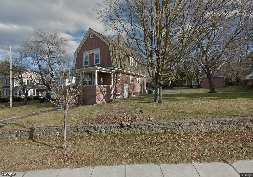
About This Home
This home is located at 954 Randolph Ave, Milton, MA 02186 and is currently estimated at $922,524, approximately $562 per square foot. 954 Randolph Ave is a home located in Norfolk County with nearby schools including Milton High School, St. Mary of the Hills School, and Milton Academy.
Ownership History
We collect this data history from publicly available records. To have your information removed, we recommend requesting removal directly through your county’s website.
Purchase Details
Home Financials for this Owner
Home Financials are based on the most recent Mortgage that was taken out on this home.Home Values in the Area
Average Home Value in this Area
Purchase History
We collect this data history from publicly available records. To have your information removed, we recommend requesting removal directly through your county’s website.
| Date | Buyer | Sale Price | Title Company |
|---|---|---|---|
| $350,000 | -- |
Mortgage History
We collect this data history from publicly available records. To have your information removed, we recommend requesting removal directly through your county’s website.
| Date | Status | Borrower | Loan Amount |
|---|---|---|---|
| Open | $280,000 |
Tax History
We collect this data history from publicly available records. To have your information removed, we recommend requesting removal directly through your county’s website.
| Year | Tax Paid | Tax Assessment Tax Assessment Total Assessment is a certain percentage of the fair market value that is determined by local assessors to be the total taxable value of land and additions on the property. | Land | Improvement |
|---|---|---|---|---|
| 2025 | $8,736 | $787,700 | $386,100 | $401,600 |
| 2024 | $8,488 | $777,300 | $367,700 | $409,600 |
| 2023 | $8,270 | $725,400 | $350,300 | $375,100 |
| 2022 | $8,006 | $642,000 | $350,300 | $291,700 |
| 2021 | $7,760 | $591,000 | $313,100 | $277,900 |
| 2020 | $7,591 | $578,600 | $305,500 | $273,100 |
| 2019 | $7,403 | $561,700 | $296,600 | $265,100 |
| 2018 | $7,195 | $521,000 | $260,900 | $260,100 |
| 2017 | $6,738 | $496,900 | $248,500 | $248,400 |
| 2016 | $7,109 | $526,600 | $295,100 | $231,500 |
| 2015 | $6,500 | $466,300 | $240,700 | $225,600 |
Map
- 52 Ridgewood Rd
- 37 Sassamon Ave
- 79 Hilltop St
- 341 Highland St
- 282 Highland St
- 55 Parkwood Dr
- 268 Highland St
- 610 Harland St
- 540 Harland St
- 73 Pleasant St Unit 73
- 403405 Reedsdale Rd
- 98 Pleasant St
- 650 Canton Ave
- 90 Countryside Ln
- 7 Phyllis Ln
- 85 Old Farm Rd
- 29 Buckingham Rd
- 625 Canton Ave
- 567 Canton Ave
- 40 Elm St
- 15 Nahanton Ave
- 0 Heather Dr
- 1006 Randolph Ave
- 10 Nahanton Ave
- 8 Nahanton Ave
- 14 Nahanton Ave
- 14 Nahanton Ave Unit 1
- 18 Nahanton Ave
- 25 Nahanton Ave
- 940 Randolph Ave
- 29 Nahanton Ave
- 1023 Randolph Ave
- 14 Sassamon Ave
- 30 Nahanton Ave
- 33 Nahanton Ave
- 1028 Randolph Ave
- 3 Heather Dr
- 32 Nahanton Ave
- 20 Sassamon Ave
- 34 Nahanton Ave
Ask me questions while you tour the home.