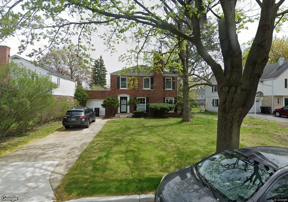
9547 Springfield Ave Evanston, IL 60203
North Skokie NeighborhoodEstimated Value: $567,000 - $718,000
3
Beds
3
Baths
1,861
Sq Ft
$352/Sq Ft
Est. Value
About This Home
This home is located at 9547 Springfield Ave, Evanston, IL 60203 and is currently estimated at $654,727, approximately $351 per square foot. 9547 Springfield Ave is a home located in Cook County with nearby schools including Walker Elementary School, Chute Middle School, and Evanston Township High School.
Ownership History
Date
Name
Owned For
Owner Type
Purchase Details
Closed on
Sep 27, 2017
Sold by
Barston Eugene Myron
Bought by
Tichenor Alexander D and Griffin Aileen C
Current Estimated Value
Home Financials for this Owner
Home Financials are based on the most recent Mortgage that was taken out on this home.
Original Mortgage
$380,000
Outstanding Balance
$321,135
Interest Rate
4.62%
Mortgage Type
New Conventional
Estimated Equity
$333,592
Purchase Details
Closed on
Jan 23, 2004
Sold by
Barston Eugene M and Barston Gilda
Bought by
Barston Eugene Myron and Barston Gilda
Create a Home Valuation Report for This Property
The Home Valuation Report is an in-depth analysis detailing your home's value as well as a comparison with similar homes in the area
Home Values in the Area
Average Home Value in this Area
Purchase History
We collect this data history from publicly available records. To have your information removed, we recommend requesting removal directly through your county’s website.
| Date | Buyer | Sale Price | Title Company |
|---|---|---|---|
| Tichenor Alexander D | $400,000 | Barrister Title | |
| Barston Eugene Myron | -- | -- |
Source: Public Records
Mortgage History
We collect this data history from publicly available records. To have your information removed, we recommend requesting removal directly through your county’s website.
| Date | Status | Borrower | Loan Amount |
|---|---|---|---|
| Open | Tichenor Alexander D | $380,000 |
Source: Public Records
Tax History
| Year | Tax Paid | Tax Assessment Tax Assessment Total Assessment is a certain percentage of the fair market value that is determined by local assessors to be the total taxable value of land and additions on the property. | Land | Improvement |
|---|---|---|---|---|
| 2025 | $11,256 | $57,000 | $18,020 | $38,980 |
| 2024 | $11,256 | $47,324 | $15,017 | $32,307 |
| 2023 | $10,806 | $47,324 | $15,017 | $32,307 |
| 2022 | $10,806 | $47,324 | $15,017 | $32,307 |
| 2021 | $10,999 | $42,168 | $9,010 | $33,158 |
| 2020 | $10,826 | $42,168 | $9,010 | $33,158 |
| 2019 | $10,683 | $46,339 | $9,010 | $37,329 |
| 2018 | $12,935 | $47,808 | $7,722 | $40,086 |
| 2017 | $11,035 | $47,808 | $7,722 | $40,086 |
| 2016 | $10,908 | $47,808 | $7,722 | $40,086 |
| 2015 | $10,890 | $45,623 | $6,650 | $38,973 |
| 2014 | $10,795 | $45,623 | $6,650 | $38,973 |
| 2013 | $10,646 | $45,623 | $6,650 | $38,973 |
Source: Public Records
Map
Nearby Homes
- 9515 Hamlin Ave
- 9360 Ridgeway Ave
- 3029 Simpson St
- 9343 Hamlin Ave
- 2311 Ridgeway Ave
- 4159 Golf Rd
- 9714 Kedvale Ave
- 9435 Central Park Ave
- 9242 Ridgeway Ave
- 9308 Karlov Ave
- 2921 Simpson St
- 9239 Kedvale Ave
- 4050 Church St
- 9138 Four Winds Way
- 2216 Forestview Rd
- 9527 Lowell Ave
- 9200 Kedvale Ave
- 9046 Pottawattami Dr
- 2555 Gross Point Rd Unit 202
- 2724 Simpson St
- 3853 Golf Rd
- 9543 Springfield Ave
- 3843 Golf Rd
- 9540 Avers Ave
- 3837 Golf Rd
- 3837 Golf Rd
- 9537 Springfield Ave
- 9546 Avers Ave
- 9550 Springfield Ave
- 9536 Avers Ave
- 9536 Avers Ave
- 9532 Springfield Ave
- 9532 Avers Ave
- 9521 Springfield Ave
- 3915 Golf Rd
- 3201 Simpson St
- 407 Trinity Ct
- 9528 Springfield Ave
- 405 Trinity Ct
- 9517 Springfield Ave
Your Personal Tour Guide
Ask me questions while you tour the home.