959 Mcbee Rd Sugarcreek Township, OH 45305
Estimated Value: $283,446 - $305,000
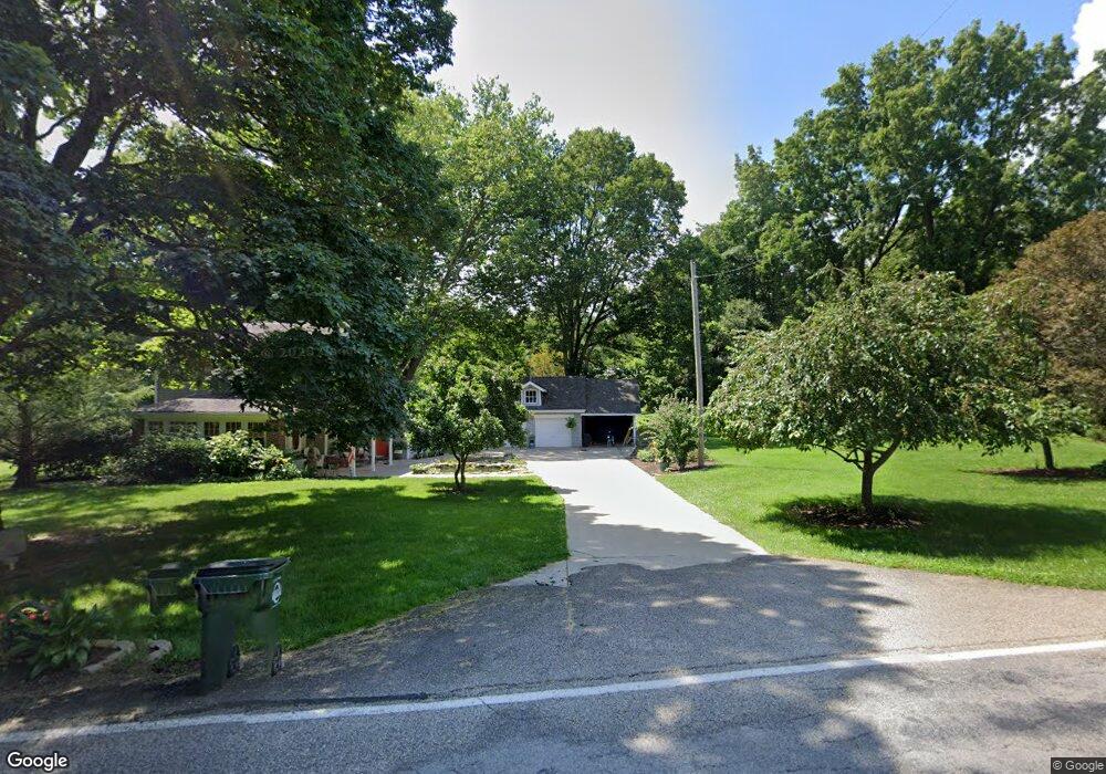
About This Home
This home is located at 959 Mcbee Rd, Sugarcreek Township, OH 45305 and is currently estimated at $295,112, approximately $207 per square foot. 959 Mcbee Rd is a home located in Greene County with nearby schools including Bell Creek Intermediate School, Stephen Bell Elementary School, and Bellbrook Middle School.
Ownership History
We collect this data history from publicly available records. To have your information removed, we recommend requesting removal directly through your county’s website.
Purchase Details
Home Financials for this Owner
Home Financials are based on the most recent Mortgage that was taken out on this home.Purchase Details
Home Values in the Area
Average Home Value in this Area
Purchase History
We collect this data history from publicly available records. To have your information removed, we recommend requesting removal directly through your county’s website.
| Date | Buyer | Sale Price | Title Company |
|---|---|---|---|
| $245,000 | -- | ||
| -- | -- |
Mortgage History
We collect this data history from publicly available records. To have your information removed, we recommend requesting removal directly through your county’s website.
| Date | Status | Borrower | Loan Amount |
|---|---|---|---|
| Open | $206,000 |
Tax History
We collect this data history from publicly available records. To have your information removed, we recommend requesting removal directly through your county’s website.
| Year | Tax Paid | Tax Assessment Tax Assessment Total Assessment is a certain percentage of the fair market value that is determined by local assessors to be the total taxable value of land and additions on the property. | Land | Improvement |
|---|---|---|---|---|
| 2025 | $4,381 | $77,820 | $31,550 | $46,270 |
| 2024 | $4,381 | $77,820 | $31,550 | $46,270 |
| 2023 | $4,304 | $77,820 | $31,550 | $46,270 |
| 2022 | $4,274 | $64,300 | $26,290 | $38,010 |
| 2021 | $4,322 | $64,300 | $26,290 | $38,010 |
| 2020 | $4,038 | $64,300 | $26,290 | $38,010 |
| 2019 | $3,733 | $54,480 | $26,290 | $28,190 |
| 2018 | $3,739 | $54,480 | $26,290 | $28,190 |
| 2017 | $3,763 | $54,480 | $26,290 | $28,190 |
| 2016 | $3,763 | $53,170 | $26,290 | $26,880 |
| 2015 | $3,703 | $53,170 | $26,290 | $26,880 |
| 2014 | $3,418 | $53,170 | $26,290 | $26,880 |
Map
- 3243 Spillway Ct
- 3235 Heritage Trace Dr E
- 1264 Kables Mill Dr
- 3204 Seton Hill Dr
- 1359 Rose Lake Dr
- 440 Sugarbrook Trail
- 1399 Heritage Trace Ct
- 41 Deerpath Cir
- 40 Deerpath Cir
- 42 Deerpath Cir
- 50 Tate Dr
- 1377 Timshel St
- 3604 Cypress Pointe Dr
- 3604 Cypress Pointe Dr
- 3605 E Salinas Cir
- 3605 Cypress Pointe Dr
- 2488 Stewart Rd
- 226 Belair Cir
- 433 Buckingham Place
- 400 Buckingham Place
Ask me questions while you tour the home.