9599 Jason Ct Thornton, CO 80260
Alta Ridge NeighborhoodEstimated Value: $306,000 - $469,128
About This Home
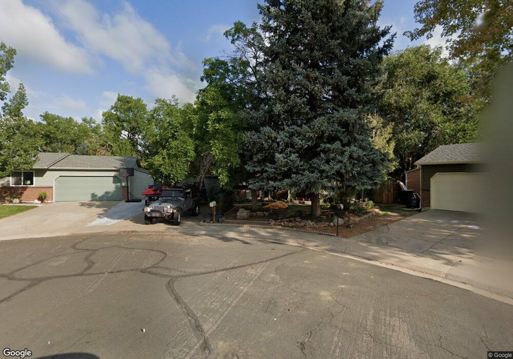
This home is located at 9599 Jason Ct, Thornton, CO 80260 and is currently estimated at $418,532, approximately $248 per square foot. 9599 Jason Ct is a home located in Adams County with nearby schools including North Mor Elementary School, Northglenn Middle School, and Northglenn High School.
Ownership History
We collect this data history from publicly available records. To have your information removed, we recommend requesting removal directly through your county’s website.
Purchase Details
Purchase Details
Home Financials for this Owner
Home Financials are based on the most recent Mortgage that was taken out on this home.Purchase Details
Home Financials for this Owner
Home Financials are based on the most recent Mortgage that was taken out on this home.Purchase Details
Home Values in the Area
Average Home Value in this Area
Purchase History
We collect this data history from publicly available records. To have your information removed, we recommend requesting removal directly through your county’s website.
| Date | Buyer | Sale Price | Title Company |
|---|---|---|---|
| $320,000 | None Listed On Document | ||
| $335,000 | Chicago Title | ||
| $205,000 | Security Title | ||
| -- | Title Services | ||
| $97,000 | -- |
Mortgage History
We collect this data history from publicly available records. To have your information removed, we recommend requesting removal directly through your county’s website.
| Date | Status | Borrower | Loan Amount |
|---|---|---|---|
| Closed | $234,500 | ||
| Closed | $200,000 | ||
| Closed | $161,816 | ||
| Closed | $173,137 | ||
| Closed | $164,000 | ||
| Closed | $41,000 | ||
| Closed | $123,500 | ||
| Closed | $40,000 |
Tax History
We collect this data history from publicly available records. To have your information removed, we recommend requesting removal directly through your county’s website.
| Year | Tax Paid | Tax Assessment Tax Assessment Total Assessment is a certain percentage of the fair market value that is determined by local assessors to be the total taxable value of land and additions on the property. | Land | Improvement |
|---|---|---|---|---|
| 2025 | $3,093 | $29,720 | $6,800 | $22,920 |
| 2024 | $3,093 | $27,310 | $6,250 | $21,060 |
| 2023 | $3,062 | $32,200 | $5,750 | $26,450 |
| 2022 | $2,937 | $25,480 | $5,910 | $19,570 |
| 2021 | $3,035 | $25,480 | $5,910 | $19,570 |
| 2020 | $2,796 | $23,960 | $6,080 | $17,880 |
| 2019 | $3,861 | $33,030 | $6,080 | $26,950 |
| 2018 | $2,633 | $21,850 | $5,900 | $15,950 |
| 2017 | $2,397 | $21,850 | $5,900 | $15,950 |
| 2016 | $1,944 | $17,230 | $3,100 | $14,130 |
| 2015 | $1,942 | $17,230 | $3,100 | $14,130 |
| 2014 | $1,460 | $12,590 | $2,310 | $10,280 |
Map
- 887 W 96th Place
- 9621 Orangewood Dr
- 9820 Croke Dr
- 9775 Croke Dr
- 747 W 96th Ave Unit 12
- 747 W 96th Ave Unit 10
- 9787 Lane St
- 707 W 96th Ave Unit 2
- 9651 Fox St
- 9785 Orangewood Dr
- 9848 Lane St
- 9864 Orangewood Dr
- 9463 Lou Dr
- 9433 Lou Dr
- 9884 Appletree Place
- 9906 Orangewood Dr
- 562 Melody Dr
- 9960 Croke Dr
- 9929 Appletree Place
- 1201 W Thornton Pkwy Unit 103
- 1125 W 96th Ave
- 1085 W 96th Ave
- 1145 W 96th Ave
- 1124 W 96th Place
- 1144 W 96th Place
- 1084 W 96th Place
- 1065 W 96th Ave
- 1165 W 96th Ave
- 1124 W 96th Ave
- 1144 W 96th Ave
- 1084 W 96th Ave
- 1164 W 96th Place
- 1064 W 96th Place
- 1164 W 96th Ave
- 1045 W 96th Ave
- 1185 W 96th Ave
- 1064 W 96th Ave
- 1184 W 96th Place
- 1044 W 96th Place
- 1184 W 96th Ave
Ask me questions while you tour the home.