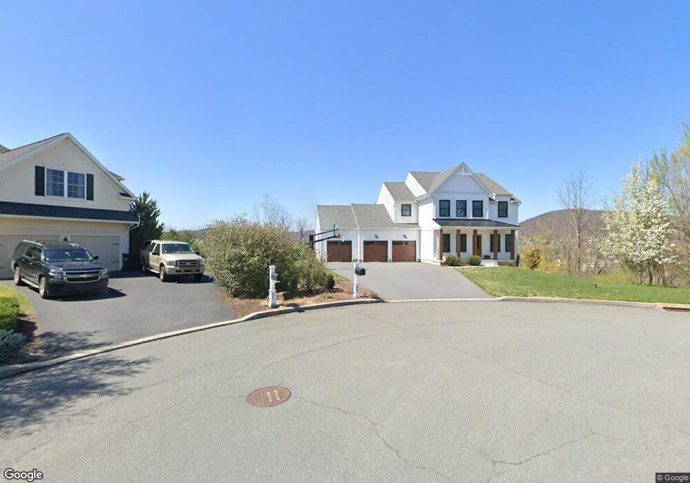
96 Linkside Ct Reading, PA 19606
Estimated Value: $475,000 - $576,000
4
Beds
3
Baths
2,714
Sq Ft
$200/Sq Ft
Est. Value
About This Home
This home is located at 96 Linkside Ct, Reading, PA 19606 and is currently estimated at $543,659, approximately $200 per square foot. 96 Linkside Ct is a home located in Berks County with nearby schools including Owatin Creek Elementary School, Exeter Township Junior High School, and Exeter Township Senior High School.
Ownership History
Date
Name
Owned For
Owner Type
Purchase Details
Closed on
Sep 25, 2020
Sold by
Jonson Tomas and Jonson Maaike
Bought by
Stein Timothy and Stein Tiffany
Current Estimated Value
Home Financials for this Owner
Home Financials are based on the most recent Mortgage that was taken out on this home.
Original Mortgage
$438,238
Outstanding Balance
$391,555
Interest Rate
2.9%
Mortgage Type
New Conventional
Estimated Equity
$152,104
Purchase Details
Closed on
Jun 29, 2011
Sold by
Red School Llc
Bought by
Jonson Tomas and Jonson Maaike
Create a Home Valuation Report for This Property
The Home Valuation Report is an in-depth analysis detailing your home's value as well as a comparison with similar homes in the area
Home Values in the Area
Average Home Value in this Area
Purchase History
We collect this data history from publicly available records. To have your information removed, we recommend requesting removal directly through your county’s website.
| Date | Buyer | Sale Price | Title Company |
|---|---|---|---|
| Stein Timothy | $90,000 | Regal Abstract | |
| Jonson Tomas | $100,000 | None Available |
Source: Public Records
Mortgage History
We collect this data history from publicly available records. To have your information removed, we recommend requesting removal directly through your county’s website.
| Date | Status | Borrower | Loan Amount |
|---|---|---|---|
| Open | Stein Timothy | $438,238 |
Source: Public Records
Tax History
| Year | Tax Paid | Tax Assessment Tax Assessment Total Assessment is a certain percentage of the fair market value that is determined by local assessors to be the total taxable value of land and additions on the property. | Land | Improvement |
|---|---|---|---|---|
| 2025 | $3,642 | $263,600 | $94,800 | $168,800 |
| 2024 | $12,518 | $263,600 | $94,800 | $168,800 |
| 2023 | $12,109 | $263,600 | $94,800 | $168,800 |
| 2022 | $11,974 | $263,600 | $94,800 | $168,800 |
| 2021 | $3,458 | $77,300 | $77,300 | $0 |
| 2020 | $3,420 | $77,300 | $77,300 | $0 |
| 2019 | $3,382 | $77,300 | $77,300 | $0 |
| 2018 | $3,372 | $77,300 | $77,300 | $0 |
| 2017 | $3,323 | $77,300 | $77,300 | $0 |
| 2016 | $837 | $77,300 | $77,300 | $0 |
| 2015 | $837 | $77,300 | $77,300 | $0 |
| 2014 | $808 | $77,300 | $77,300 | $0 |
Source: Public Records
Map
Nearby Homes
- 119 Constitution Ave
- 59 Winchester Ct
- 114 Wessex Ct
- 104 Pennsylvania Ave
- 99 Constitution Ave
- 148 Wellington Ct
- 200 Walton Ct
- 196 Walton Ct
- 4961 Dunham Dr
- 4870 Dunham Dr
- 24 Sycamore Dr
- 23 Nancy Cir
- 2 Cathy Ann Dr
- 705 Schoffers Rd
- 31 Estates Dr
- 108 Center Ln
- 3 Hawley Ct
- 36 Hayden Cir
- 1 Fairway Dr
- 2 Fairway Dr
- 91 Linkside Ct
- 39 Linree Ave
- 35 Linree Ave
- 31 Linree Ave
- 43 Linree Ave
- 80 Linkside Ct Unit L10
- 80 Linkside Ct
- 47 Linree Ave
- 38 Linree Ave
- 81 Linkside Ct
- 128 Constitution Ave
- 42 Linree Ave
- 34 Linree Ave
- 72 Linkside Ct
- 51 Linree Ave
- 200 Constitution Ave
- 27 Linree Ave
- 46 Linree Ave
- 143 Constitution Ave
- 208 Constitution Ave
Your Personal Tour Guide
Ask me questions while you tour the home.