Estimated Value: $752,000 - $855,000
4
Beds
2
Baths
1,630
Sq Ft
$500/Sq Ft
Est. Value
About This Home
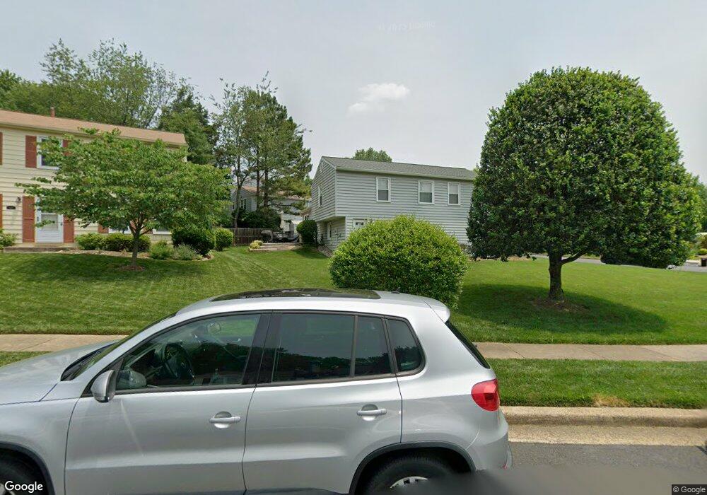
This home is located at 9612 Ashbourn Dr, Burke, VA 22015 and is currently estimated at $815,026, approximately $500 per square foot. 9612 Ashbourn Dr is a home located in Fairfax County with nearby schools including Kings Park Elementary School, Kings Glen Elementary School, and Lake Braddock Secondary School.
Ownership History
Date
Name
Owned For
Owner Type
Purchase Details
Closed on
Nov 22, 2010
Sold by
Jakoboski Heir Bethann and Fink Heir Robyn J
Bought by
Nealon Kathleen
Current Estimated Value
Home Financials for this Owner
Home Financials are based on the most recent Mortgage that was taken out on this home.
Original Mortgage
$336,000
Outstanding Balance
$221,462
Interest Rate
4.25%
Mortgage Type
New Conventional
Estimated Equity
$593,564
Create a Home Valuation Report for This Property
The Home Valuation Report is an in-depth analysis detailing your home's value as well as a comparison with similar homes in the area
Home Values in the Area
Average Home Value in this Area
Purchase History
We collect this data history from publicly available records. To have your information removed, we recommend requesting removal directly through your county’s website.
| Date | Buyer | Sale Price | Title Company |
|---|---|---|---|
| Nealon Kathleen | $420,000 | -- |
Source: Public Records
Mortgage History
We collect this data history from publicly available records. To have your information removed, we recommend requesting removal directly through your county’s website.
| Date | Status | Borrower | Loan Amount |
|---|---|---|---|
| Open | Nealon Kathleen | $336,000 |
Source: Public Records
Tax History
| Year | Tax Paid | Tax Assessment Tax Assessment Total Assessment is a certain percentage of the fair market value that is determined by local assessors to be the total taxable value of land and additions on the property. | Land | Improvement |
|---|---|---|---|---|
| 2025 | $7,919 | $748,840 | $331,000 | $417,840 |
| 2024 | $7,919 | $683,540 | $306,000 | $377,540 |
| 2023 | $7,734 | $685,310 | $306,000 | $379,310 |
| 2022 | $7,207 | $630,270 | $281,000 | $349,270 |
| 2021 | $6,514 | $555,100 | $251,000 | $304,100 |
| 2020 | $6,197 | $523,650 | $241,000 | $282,650 |
| 2019 | $5,961 | $503,700 | $236,000 | $267,700 |
| 2018 | $5,793 | $503,700 | $236,000 | $267,700 |
| 2017 | $5,519 | $475,400 | $226,000 | $249,400 |
| 2016 | $5,334 | $460,400 | $211,000 | $249,400 |
| 2015 | $5,255 | $470,900 | $211,000 | $259,900 |
| 2014 | $5,048 | $453,330 | $201,000 | $252,330 |
Source: Public Records
Map
Nearby Homes
- 9710 Ashbourn Dr
- 9510 Ashbourn Dr
- 9535 Burdett Rd
- 9865 High Water Ct
- 5208 Ruffner Woods Ct
- 5661 Chelmsford Ct
- 9662 Westport Ln
- 5629 Rapid Run Ct
- 5218 Olley Ln
- 5700 Mason Bluff Dr
- 5420 Brixham Ct
- 5510 Conistone Ct
- 5105 Walport Ln
- 9518 Heathwood Ct
- 5392 Gainsborough Dr
- 5224 Bradfield Dr
- 5002 Mcfarland Dr
- 9626 Blincoe Ct
- 4978 Mcfarland Dr
- 9215 Cork Place
- 5402 Duxford Place
- 5406 Duxford Place
- 9611 Ashbourn Dr
- 5408 Duxford Place
- 9525 Kirkfield Rd
- 5405 Duxford Place
- 9527 Kirkfield Rd
- 9613 Ashbourn Dr
- 5407 Duxford Place
- 9530 Barnstable Ct
- 9615 Ashbourn Dr
- 9529 Barnstable Ct
- 5409 Duxford Place
- 5401 Duxford Place
- 5410 Duxford Place
- 9528 Barnstable Ct
- 9605 Ashbourn Dr
- 9610 Ashbourn Dr
- 9610 Glenarm Ct
- 9617 Ashbourn Dr
Your Personal Tour Guide
Ask me questions while you tour the home.