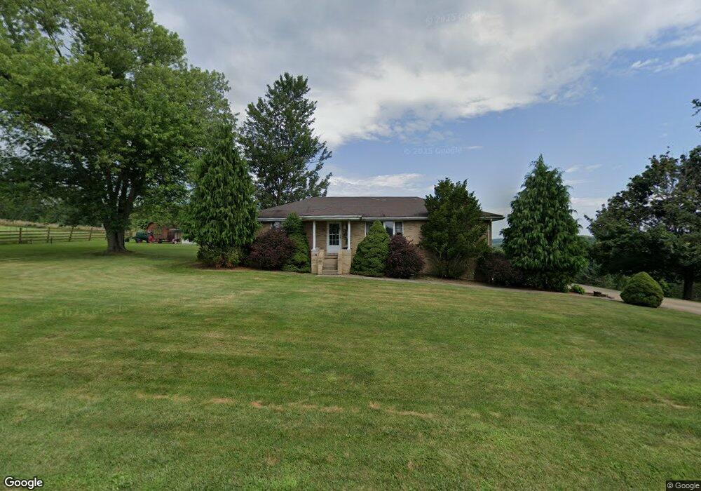
97 Rawson Dr Washington, PA 15301
Estimated Value: $260,000 - $323,000
3
Beds
2
Baths
1,404
Sq Ft
$203/Sq Ft
Est. Value
About This Home
This home is located at 97 Rawson Dr, Washington, PA 15301 and is currently estimated at $284,869, approximately $202 per square foot. 97 Rawson Dr is a home located in Washington County with nearby schools including Trinity Senior High School.
Ownership History
Date
Name
Owned For
Owner Type
Purchase Details
Closed on
Oct 8, 2025
Sold by
Reese Nicole L
Bought by
Reese Timothy J
Current Estimated Value
Home Financials for this Owner
Home Financials are based on the most recent Mortgage that was taken out on this home.
Original Mortgage
$90,000
Outstanding Balance
$90,000
Interest Rate
6.5%
Mortgage Type
New Conventional
Estimated Equity
$194,869
Purchase Details
Closed on
Sep 6, 2000
Sold by
Wolf Craig M
Bought by
Reese Timothy J
Home Financials for this Owner
Home Financials are based on the most recent Mortgage that was taken out on this home.
Original Mortgage
$100,000
Interest Rate
8.1%
Create a Home Valuation Report for This Property
The Home Valuation Report is an in-depth analysis detailing your home's value as well as a comparison with similar homes in the area
Home Values in the Area
Average Home Value in this Area
Purchase History
| Date | Buyer | Sale Price | Title Company |
|---|---|---|---|
| Reese Timothy J | -- | None Listed On Document | |
| Reese Timothy J | $125,000 | -- |
Source: Public Records
Mortgage History
| Date | Status | Borrower | Loan Amount |
|---|---|---|---|
| Open | Reese Timothy J | $90,000 | |
| Previous Owner | Reese Timothy J | $100,000 |
Source: Public Records
Tax History
| Year | Tax Paid | Tax Assessment Tax Assessment Total Assessment is a certain percentage of the fair market value that is determined by local assessors to be the total taxable value of land and additions on the property. | Land | Improvement |
|---|---|---|---|---|
| 2025 | $3,320 | $167,100 | $39,400 | $127,700 |
| 2024 | $2,926 | $167,100 | $39,400 | $127,700 |
| 2023 | $2,926 | $167,100 | $39,400 | $127,700 |
| 2022 | $2,829 | $167,100 | $39,400 | $127,700 |
| 2021 | $2,787 | $167,100 | $39,400 | $127,700 |
| 2020 | $2,787 | $167,100 | $39,400 | $127,700 |
| 2019 | $2,730 | $167,100 | $39,400 | $127,700 |
| 2018 | $2,767 | $167,100 | $39,400 | $127,700 |
| 2017 | $77 | $167,100 | $39,400 | $127,700 |
| 2016 | $77 | $13,985 | $2,386 | $11,599 |
| 2015 | $77 | $13,985 | $2,386 | $11,599 |
| 2014 | $348 | $13,985 | $2,386 | $11,599 |
| 2013 | $348 | $13,985 | $2,386 | $11,599 |
Source: Public Records
Map
Nearby Homes
- 4 Dogwood Dr
- 1120 Henderson Ave
- 338 Festival Rd
- 328 Festival Rd
- 248 Laddie Dr
- 204 Castle Rd
- 69 Hewitt Ave
- 2667 Jefferson Ave
- 421 Fawn Dr
- 1824 Jefferson Ave
- 502 Bower Ave
- 7 Short Ave
- 199 Mcclay Rd
- 1260 Bruce St
- 229 Miller Rd
- 108 Oakwood Ave
- 103 Elizabeth St
- 1226 Summerlea Ave
- 265 Taylor Ave
- 172 Malone Ridge Rd
- 85 Rawson Dr
- 98 Rawson Dr
- 69 Rawson Dr
- 69 Rawson Dr
- 111 Rawson Dr
- 61 Rawson Dr
- 40 Rawson Dr
- 39 Rawson Dr
- 39 Rawson Dr
- 39 Rawson Dr
- 23 Rawson Dr
- 1395 Henderson Ave
- 1405 Henderson Ave
- 1411 Henderson Ave
- 1415 Henderson Ave
- 517 Malone Ridge Rd
- 527 Malone Ridge Rd
- 1385 Henderson Ave
- 1419 Henderson Ave
- 533 Malone Ridge Rd
Your Personal Tour Guide
Ask me questions while you tour the home.