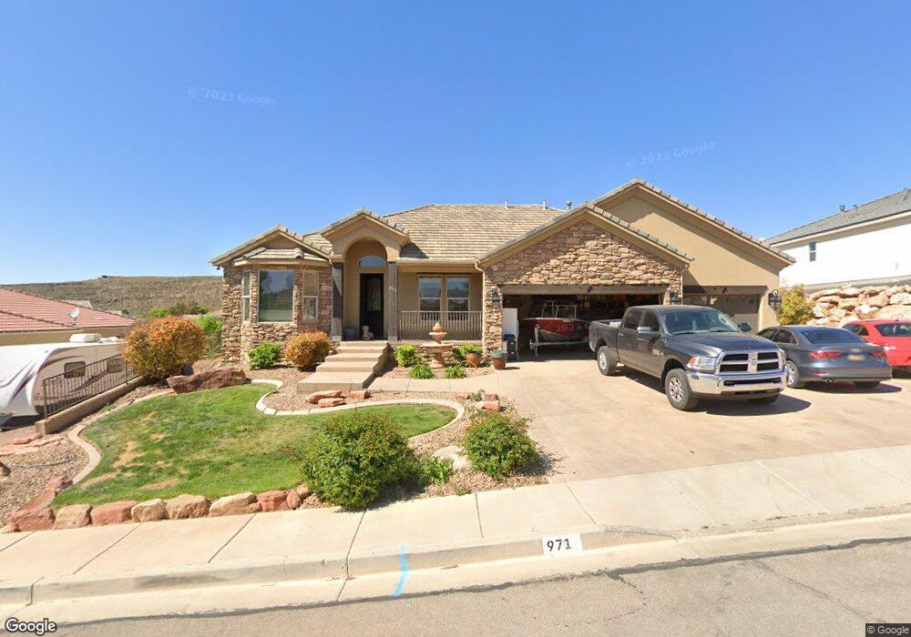
971 E High Noon Cir Washington, UT 84780
Estimated Value: $870,000 - $976,472
About This Home
This home is located at 971 E High Noon Cir, Washington, UT 84780 and is currently estimated at $909,618, approximately $174 per square foot. 971 E High Noon Cir is a home located in Washington County with nearby schools including Horizon School, Washington Fields Intermediate School, and Crimson Cliffs Middle School.
Ownership History
We collect this data history from publicly available records. To have your information removed, we recommend requesting removal directly through your county’s website.
Purchase Details
Purchase Details
Purchase Details
Purchase Details
Purchase Details
Purchase Details
Purchase Details
Purchase Details
Home Financials for this Owner
Home Financials are based on the most recent Mortgage that was taken out on this home.Purchase History
We collect this data history from publicly available records. To have your information removed, we recommend requesting removal directly through your county’s website.
| Date | Buyer | Sale Price | Title Company |
|---|---|---|---|
| -- | Accommodation | ||
| -- | Eagle Gate Title Ins Agency | ||
| -- | Eagle Gate Title Ins Agency | ||
| -- | Eagle Gate Title Ins Agency | ||
| -- | Eagle Gate Title Ins Agency | ||
| -- | Eagle Gate Title Ins Agency | ||
| -- | Eagle Gate Title Ins Agency | ||
| -- | Eagle Gate Title Ins Agency | ||
| -- | Eagle Gate Title Ins Agency | ||
| -- | Eagle Gate Title Ins Agency | ||
| -- | Eagle Gate Title Ins Agency | ||
| -- | Eagle Gate Title Ins Agency | ||
| -- | Eagle Gate Title Ins Agency | ||
| -- | Eagle Gate Title Ins Agency | ||
| -- | Eagle Gate Title Ins Agency | ||
| -- | None Available | ||
| -- | None Available | ||
| $705,181 | None Available | ||
| -- | First Title Of Utah |
Mortgage History
We collect this data history from publicly available records. To have your information removed, we recommend requesting removal directly through your county’s website.
| Date | Status | Borrower | Loan Amount |
|---|---|---|---|
| Previous Owner | $588,000 |
Tax History
We collect this data history from publicly available records. To have your information removed, we recommend requesting removal directly through your county’s website.
| Year | Tax Paid | Tax Assessment Tax Assessment Total Assessment is a certain percentage of the fair market value that is determined by local assessors to be the total taxable value of land and additions on the property. | Land | Improvement |
|---|---|---|---|---|
| 2025 | $3,404 | $517,715 | $126,500 | $391,215 |
| 2023 | $6,172 | $926,300 | $240,000 | $686,300 |
| 2022 | $6,631 | $936,400 | $185,000 | $751,400 |
| 2021 | $3,093 | $649,600 | $115,000 | $534,600 |
| 2020 | $2,860 | $568,100 | $105,000 | $463,100 |
| 2019 | $2,742 | $531,800 | $90,000 | $441,800 |
| 2018 | $2,623 | $263,010 | $0 | $0 |
| 2017 | $2,563 | $250,030 | $0 | $0 |
| 2016 | $2,706 | $244,365 | $0 | $0 |
| 2015 | $2,749 | $238,865 | $0 | $0 |
| 2014 | $2,648 | $231,660 | $0 | $0 |
Map
- 969 E Outlaw Gulch
- 2785 Desperado Dr
- 831 Queensridge Dr
- 1141 E Lost Ridge Dr
- 2909 S Kate Ln
- 2927 S Majestic Court Dr
- 2976 S Camino Real
- 1935 S Dr
- 1927 Queens Ct Unit 4259
- 1853 S Queens Garden Dr Unit 4252
- 2451 S Camino Real
- 3066 Kings Court Ln
- 1020 E Silver Shadows Dr
- 751 Majestic Dr
- 922 E Silver Shadows Dr
- 1067 E Bronco Dr Unit 21
- 1067 E Bronco Dr
- 1290 E Royal Sunset Rd Unit 34
- 2978 S Farmland Dr
- 3169 S Pecos Dr
- 0 E High Noon Cir
- Lot #78 E High Noon Cir
- Lot #79 E High Noon Cir
- Lot #77 E High Noon Cir
- Lot #81 E High Noon Cir
- Lot #80 E High Noon Cir
- Lot 82 E High Noon Cir
- 951 E High Noon Cir
- 951 E High Noon Cir Unit Lot 75
- 976 E Outlaw Gulch
- 968 E Outlaw Gulch
- 998 E Outlaw Gulch
- 1011 E High Noon Cir
- 968 E High Noon Cir Unit 83
- 986 E High Noon Cir Unit 82
- 948 E High Noon Cir
- 934 E Outlaw Gulch
- 1006 E High Noon Cir
- 1006 E High Noon Cir
- 1020 E Outlaw Gulch
Ask me questions while you tour the home.