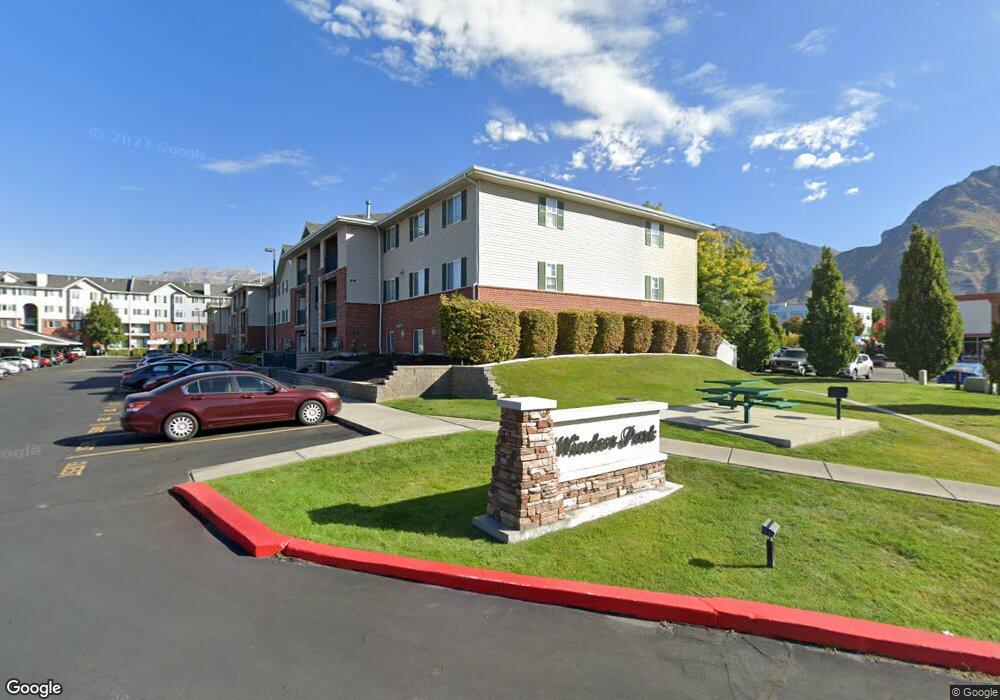
98 W 1230 N Provo, UT 84604
Riverside NeighborhoodEstimated Value: $341,000 - $354,879
3
Beds
2
Baths
1,092
Sq Ft
$318/Sq Ft
Est. Value
About This Home
This home is located at 98 W 1230 N, Provo, UT 84604 and is currently estimated at $347,220, approximately $317 per square foot. 98 W 1230 N is a home located in Utah County with nearby schools including Rock Canyon Elementary School, Centennial Middle School, and Timpview High School.
Ownership History
Date
Name
Owned For
Owner Type
Purchase Details
Closed on
Dec 16, 2025
Sold by
Curtis Bennett Ira and Equity Trust Company
Bought by
Arnoldsen Stefan and Arnoldsen Shannon
Current Estimated Value
Home Financials for this Owner
Home Financials are based on the most recent Mortgage that was taken out on this home.
Original Mortgage
$260,625
Outstanding Balance
$260,126
Interest Rate
6.22%
Mortgage Type
New Conventional
Estimated Equity
$87,094
Purchase Details
Closed on
Dec 27, 2016
Sold by
Nye Mark A and Nye Hselll W
Bought by
Fbo Curis Bennett Ira
Purchase Details
Closed on
Nov 15, 2016
Sold by
Nye Mary Anne
Bought by
Nye Mark A and Nye Shelli W
Purchase Details
Closed on
Dec 18, 2008
Sold by
Mcclellan David and Mcclellan Linda
Bought by
Nye Mary Anne and Nye Mark A
Home Financials for this Owner
Home Financials are based on the most recent Mortgage that was taken out on this home.
Original Mortgage
$157,783
Interest Rate
6.1%
Mortgage Type
FHA
Purchase Details
Closed on
Aug 6, 1997
Sold by
Windsor Provo Ltd Partnership
Bought by
Stevenson Kent and Stevenson Nancy R
Home Financials for this Owner
Home Financials are based on the most recent Mortgage that was taken out on this home.
Original Mortgage
$79,030
Interest Rate
7.42%
Create a Home Valuation Report for This Property
The Home Valuation Report is an in-depth analysis detailing your home's value as well as a comparison with similar homes in the area
Home Values in the Area
Average Home Value in this Area
Purchase History
| Date | Buyer | Sale Price | Title Company |
|---|---|---|---|
| Arnoldsen Stefan | -- | Metro National Title | |
| Fbo Curis Bennett Ira | -- | First American Title | |
| Nye Mark A | -- | First American Title | |
| Nye Mary Anne | -- | Vintage Title Insurance Age | |
| Stevenson Kent | -- | First American Title |
Source: Public Records
Mortgage History
| Date | Status | Borrower | Loan Amount |
|---|---|---|---|
| Open | Arnoldsen Stefan | $260,625 | |
| Previous Owner | Nye Mary Anne | $157,783 | |
| Previous Owner | Stevenson Kent | $79,030 |
Source: Public Records
Tax History
| Year | Tax Paid | Tax Assessment Tax Assessment Total Assessment is a certain percentage of the fair market value that is determined by local assessors to be the total taxable value of land and additions on the property. | Land | Improvement |
|---|---|---|---|---|
| 2025 | $1,832 | $184,635 | -- | -- |
| 2024 | $1,832 | $180,345 | $0 | $0 |
| 2023 | $1,874 | $181,830 | $0 | $0 |
| 2022 | $1,845 | $180,510 | $0 | $0 |
| 2021 | $1,551 | $264,700 | $31,800 | $232,900 |
| 2020 | $1,530 | $244,700 | $29,400 | $215,300 |
| 2019 | $1,331 | $221,400 | $26,000 | $195,400 |
| 2018 | $1,215 | $205,000 | $26,000 | $179,000 |
| 2017 | $1,089 | $100,980 | $0 | $0 |
| 2016 | $1,082 | $93,500 | $0 | $0 |
| 2015 | $1,007 | $88,000 | $0 | $0 |
| 2014 | $966 | $88,000 | $0 | $0 |
Source: Public Records
Map
Nearby Homes
- 1470 N 380 W
- 1533 N 550 W Unit 26
- 360 Sumac Ln
- 1250 Riverside Ave
- 36 W 700 N Unit 206
- 1273 Riverside Ave Unit 6
- 1960 N Canyon Rd
- 556 W 800 N Unit 18
- 639 N University Ave Unit 10
- 668 W 890 N
- 620 N 100 St W
- 810 N 600 W
- 186 E 2100 N
- 1160 N 850 W
- 2091 N 220 E
- 567 N University Ave Unit 209
- 223 W 2230 N Unit 14
- 879 N 750 W
- 241 W 2230 N Unit 16
- 830 N 750 W
- 98 W 1230 N Unit 327
- 98 W 1230 N
- 98 W 1230 N
- 98 W 1230 N
- 98 W 1230 N Unit 227
- 98 W 1230 N
- 98 W 1230 N
- 98 W 1230 N
- 98 W 1230 N
- 98 W 1230 N
- 98 W 1230 N
- 98 W 1230 N Unit 128
- 98 W 1230 N Unit 126
- 98 W 1230 N Unit 127
- 98 W 1230 N Unit 326
- 98 W 1230 N Unit 125
- 98 W 1230 N Unit 325
- 104 W Cougar Blvd Unit 121
- 104 W 1230 N
- 104 W 1230 N Unit 322
Your Personal Tour Guide
Ask me questions while you tour the home.