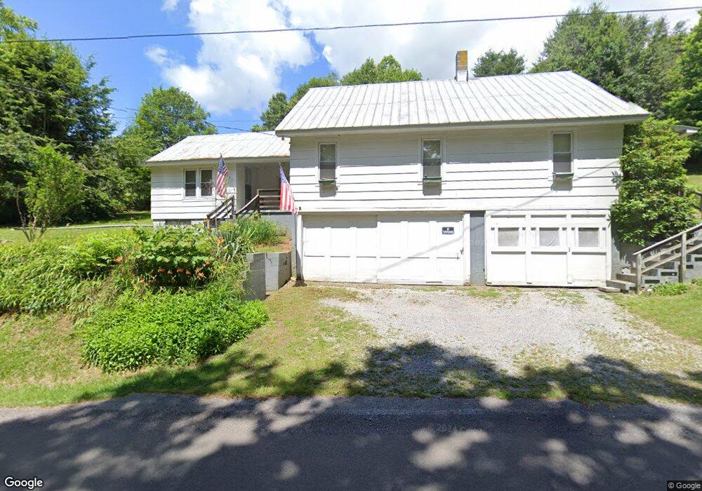
981 Riverside Rd Chilhowie, VA 24319
Estimated Value: $140,000 - $225,000
3
Beds
1
Bath
1,528
Sq Ft
$109/Sq Ft
Est. Value
About This Home
This home is located at 981 Riverside Rd, Chilhowie, VA 24319 and is currently estimated at $167,292, approximately $109 per square foot. 981 Riverside Rd is a home located in Smyth County with nearby schools including Chilhowie Elementary School, Chilhowie Middle School, and Chilhowie High School.
Ownership History
Date
Name
Owned For
Owner Type
Purchase Details
Closed on
Oct 25, 2022
Sold by
Pierce John Edward
Bought by
Pierce John Edward
Current Estimated Value
Home Financials for this Owner
Home Financials are based on the most recent Mortgage that was taken out on this home.
Original Mortgage
$60,000
Outstanding Balance
$52,423
Interest Rate
6.09%
Mortgage Type
New Conventional
Estimated Equity
$114,869
Create a Home Valuation Report for This Property
The Home Valuation Report is an in-depth analysis detailing your home's value as well as a comparison with similar homes in the area
Home Values in the Area
Average Home Value in this Area
Purchase History
| Date | Buyer | Sale Price | Title Company |
|---|---|---|---|
| Pierce John Edward | -- | Blue Ridge Title |
Source: Public Records
Mortgage History
| Date | Status | Borrower | Loan Amount |
|---|---|---|---|
| Open | Pierce John Edward | $60,000 |
Source: Public Records
Tax History
| Year | Tax Paid | Tax Assessment Tax Assessment Total Assessment is a certain percentage of the fair market value that is determined by local assessors to be the total taxable value of land and additions on the property. | Land | Improvement |
|---|---|---|---|---|
| 2025 | $647 | $109,600 | $15,000 | $94,600 |
| 2024 | $647 | $109,600 | $15,000 | $94,600 |
| 2023 | $527 | $71,200 | $12,500 | $58,700 |
| 2022 | $527 | $71,200 | $12,500 | $58,700 |
| 2021 | $527 | $71,200 | $12,500 | $58,700 |
| 2020 | $527 | $71,200 | $12,500 | $58,700 |
| 2019 | $483 | $65,300 | $12,500 | $52,800 |
| 2018 | $483 | $65,300 | $12,500 | $52,800 |
| 2017 | $483 | $65,300 | $12,500 | $52,800 |
| 2016 | $483 | $65,300 | $12,500 | $52,800 |
| 2015 | $483 | $0 | $0 | $0 |
| 2014 | $491 | $0 | $0 | $0 |
Source: Public Records
Map
Nearby Homes
- 470 Riverside Rd
- tbd Chestnut Ridge Rd
- 447 Old Airport Rd
- 454 Old Airport Rd
- 787 Wet Springs Rd
- 182 Saint Johns Way
- 1219 Chestnut Ridge Rd
- 625 Belle Hollow Rd
- 0 Shuler Hollow Rd
- 1729 Whitetop Rd
- 139 Brooke St
- 1843 Saint Clairs Creek Rd
- TBD Saint Clairs Creek Rd
- 38 Brooke St
- TBD Lot#19 Christin Ln
- TBD Lot#15 Chestnutwood Dr
- TBD Lot#42 Brooke St
- TBD Lot#8 Elem Dr
- TBD Lo #24 Christin Ln
- TBD Lot#12 Chestnutwood Dr
- n/a Riverside Rd
- 1049 Riverside Rd
- 1082 Riverside Rd
- 908 Riverside Rd
- 900 Riverside Rd
- 1089 Riverside Rd
- 888 Riverside Rd
- 871 Riverside Rd
- 1084 Riverside Rd
- 1098 Riverside Rd
- 853 Riverside Rd
- 841 Riverside Rd
- 315 Straight Way
- 1055 Riverside Rd
- 1147 Riverside Rd
- 1154 Riverside Rd
- 816 Riverside Rd
- 1945 Chestnut Ridge Rd
- 765 Riverside Rd
- 1985 Chestnut Ridge Rd
Your Personal Tour Guide
Ask me questions while you tour the home.