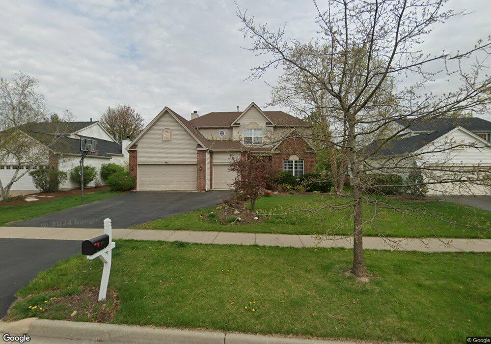
981 Wilkinson Ln North Aurora, IL 60542
Estimated Value: $423,097 - $516,000
4
Beds
--
Bath
2,448
Sq Ft
$192/Sq Ft
Est. Value
About This Home
This home is located at 981 Wilkinson Ln, North Aurora, IL 60542 and is currently estimated at $469,524, approximately $191 per square foot. 981 Wilkinson Ln is a home located in Kane County with nearby schools including Fearn Elementary School, Jewel Middle School, and West Aurora High School.
Ownership History
Date
Name
Owned For
Owner Type
Purchase Details
Closed on
Sep 8, 2025
Sold by
Dejohnette Carl G and Dejohnette Cynthia A
Bought by
Chicago Title Land Trust
Current Estimated Value
Purchase Details
Closed on
Apr 4, 2000
Sold by
Neumann Homes Inc
Bought by
Dejohnette Carl G and Dejohnette Cynthia
Home Financials for this Owner
Home Financials are based on the most recent Mortgage that was taken out on this home.
Original Mortgage
$235,550
Interest Rate
8.21%
Create a Home Valuation Report for This Property
The Home Valuation Report is an in-depth analysis detailing your home's value as well as a comparison with similar homes in the area
Home Values in the Area
Average Home Value in this Area
Purchase History
| Date | Buyer | Sale Price | Title Company |
|---|---|---|---|
| Chicago Title Land Trust | -- | None Listed On Document | |
| Dejohnette Carl G | $248,000 | Chicago Title Insurance Co |
Source: Public Records
Mortgage History
| Date | Status | Borrower | Loan Amount |
|---|---|---|---|
| Previous Owner | Dejohnette Carl G | $235,550 |
Source: Public Records
Tax History
| Year | Tax Paid | Tax Assessment Tax Assessment Total Assessment is a certain percentage of the fair market value that is determined by local assessors to be the total taxable value of land and additions on the property. | Land | Improvement |
|---|---|---|---|---|
| 2024 | $7,719 | $116,974 | $15,951 | $101,023 |
| 2023 | $7,453 | $106,166 | $14,477 | $91,689 |
| 2022 | $7,819 | $99,221 | $13,530 | $85,691 |
| 2021 | $7,553 | $94,102 | $12,832 | $81,270 |
| 2020 | $7,505 | $92,293 | $12,585 | $79,708 |
| 2019 | $7,559 | $89,025 | $12,139 | $76,886 |
| 2018 | $7,499 | $85,634 | $11,677 | $73,957 |
| 2017 | $7,466 | $82,410 | $11,292 | $71,118 |
| 2016 | $7,429 | $80,010 | $10,963 | $69,047 |
| 2015 | -- | $78,188 | $10,713 | $67,475 |
| 2014 | -- | $75,727 | $10,376 | $65,351 |
| 2013 | -- | $74,250 | $10,174 | $64,076 |
Source: Public Records
Map
Nearby Homes
- 933 Wilkinson Ln
- 1524 W Mooseheart Rd
- 1671 Breton Ave
- 1615 Patterson Ave
- 1614 Patterson Ave
- 1623 Patterson Ave
- 1622 Patterson Ave
- 1630 Patterson Ave
- 1736 Breton Ave
- 1639 Patterson Ave
- 1647 Patterson Ave
- 867 Fair Meadow Ct
- 1792 Breton Ave
- 1799 Breton Ave
- 1791 Breton Ave
- 925 Fair Meadow St
- 924 Fair Meadow St
- 3S177 Deerpath Rd
- 233 Spring Ct
- 890 Stratford Dr
- 973 Wilkinson Ln
- 989 Wilkinson Ln
- 1463 Carlson Ct
- 965 Wilkinson Ln Unit 1
- 1471 Carlson Ct
- 1486 Patterson Ave
- 1478 Patterson Ave
- 982 Wilkinson Ln
- 990 Wilkinson Ln
- 957 Wilkinson Ln
- 1455 Carlson Ct
- 974 Wilkinson Ln
- 1474 Carlson Ct
- 998 Wilkinson Ln
- 1470 Patterson Ave
- 966 Wilkinson Ln
- 949 Wilkinson Ln
- 1462 Patterson Ave
- 958 Wilkinson Ln Unit 1
- 1447 Carlson Ct
Your Personal Tour Guide
Ask me questions while you tour the home.