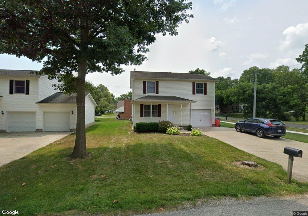
99 1st Ave Pataskala, OH 43062
Estimated Value: $265,000 - $302,000
3
Beds
3
Baths
1,512
Sq Ft
$190/Sq Ft
Est. Value
About This Home
This home is located at 99 1st Ave, Pataskala, OH 43062 and is currently estimated at $287,507, approximately $190 per square foot. 99 1st Ave is a home located in Licking County with nearby schools including Pataskala Elementary School, Etna Elementary School, and Watkins Middle School.
Ownership History
Date
Name
Owned For
Owner Type
Purchase Details
Closed on
Aug 25, 1998
Sold by
Cassel Joyce L
Bought by
Riggleman Richard D and Riggleman Rebecca L
Current Estimated Value
Home Financials for this Owner
Home Financials are based on the most recent Mortgage that was taken out on this home.
Original Mortgage
$69,520
Outstanding Balance
$15,920
Interest Rate
10.23%
Mortgage Type
New Conventional
Estimated Equity
$271,587
Create a Home Valuation Report for This Property
The Home Valuation Report is an in-depth analysis detailing your home's value as well as a comparison with similar homes in the area
Home Values in the Area
Average Home Value in this Area
Purchase History
We collect this data history from publicly available records. To have your information removed, we recommend requesting removal directly through your county’s website.
| Date | Buyer | Sale Price | Title Company |
|---|---|---|---|
| Riggleman Richard D | $87,000 | -- |
Source: Public Records
Mortgage History
We collect this data history from publicly available records. To have your information removed, we recommend requesting removal directly through your county’s website.
| Date | Status | Borrower | Loan Amount |
|---|---|---|---|
| Open | Riggleman Richard D | $69,520 |
Source: Public Records
Tax History
| Year | Tax Paid | Tax Assessment Tax Assessment Total Assessment is a certain percentage of the fair market value that is determined by local assessors to be the total taxable value of land and additions on the property. | Land | Improvement |
|---|---|---|---|---|
| 2025 | $3,119 | $69,620 | $14,210 | $55,410 |
| 2024 | $3,160 | $74,630 | $19,220 | $55,410 |
| 2023 | $4,439 | $74,630 | $19,220 | $55,410 |
| 2022 | $1,871 | $37,910 | $9,630 | $28,280 |
| 2021 | $1,927 | $37,910 | $9,630 | $28,280 |
| 2020 | $1,960 | $37,910 | $9,630 | $28,280 |
| 2019 | $2,125 | $37,910 | $9,630 | $28,280 |
| 2018 | $2,133 | $0 | $0 | $0 |
| 2017 | $2,712 | $0 | $0 | $0 |
| 2016 | $1,666 | $0 | $0 | $0 |
| 2015 | $804 | $0 | $0 | $0 |
| 2014 | $804 | $0 | $0 | $0 |
| 2013 | $791 | $0 | $0 | $0 |
Source: Public Records
Map
Nearby Homes
- 198 S Vine St
- 267 S Main St
- 303 Levi Dr Unit Lot 7
- 186 Markway Dr Unit Lot 12
- 188 Markway Dr Unit Lot 13
- 0 W Broad St
- 0 Blacks Rd Unit 215031989
- 0 Blacks Rd Unit Lot 10
- 0 E Broad St
- 162 S Fork Cir
- 10 Buckeye Blvd
- 156 Heron Ave
- 100 Indian Creek Ct
- 801 Whitehead Dr
- 157 Hickory Dr SW
- 10530 Mill Street Rd SW
- 401 Waterlily Ln
- 403 Waterlily Ln
- 420 Waterlily Ln
- 359 Isaac Tharp St
Your Personal Tour Guide
Ask me questions while you tour the home.