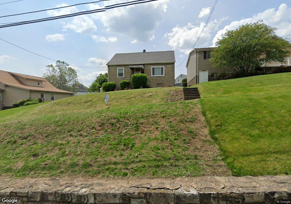
99 Dixon Blvd Uniontown, PA 15401
Estimated Value: $86,000 - $138,443
4
Beds
2
Baths
1,075
Sq Ft
$100/Sq Ft
Est. Value
About This Home
This home is located at 99 Dixon Blvd, Uniontown, PA 15401 and is currently estimated at $107,611, approximately $100 per square foot. 99 Dixon Blvd is a home located in Fayette County with nearby schools including Laurel Highlands Senior High School, St. John the Evangelist School, and Chestnut Ridge Christian Academy.
Ownership History
Date
Name
Owned For
Owner Type
Purchase Details
Closed on
Nov 4, 2022
Sold by
Vernon Thomas and Vernon Carla
Bought by
Howard Matthew T
Current Estimated Value
Purchase Details
Closed on
Oct 19, 2022
Sold by
Mlakar Donald E
Bought by
Vernon Thomas and Vernon Carla
Purchase Details
Closed on
Jan 1, 1968
Bought by
Mlakar Cecelia
Create a Home Valuation Report for This Property
The Home Valuation Report is an in-depth analysis detailing your home's value as well as a comparison with similar homes in the area
Home Values in the Area
Average Home Value in this Area
Purchase History
| Date | Buyer | Sale Price | Title Company |
|---|---|---|---|
| Howard Matthew T | $114,000 | -- | |
| Vernon Thomas | $75,000 | -- | |
| Mlakar Cecelia | -- | -- |
Source: Public Records
Tax History
| Year | Tax Paid | Tax Assessment Tax Assessment Total Assessment is a certain percentage of the fair market value that is determined by local assessors to be the total taxable value of land and additions on the property. | Land | Improvement |
|---|---|---|---|---|
| 2025 | $791 | $27,720 | $9,090 | $18,630 |
| 2024 | $769 | $27,720 | $9,090 | $18,630 |
| 2023 | $1,478 | $27,720 | $9,090 | $18,630 |
| 2022 | $1,465 | $27,720 | $9,090 | $18,630 |
| 2021 | $1,424 | $27,720 | $9,090 | $18,630 |
| 2020 | $1,424 | $27,720 | $9,090 | $18,630 |
| 2019 | $1,493 | $27,720 | $9,090 | $18,630 |
| 2018 | $1,268 | $27,720 | $9,090 | $18,630 |
| 2017 | $1,268 | $27,720 | $9,090 | $18,630 |
| 2016 | -- | $27,720 | $9,090 | $18,630 |
| 2015 | -- | $27,720 | $9,090 | $18,630 |
| 2014 | -- | $55,440 | $18,180 | $37,260 |
Source: Public Records
Map
Nearby Homes
- 205 Michael Dr
- 58 Mullen St
- 190 Dixon Blvd
- TR 584 Duck Hollow Rd
- LOT 10 Wellington Dr
- 92 2nd St
- 112 Easy St
- 71 Lebanon Ave
- 40 Miller Ave
- 75 Nutt Ave
- 220 Clarendon Ave
- 158 Clarendon Ave
- 9 Woodlawn Ave
- 19 Jefferis St
- 520 Royalty Dr
- 229 W Berkeley St
- 0 Coal Lick Hollow Rd Unit 1738026
- 113 Washington Ave
- 348 1st St
- 0 Foreman Ave Derrick Ave Unit 1730532
Your Personal Tour Guide
Ask me questions while you tour the home.