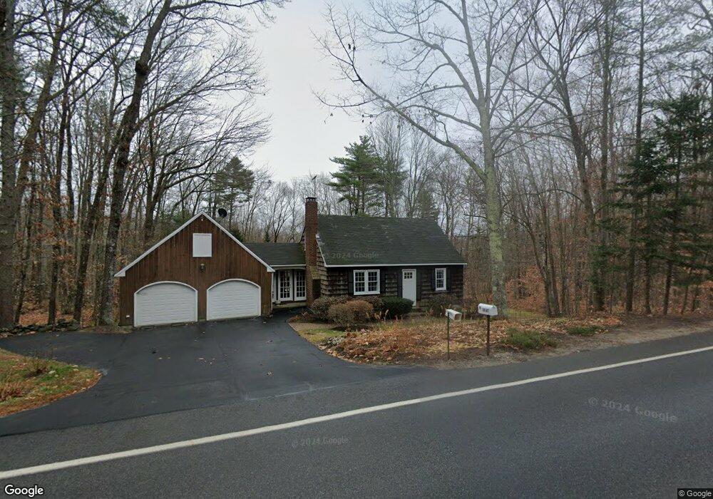
99 Varney Mill Rd Windham, ME 04062
Estimated Value: $360,000 - $449,000
2
Beds
2
Baths
1,272
Sq Ft
$311/Sq Ft
Est. Value
About This Home
This home is located at 99 Varney Mill Rd, Windham, ME 04062 and is currently estimated at $395,296, approximately $310 per square foot. 99 Varney Mill Rd is a home located in Cumberland County with nearby schools including Manchester School, Windham Primary School, and Windham Middle School.
Ownership History
Date
Name
Owned For
Owner Type
Purchase Details
Closed on
Aug 5, 2014
Sold by
Grant Reginald T and Grant Maryadele L
Bought by
Grant Reginald T
Current Estimated Value
Create a Home Valuation Report for This Property
The Home Valuation Report is an in-depth analysis detailing your home's value as well as a comparison with similar homes in the area
Home Values in the Area
Average Home Value in this Area
Purchase History
| Date | Buyer | Sale Price | Title Company |
|---|---|---|---|
| Grant Reginald T | -- | -- | |
| Grant Reginald T | -- | -- |
Source: Public Records
Tax History
| Year | Tax Paid | Tax Assessment Tax Assessment Total Assessment is a certain percentage of the fair market value that is determined by local assessors to be the total taxable value of land and additions on the property. | Land | Improvement |
|---|---|---|---|---|
| 2025 | $4,665 | $386,800 | $134,800 | $252,000 |
| 2024 | $4,437 | $386,800 | $134,800 | $252,000 |
| 2023 | $4,078 | $364,100 | $125,400 | $238,700 |
| 2022 | $3,755 | $323,400 | $111,100 | $212,300 |
| 2021 | $3,359 | $266,600 | $96,800 | $169,800 |
| 2020 | $3,455 | $230,300 | $85,100 | $145,200 |
| 2019 | $3,372 | $230,300 | $85,100 | $145,200 |
| 2018 | $3,135 | $206,500 | $76,500 | $130,000 |
| 2017 | $3,076 | $187,200 | $68,600 | $118,600 |
| 2016 | $2,939 | $187,200 | $68,600 | $118,600 |
| 2015 | $2,836 | $187,200 | $68,600 | $118,600 |
| 2014 | $2,600 | $187,200 | $68,600 | $118,600 |
| 2013 | -- | $187,200 | $68,600 | $118,600 |
Source: Public Records
Map
Nearby Homes
- 36 Belvedere Dr
- 9 Dusty Rhoades Ln
- 102 Running Brook Rd
- 014-17-J01 Mimi Ln
- 74 Emerson Dr
- 0 Turning Leaf Dr Unit 1640377
- 9 Settlers Ct
- 516 Falmouth Rd
- 14 Emerson Dr
- 55 Page Rd
- 5 Sandbar Rd
- 34 Robin Ln
- 7 Baxter Woods Trail
- 29 Baxter Woods Trail
- 10 Abby Rd
- 336 Pope Rd Unit 3
- 8 Lamb St
- 325 Pope Rd
- 68 Sky Dr
- 41 Lotts Dr
- 103 Varney Mill Rd
- Lot #1 Pemberly Dr
- Lot A Pemberly Dr
- 2 Pemberly Dr
- 105 Varney Mill Rd
- 95 Varney Mill Rd
- 4 Lucinda Ln
- 104 Varney Mill Rd
- 96 Varney Mill Rd
- 3 Pemberly Dr
- 100 Varney Mill Rd
- 107 Varney Mill Rd
- 7 Pemberly Dr
- 4 Pemberly Dr
- 5 Virginia Way
- 110 Varney Mill Rd
- 94 Varney Mill Rd
- 91 Varney Mill Rd
- 6 Sabatino Dr
- 109 Varney Mill Rd
Your Personal Tour Guide
Ask me questions while you tour the home.