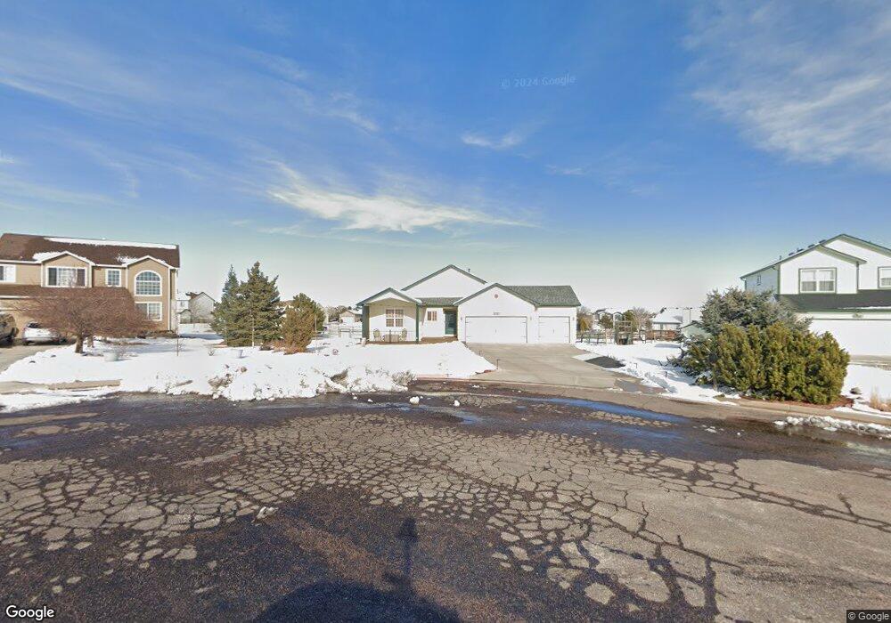
9945 Allendale Ct Peyton, CO 80831
Falcon NeighborhoodEstimated Value: $483,328 - $571,000
3
Beds
2
Baths
1,521
Sq Ft
$345/Sq Ft
Est. Value
About This Home
This home is located at 9945 Allendale Ct, Peyton, CO 80831 and is currently estimated at $524,082, approximately $344 per square foot. 9945 Allendale Ct is a home located in El Paso County with nearby schools including Bennett Ranch Elementary School, Falcon Middle School, and Falcon High School.
Ownership History
Date
Name
Owned For
Owner Type
Purchase Details
Closed on
Mar 2, 2023
Sold by
Bacharach David A
Bought by
Bacharach Living Trust
Current Estimated Value
Purchase Details
Closed on
Aug 28, 1997
Sold by
Regency Homes Inc
Bought by
Bacharach David A and Bacharach Bettie A
Home Financials for this Owner
Home Financials are based on the most recent Mortgage that was taken out on this home.
Original Mortgage
$148,575
Interest Rate
7.43%
Mortgage Type
VA
Create a Home Valuation Report for This Property
The Home Valuation Report is an in-depth analysis detailing your home's value as well as a comparison with similar homes in the area
Home Values in the Area
Average Home Value in this Area
Purchase History
We collect this data history from publicly available records. To have your information removed, we recommend requesting removal directly through your county’s website.
| Date | Buyer | Sale Price | Title Company |
|---|---|---|---|
| Bacharach Living Trust | -- | -- | |
| Bacharach David A | $158,575 | -- |
Source: Public Records
Mortgage History
We collect this data history from publicly available records. To have your information removed, we recommend requesting removal directly through your county’s website.
| Date | Status | Borrower | Loan Amount |
|---|---|---|---|
| Previous Owner | Bacharach David A | $148,575 |
Source: Public Records
Tax History
| Year | Tax Paid | Tax Assessment Tax Assessment Total Assessment is a certain percentage of the fair market value that is determined by local assessors to be the total taxable value of land and additions on the property. | Land | Improvement |
|---|---|---|---|---|
| 2025 | $2,870 | $35,320 | -- | -- |
| 2024 | $2,110 | $35,860 | $9,000 | $26,860 |
| 2023 | $2,110 | $35,860 | $9,000 | $26,860 |
| 2022 | $1,664 | $25,260 | $7,390 | $17,870 |
| 2021 | $1,693 | $25,980 | $7,600 | $18,380 |
| 2020 | $1,322 | $21,760 | $4,680 | $17,080 |
| 2019 | $1,292 | $21,760 | $4,680 | $17,080 |
| 2018 | $924 | $17,360 | $3,280 | $14,080 |
| 2017 | $863 | $17,360 | $3,280 | $14,080 |
| 2016 | $724 | $16,570 | $3,620 | $12,950 |
| 2015 | $759 | $16,570 | $3,620 | $12,950 |
| 2014 | $673 | $15,060 | $3,340 | $11,720 |
Source: Public Records
Map
Nearby Homes
- 9970 Litchfield St
- 11256 Allendale Dr
- 11553 Allendale Dr
- 11232 Allendale Dr
- 11260 Cressman Dr
- 11570 Cranston Dr
- 11459 Cranston Dr
- 10467 Pictured Rocks Dr
- 10342 Biscayne Dr
- 10324 Biscayne Dr
- 10429 Cedar Breaks Dr
- 12113 Point Reyes Dr
- 10489 Cedar Breaks Dr
- 9817 Beckham St
- 10054 Exeter Trail
- 10087 Beckham St
- 12231 Sleeping Bear Rd
- 10060 Everglades Dr
- 11334 Scenic Brush Dr
- 9876 Chromatic Terrace
- 9950 Allendale Ct
- 9935 Allendale Ct
- 9960 Litchfield St
- 9950 Litchfield St
- 9940 Allendale Ct
- 9980 Litchfield St
- 9925 Allendale Ct
- 9930 Litchfield St
- 9930 Allendale Ct
- 9920 Allendale Ct
- 11230 Cranston Dr
- 9990 Litchfield St
- 11240 Cranston Dr
- 9915 Allendale Ct
- 9910 Allendale Ct
- 11250 Cranston Dr
- 9920 Litchfield St
- 10010 Litchfield St
- 9955 Litchfield St
- 9985 Litchfield St
Your Personal Tour Guide
Ask me questions while you tour the home.