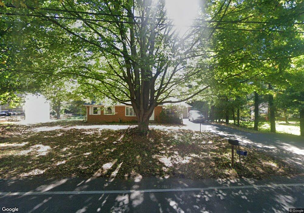
999 Security Rd Hagerstown, MD 21742
Northeast Hagerstown NeighborhoodEstimated Value: $227,000 - $322,000
3
Beds
2
Baths
1,738
Sq Ft
$163/Sq Ft
Est. Value
About This Home
This home is located at 999 Security Rd, Hagerstown, MD 21742 and is currently estimated at $283,718, approximately $163 per square foot. 999 Security Rd is a home located in Washington County with nearby schools including Pangborn Elementary School, Northern Middle School, and North Hagerstown High School.
Ownership History
Date
Name
Owned For
Owner Type
Purchase Details
Closed on
Jul 11, 2006
Sold by
Brown Dennis L
Bought by
Vogel Katherine L and Vogel John D
Current Estimated Value
Purchase Details
Closed on
Jul 6, 2006
Sold by
Brown Dennis L
Bought by
Vogel Katherine L and Vogel John D
Purchase Details
Closed on
Jan 17, 2006
Sold by
Brown Sophia I
Bought by
Brown Dennis L
Home Financials for this Owner
Home Financials are based on the most recent Mortgage that was taken out on this home.
Original Mortgage
$128,500
Interest Rate
5.75%
Mortgage Type
Purchase Money Mortgage
Create a Home Valuation Report for This Property
The Home Valuation Report is an in-depth analysis detailing your home's value as well as a comparison with similar homes in the area
Home Values in the Area
Average Home Value in this Area
Purchase History
| Date | Buyer | Sale Price | Title Company |
|---|---|---|---|
| Vogel Katherine L | $225,000 | -- | |
| Vogel Katherine L | $225,000 | -- | |
| Brown Dennis L | $225,000 | -- |
Source: Public Records
Mortgage History
| Date | Status | Borrower | Loan Amount |
|---|---|---|---|
| Previous Owner | Brown Dennis L | $128,500 |
Source: Public Records
Tax History
| Year | Tax Paid | Tax Assessment Tax Assessment Total Assessment is a certain percentage of the fair market value that is determined by local assessors to be the total taxable value of land and additions on the property. | Land | Improvement |
|---|---|---|---|---|
| 2025 | $1,522 | $175,700 | $0 | $0 |
| 2024 | $1,522 | $147,000 | $55,000 | $92,000 |
| 2023 | $1,456 | $140,600 | $0 | $0 |
| 2022 | $1,389 | $134,200 | $0 | $0 |
| 2021 | $1,355 | $127,800 | $55,000 | $72,800 |
| 2020 | $1,349 | $127,800 | $55,000 | $72,800 |
| 2019 | $1,355 | $127,800 | $55,000 | $72,800 |
| 2018 | $1,359 | $128,200 | $55,000 | $73,200 |
| 2017 | $1,359 | $128,200 | $0 | $0 |
| 2016 | -- | $128,200 | $0 | $0 |
| 2015 | -- | $134,100 | $0 | $0 |
| 2014 | $1,950 | $134,100 | $0 | $0 |
Source: Public Records
Map
Nearby Homes
- 313 Sunbrook Ln Unit 95
- 319 Sunbrook Ln Unit 98
- 340 Sunbrook Ln
- 43 Sunbrook Ln Unit 6
- 466 Pangborn Blvd
- 344 Hollymead Terrace
- 942 Monet Dr
- 486 Antietam Dr
- 1001 Jefferson Blvd
- 1005 Valleybrook Dr
- 752 Monet Dr
- 713 Medway Rd
- 1056 Valleybrook Dr
- 1023 Klick Way
- 953 View St
- 826 Monet Dr
- 939 View St
- 1275 Jefferson Blvd
- 120 E Irvin Ave
- 0 Jefferson Blvd Unit MDWA2032528
- 999 Security Rd
- 999A Security Rd
- 931 Security Rd
- 933 Security Rd
- 997 Security Rd
- 1001 Security Rd
- 1005 Security Rd
- 995 Security Rd
- 927 Security Rd
- 504 Lynnehaven Dr Unit H
- 504 Lynnehaven Dr Unit C
- 504 Lynnehaven Dr Unit M
- 504 Lynnehaven Dr Unit E
- 504 Lynnehaven Dr
- 343 Sunbrook Ln Unit 108
- 343 Sunbrook Ln
- 1221 1221 Security Rd
- 173 Security Rd
- 172 Security Rd
- 174 Security Rd
Your Personal Tour Guide
Ask me questions while you tour the home.