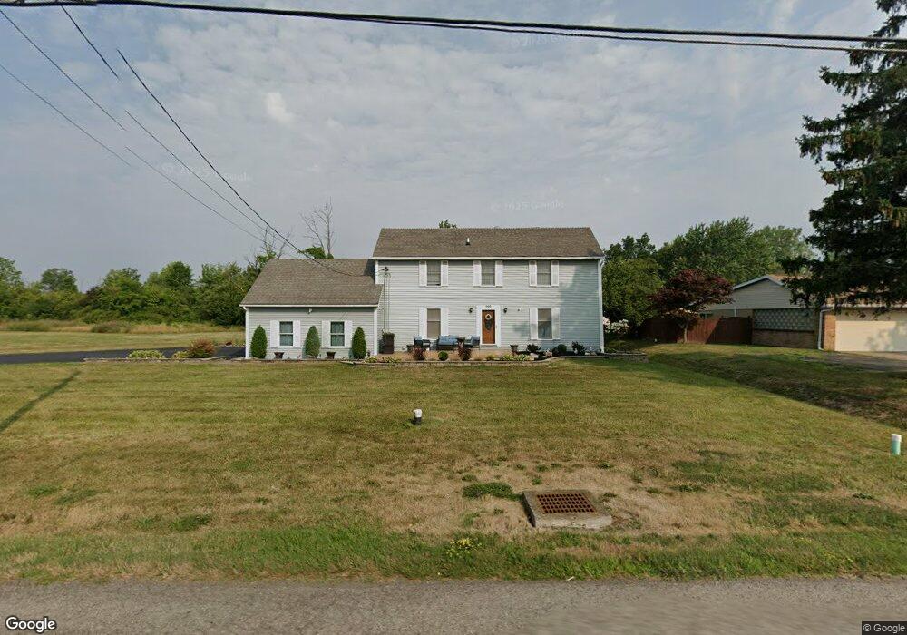
999 Upper Mountain Rd Lewiston, NY 14092
Estimated Value: $317,000 - $391,000
3
Beds
2
Baths
1,900
Sq Ft
$187/Sq Ft
Est. Value
About This Home
This home is located at 999 Upper Mountain Rd, Lewiston, NY 14092 and is currently estimated at $355,151, approximately $186 per square foot. 999 Upper Mountain Rd is a home located in Niagara County with nearby schools including Primary Education Center, Intermediate Education Center, and Lewiston Porter Middle School.
Ownership History
Date
Name
Owned For
Owner Type
Purchase Details
Closed on
Nov 15, 2011
Sold by
Foran Rachel C
Bought by
Grimmer Eric
Current Estimated Value
Home Financials for this Owner
Home Financials are based on the most recent Mortgage that was taken out on this home.
Original Mortgage
$7,500
Interest Rate
3.92%
Mortgage Type
Stand Alone Second
Purchase Details
Closed on
Jun 25, 1999
Create a Home Valuation Report for This Property
The Home Valuation Report is an in-depth analysis detailing your home's value as well as a comparison with similar homes in the area
Home Values in the Area
Average Home Value in this Area
Purchase History
We collect this data history from publicly available records. To have your information removed, we recommend requesting removal directly through your county’s website.
| Date | Buyer | Sale Price | Title Company |
|---|---|---|---|
| Grimmer Eric | $130,000 | None Available | |
| -- | -- | -- |
Source: Public Records
Mortgage History
We collect this data history from publicly available records. To have your information removed, we recommend requesting removal directly through your county’s website.
| Date | Status | Borrower | Loan Amount |
|---|---|---|---|
| Closed | Grimmer Eric | $7,500 | |
| Open | Grimmer Eric | $126,704 |
Source: Public Records
Tax History
| Year | Tax Paid | Tax Assessment Tax Assessment Total Assessment is a certain percentage of the fair market value that is determined by local assessors to be the total taxable value of land and additions on the property. | Land | Improvement |
|---|---|---|---|---|
| 2025 | $6,726 | $151,400 | $18,100 | $133,300 |
| 2024 | $6,726 | $151,400 | $18,100 | $133,300 |
| 2023 | $7,617 | $151,400 | $18,100 | $133,300 |
| 2022 | $6,172 | $139,400 | $18,100 | $121,300 |
| 2021 | $6,106 | $139,400 | $18,100 | $121,300 |
| 2020 | $5,251 | $131,400 | $18,100 | $113,300 |
| 2019 | $4,855 | $131,400 | $18,100 | $113,300 |
| 2018 | $5,018 | $131,400 | $18,100 | $113,300 |
| 2017 | $4,855 | $131,400 | $18,100 | $113,300 |
| 2016 | $4,843 | $131,400 | $18,100 | $113,300 |
| 2015 | -- | $131,400 | $18,100 | $113,300 |
| 2014 | -- | $131,400 | $18,100 | $113,300 |
Source: Public Records
Map
Nearby Homes
- 5121 Bridle Path Ln
- 809 Carriage Ln
- 5151 Bridle Path Ln
- 4951 Big Vista Dr
- 996 Little Vista Dr
- 972 Hillside Dr
- 5056 Bronson Dr
- 994 Ridge Rd
- 1043 Ridge Rd
- 4961 Creek Road Extension
- 5120 Country Club Trail
- 5079 Forest Rd
- VL Creek Rd
- VL Ridge Rd
- V/L Creek Rd
- 5082 Woodland Dr
- 5376 Annover Dr
- 2330 Ridge Rd
- Lot 38 Eddy Dr W
- Lot 36 Eddy Dr W
- 1015 Upper Mountain Rd
- 1011 Upper Mountain Rd
- 1023 Upper Mountain Rd
- 1007 Upper Mountain Rd
- 1025 Upper Mountain Rd
- 1014 Upper Mountain Rd
- 1020 Upper Mountain Rd
- 1010 Upper Mountain Rd
- 1029 Upper Mountain Rd
- 1000 Upper Mountain Rd
- 1026 Upper Mountain Rd
- 1030 Upper Mountain Rd
- 991 Upper Mountain Rd
- 1039 Upper Mountain Rd
- 1041 Upper Mountain Rd
- 1040 Upper Mountain Rd
- 1045 Upper Mountain Rd
- 986 Upper Mountain Rd
- 1046 Upper Mountain Rd
- 1008 James Dr
Your Personal Tour Guide
Ask me questions while you tour the home.