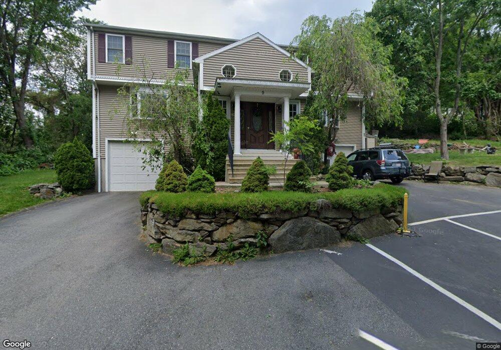
9A Ansonia Rd Worcester, MA 01605
Estimated Value: $338,000 - $439,000
3
Beds
2
Baths
1,538
Sq Ft
$260/Sq Ft
Est. Value
About This Home
This home is located at 9A Ansonia Rd, Worcester, MA 01605 and is currently estimated at $399,407, approximately $259 per square foot. 9A Ansonia Rd is a home located in Worcester County with nearby schools including Jacob Hiatt Magnet School, Chandler Magnet, and Lake View Elementary School.
Ownership History
Date
Name
Owned For
Owner Type
Purchase Details
Closed on
Oct 23, 2023
Sold by
Daigle Nicole A
Bought by
Wu Ching-Mei and Yang Chun-Hao
Current Estimated Value
Purchase Details
Closed on
Oct 4, 2012
Sold by
Hauptman Bruce and Fuller Nancy L
Bought by
Daigle Nicole A
Home Financials for this Owner
Home Financials are based on the most recent Mortgage that was taken out on this home.
Original Mortgage
$165,300
Interest Rate
3.66%
Mortgage Type
New Conventional
Purchase Details
Closed on
Jun 19, 2008
Sold by
Crown Rt and Corapi
Bought by
Hauptman Bruce and Fuller Nancy L
Home Financials for this Owner
Home Financials are based on the most recent Mortgage that was taken out on this home.
Original Mortgage
$194,000
Interest Rate
6.1%
Mortgage Type
Purchase Money Mortgage
Purchase Details
Closed on
Oct 9, 2001
Sold by
Nanni Fernando and Piombino Angelo
Bought by
Crown Rt and Corapi Antonio
Create a Home Valuation Report for This Property
The Home Valuation Report is an in-depth analysis detailing your home's value as well as a comparison with similar homes in the area
Purchase History
| Date | Buyer | Sale Price | Title Company |
|---|---|---|---|
| Wu Ching-Mei | $370,000 | None Available | |
| Daigle Nicole A | $174,000 | -- | |
| Hauptman Bruce | $242,500 | -- | |
| Hauptman Bruce | $242,500 | -- | |
| Crown Rt | $26,000 | -- |
Source: Public Records
Mortgage History
| Date | Status | Borrower | Loan Amount |
|---|---|---|---|
| Previous Owner | Crown Rt | $165,300 | |
| Previous Owner | Crown Rt | $193,000 | |
| Previous Owner | Hauptman Bruce | $194,000 |
Source: Public Records
Tax History
| Year | Tax Paid | Tax Assessment Tax Assessment Total Assessment is a certain percentage of the fair market value that is determined by local assessors to be the total taxable value of land and additions on the property. | Land | Improvement |
|---|---|---|---|---|
| 2025 | $3,684 | $279,300 | $0 | $279,300 |
| 2024 | $3,788 | $275,500 | $0 | $275,500 |
| 2023 | $3,492 | $243,500 | $0 | $243,500 |
| 2022 | $3,218 | $211,600 | $0 | $211,600 |
| 2021 | $3,329 | $204,500 | $0 | $204,500 |
| 2020 | $3,154 | $185,500 | $0 | $185,500 |
| 2019 | $3,231 | $179,500 | $0 | $179,500 |
| 2018 | $3,200 | $169,200 | $0 | $169,200 |
| 2017 | $3,202 | $166,600 | $0 | $166,600 |
| 2016 | $3,203 | $155,400 | $0 | $155,400 |
| 2015 | $3,338 | $166,300 | $0 | $166,300 |
| 2014 | $3,285 | $168,100 | $0 | $168,100 |
Source: Public Records
Map
Nearby Homes
- 29 Dominion Rd
- 64 Wauwinet Rd
- 91-93 Natural History Dr
- 2 Teconnett Path
- 340 Lake Ave N
- 19 Marietta Ave
- 65 Lake Ave Unit 1008
- 65 Lake Ave Unit 510
- 51 Alvarado Ave Unit 204
- 2 Shrewsbury Green Dr Unit F
- 18 Shrewsbury Green Dr Unit I
- 30 Shrewsbury Green Dr Unit K
- 44 Shrewsbury Green Dr Unit B
- 70 S Quinsigamond Ave Unit 5
- 6 Selina St
- 43 Tampa St
- 73 S Quinsigamond Ave
- 28 Granby Rd
- 12 Brookside Place
- 4 Hancock St
- 9 Ansonia Rd Unit B
- 9 Ansonia Rd Unit A
- 9A Ansonia Rd Unit 1
- 9 Ansonia Rd Unit 1A - Left
- 9 Ansonia Rd Unit 9A
- 9 Ansonia Rd Unit 2
- 20 Chequeset Rd
- 21 Dominion Rd
- 19 Chequeset Rd
- 11 Chequeset Rd
- 33 Dominion Rd Unit C
- 33 Dominion Rd Unit B
- 9 Chequeset Rd
- 10 Ansonia Rd
- 17 Dominion Rd
- 4 Chequeset Rd
- 7 Chequeset Rd
- 18 Belcourt Rd
- 16 Belcourt Rd
- 16 Belcourt Rd Unit 2
Your Personal Tour Guide
Ask me questions while you tour the home.