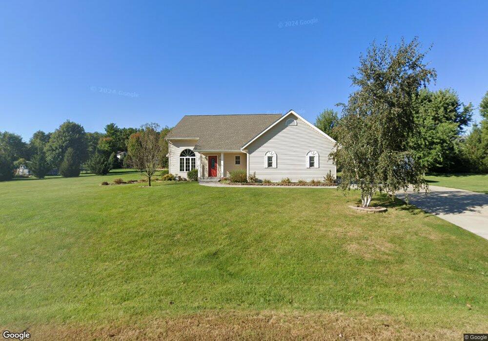
N1671 Maxwell Way Fort Atkinson, WI 53538
Estimated Value: $467,737 - $647,000
4
Beds
3
Baths
2,300
Sq Ft
$232/Sq Ft
Est. Value
About This Home
This home is located at N1671 Maxwell Way, Fort Atkinson, WI 53538 and is currently estimated at $534,684, approximately $232 per square foot. N1671 Maxwell Way is a home located in Jefferson County with nearby schools including Luther Elementary School, Fort Atkinson Middle School, and Fort Atkinson High School.
Ownership History
Date
Name
Owned For
Owner Type
Purchase Details
Closed on
Oct 22, 2008
Sold by
Deutsche Bank National Trust Co
Bought by
Theriault Michael J and Theriault April M
Current Estimated Value
Home Financials for this Owner
Home Financials are based on the most recent Mortgage that was taken out on this home.
Original Mortgage
$161,600
Outstanding Balance
$101,989
Interest Rate
5.73%
Mortgage Type
New Conventional
Estimated Equity
$432,695
Purchase Details
Closed on
Jul 10, 2008
Sold by
Brown Robert and Doe Jane
Bought by
Deutsche Bank National Trust Co
Purchase Details
Closed on
May 9, 2006
Sold by
American Builders Inc
Bought by
Brown Robert
Home Financials for this Owner
Home Financials are based on the most recent Mortgage that was taken out on this home.
Original Mortgage
$180,000
Interest Rate
9.4%
Mortgage Type
Adjustable Rate Mortgage/ARM
Create a Home Valuation Report for This Property
The Home Valuation Report is an in-depth analysis detailing your home's value as well as a comparison with similar homes in the area
Home Values in the Area
Average Home Value in this Area
Purchase History
| Date | Buyer | Sale Price | Title Company |
|---|---|---|---|
| Theriault Michael J | $208,000 | None Available | |
| Deutsche Bank National Trust Co | $204,460 | None Available | |
| Brown Robert | $225,000 | Clear Title East Llc |
Source: Public Records
Mortgage History
| Date | Status | Borrower | Loan Amount |
|---|---|---|---|
| Open | Theriault Michael J | $161,600 | |
| Previous Owner | Brown Robert | $180,000 |
Source: Public Records
Tax History
| Year | Tax Paid | Tax Assessment Tax Assessment Total Assessment is a certain percentage of the fair market value that is determined by local assessors to be the total taxable value of land and additions on the property. | Land | Improvement |
|---|---|---|---|---|
| 2025 | $5,722 | $279,300 | $47,600 | $231,700 |
| 2024 | $5,095 | $279,300 | $47,600 | $231,700 |
| 2023 | $5,158 | $279,300 | $47,600 | $231,700 |
| 2022 | $5,023 | $279,300 | $47,600 | $231,700 |
| 2021 | $4,673 | $279,300 | $47,600 | $231,700 |
| 2020 | $4,129 | $279,300 | $47,600 | $231,700 |
| 2019 | $3,836 | $208,100 | $43,600 | $164,500 |
| 2018 | $3,562 | $208,100 | $43,600 | $164,500 |
| 2017 | $3,508 | $208,100 | $43,600 | $164,500 |
| 2016 | $3,635 | $208,100 | $43,600 | $164,500 |
| 2015 | $3,678 | $208,100 | $43,600 | $164,500 |
| 2014 | $3,578 | $208,100 | $43,600 | $164,500 |
| 2013 | $3,698 | $208,100 | $43,600 | $164,500 |
Source: Public Records
Map
Nearby Homes
- 1626 Stacy Ln
- 1321 Jamesway
- 1510 Agnes Rd
- 1331 Erick St
- 213 Wollet Dr
- 217 Wollet Dr
- 1213 Adrian Blvd
- 1227 S Main St
- 602 Hilltop Trail W
- 206 Hilltop Trail
- 1220 Janesville Ave
- W5879 Arbor Rd
- N1810 U S 12
- Lot #6 Commerce Pkwy
- 1010 Grant St
- Lot #10 Commerce Pkwy
- Lot #7 Commerce Pkwy
- Lot #1 Commerce Pkwy
- Lot #9 Commerce Pkwy
- 910 S Main St
- n 1671 Maxwell Way
- N1641 Maxwell Way
- W6271 Apple Ln
- W6283 Apple Ln
- 6271 Apple Ln
- W6263 Apple Ln
- N1676 Maxwell Way
- W6225 Apple Ln
- N1644 Maxwell Way
- W6259 Apple Ln
- Lot 1 Maxwell Way
- W5929 Apple Ln
- N1693 Fairview Ln
- 5929 W Apple
- 5929 Apple Ln
- W6276 Apple Ln
- W5941 Apple Ln
- W6224 Apple Ln
- W6203 Hackbarth Rd
- N1681 Fairview Ln
Your Personal Tour Guide
Ask me questions while you tour the home.