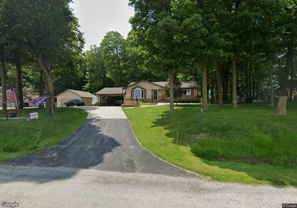
N4287 Maple Dr Iron Ridge, WI 53035
Estimated Value: $323,517 - $375,000
Studio
--
Bath
--
Sq Ft
24,742
Sq Ft Lot
About This Home
This home is located at N4287 Maple Dr, Iron Ridge, WI 53035 and is currently estimated at $346,879. N4287 Maple Dr is a home located in Dodge County with nearby schools including John Hustis Elementary School, Hustisford High School, and Bethany Lutheran School.
Ownership History
Date
Name
Owned For
Owner Type
Purchase Details
Closed on
Oct 6, 2017
Sold by
Wiersman Carol G
Bought by
Fleischmann Wayne and Fleischmann Nancy
Current Estimated Value
Home Financials for this Owner
Home Financials are based on the most recent Mortgage that was taken out on this home.
Original Mortgage
$100,000
Outstanding Balance
$51,460
Interest Rate
3.78%
Mortgage Type
Purchase Money Mortgage
Estimated Equity
$295,419
Purchase Details
Closed on
Oct 8, 2013
Sold by
Wiersma Gene H and Wiersma Jan A
Bought by
Wiersma Carol G
Purchase Details
Closed on
Feb 23, 2011
Sold by
Wiersma Howard J and Wiersma Carol G
Bought by
Wiersma Gene H and Wiersma Jan A
Create a Home Valuation Report for This Property
The Home Valuation Report is an in-depth analysis detailing your home's value as well as a comparison with similar homes in the area
Purchase History
| Date | Buyer | Sale Price | Title Company |
|---|---|---|---|
| Fleischmann Wayne | $210,000 | None Available | |
| Wiersma Carol G | -- | None Available | |
| Wiersma Gene H | -- | -- |
Source: Public Records
Mortgage History
| Date | Status | Borrower | Loan Amount |
|---|---|---|---|
| Open | Fleischmann Wayne | $100,000 |
Source: Public Records
Tax History
| Year | Tax Paid | Tax Assessment Tax Assessment Total Assessment is a certain percentage of the fair market value that is determined by local assessors to be the total taxable value of land and additions on the property. | Land | Improvement |
|---|---|---|---|---|
| 2025 | $2,891 | $163,600 | $36,800 | $126,800 |
| 2024 | $2,669 | $163,600 | $36,800 | $126,800 |
| 2023 | $2,607 | $163,600 | $36,800 | $126,800 |
| 2022 | $2,775 | $163,600 | $36,800 | $126,800 |
| 2021 | $2,352 | $161,000 | $36,800 | $124,200 |
| 2020 | $2,547 | $161,000 | $36,800 | $124,200 |
| 2019 | $2,524 | $161,000 | $36,800 | $124,200 |
| 2018 | $2,383 | $149,500 | $36,800 | $112,700 |
| 2017 | $2,436 | $149,500 | $36,800 | $112,700 |
| 2016 | $2,482 | $149,500 | $36,800 | $112,700 |
| 2015 | $2,473 | $149,500 | $36,800 | $112,700 |
| 2014 | $2,682 | $149,500 | $36,800 | $112,700 |
Source: Public Records
Map
Nearby Homes
- W4011 Hickory Rd
- N4493 Hickory Rd
- N4411 Daley Rd
- N4583 Hickory Rd
- 109 S Lake St
- 127 S Lake St
- 143 N Ridge St
- 244 S Ridge St
- 0 Confidential Rd Unit 1955726
- W4436 E Lakeview Rd
- N4973 Lake Dr
- N4554 Lakeview Rd
- N4985 Arrowhead Trail
- N5413 County Rd S
- 119 S Schuyler St
- 233 W Pleasant St
- 138 E Lehman St
- 210 N Main St
- 234 Watertower Cir
- Lt1 Lilly Rd
- N4295 Maple Dr
- N4277 Maple Dr
- N4269 Maple Dr
- N4298 Maple Dr
- N4270 Maple Dr
- N4255 Maple Dr
- W3684 E Maple Dr
- N4235 Maple Dr
- W3687 E Maple Dr
- N4216 Maple Dr
- N4211 Maple Dr
- N4202 Maple Dr
- W3703 Oak Lawn Rd
- W3696 Oak Lawn Rd
- N4189 Maple Dr
- N4170 Maple Dr
- N4311 Rich Glo Ln
- N4152 Maple Dr
- N4316 Rich Glo Ln
- N4322 Rich Glo Ln
Your Personal Tour Guide
Ask me questions while you tour the home.