


on Sand Point Rd Munising, MI 49862
Estimated payment $1,268/month
About This Lot
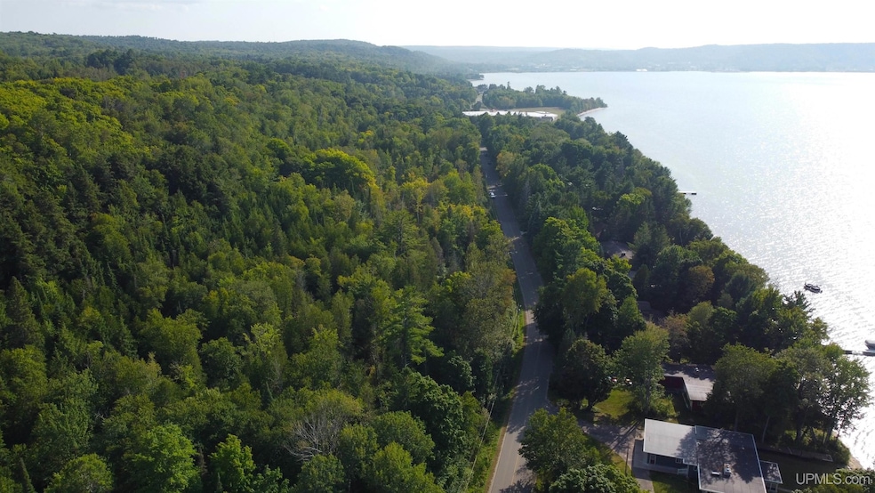
Looking for acreage within the city limits of Munising? Look no further. This +/-17 acre parcel has roughly 2,000 feet of frontage on Sand Point Road. It’s located just down the road from Pictured Rocks National Lakeshore Headquarters and the Sand Point Public Beach.
Property Details
Property Type
- Land
Lot Details
- 17 Acre Lot
- 2,300 Ft Wide Lot
- Property is zoned Recreational
Listing and Financial Details
- Assessor Parcel Number 051-486-002-00
Map
Property History
| Date | Event | Price | List to Sale | Price per Sq Ft |
|---|---|---|---|---|
| 08/23/2024 08/23/24 | For Sale | $200,000 | -- | -- |
Source: Upper Peninsula Association of REALTORS®
MLS Number: 50153190
Disclaimer: Certain information contained herein is derived from information provided by parties other than Homes.com. All information provided is deemed reliable, but is not guaranteed to be accurate and should be independently verified.
![]() IDX information is provided exclusively for personal, non-commercial use, and may not be used for any purpose other than to identify prospective properties consumers may be interested in purchasing. Information is deemed reliable but not guaranteed.
IDX information is provided exclusively for personal, non-commercial use, and may not be used for any purpose other than to identify prospective properties consumers may be interested in purchasing. Information is deemed reliable but not guaranteed.
- E 9858 Negilski Rd
- 0000 County Road H-58
- 212 W Munising Ave
- 220 W Munising Ave
- E9399 Michigan 28
- 208 E Onota St
- 213 Lynn St
- 322 W Superior St
- 712 & 712 1/2 W Superior
- 324 W Onota St
- 921 W Superior St
- 331 E Varnum St
- 909 W Superior St
- 116 W Varnum St
- E9915 Old Indiantown Rd
- on Gage Rd
- E9434 Stone St
- TBD Leatherleaf Ln
- TBD H58
- South 8 Acres Perch Lake Rd

Ask me questions while you tour the home.