


Estimated payment $2,500/month
Highlights
- View of Trees or Woods
- No HOA
- No Heating
- 640 Acre Lot
- Landscaped with Trees
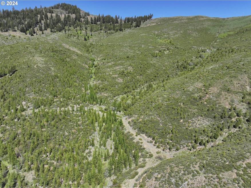
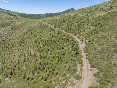
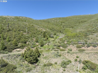
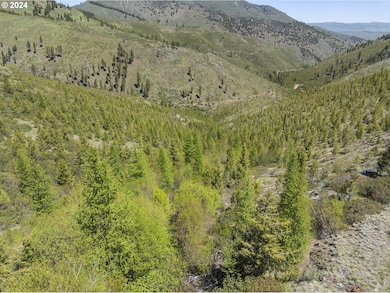
About This Lot
Discover your own private retreat with this 640-acre recreational property in southern Baker County, OR. Perfectly positioned for outdoor enthusiasts, the land offers eligibility for two Landowner Preference Tags each for both deer and elk. The property boasts an excellent road system, ensuring easy access throughout the terrain. With multiple springs scattered across the acreage, water sources are plentiful and present opportunities for spring developments.Completely surrounded by National Forest, this property provides unmatched privacy and a seamless connection to nature. The nearby Monument Rock Wilderness Area adds to the allure, offering stunning landscapes and additional recreational opportunities. As a long-term investment, this property presents a unique opportunity with potential grants and cost share funding available for timber replanting through the NRCS and/or Oregon Department of Forestry, ensuring sustainable land management.Potential to build multiple cabins, creating a perfect getaway - buyers should verify building regulations with the Baker County Planning Department. Conveniently located just 11 miles from Unity, 59 miles from Baker City, 60 miles from John Day, 139 miles from Boise, ID, and 212 miles from Bend. This property combines seclusion with accessibility. Embrace the serene beauty and endless possibilities of this exceptional Baker County recreational property. *Potential buyers entering property do so at their own risk. Side roads are not suitable for pickups and should be considered ATV/UTV only with some roads very difficult to turn around. Anyone entering property must have suitable fire fighting equipment. *Seller financing terms: $200,000 down, 5% interest, up to 10 year carry.
Listing Agent
Land Leader Brokerage Email: evan@landandwildlife.com License #201223650 Listed on: 06/10/2024
Property Details
Property Type
- Land
Est. Annual Taxes
- $1,621
Lot Details
- 640 Acre Lot
- Lot Dimensions are 5280' x 5280'
- Dirt Road
- Landscaped with Trees
- Additional Parcels
- Property is zoned T/G
Property Views
- Woods
- Mountain
- Valley
Schools
- Burnt River Elementary And Middle School
- Burnt River High School
Utilities
- No Utilities
Community Details
- No Home Owners Association
Listing and Financial Details
- Assessor Parcel Number 11405
Map
Home Values in the Area
Average Home Value in this Area
Property History
| Date | Event | Price | List to Sale | Price per Sq Ft |
|---|---|---|---|---|
| 06/02/2025 06/02/25 | Price Changed | $450,000 | 0.0% | -- |
| 06/02/2025 06/02/25 | For Sale | $450,000 | -9.1% | -- |
| 06/01/2025 06/01/25 | Off Market | $495,000 | -- | -- |
| 10/09/2024 10/09/24 | Price Changed | $495,000 | -10.0% | -- |
| 06/11/2024 06/11/24 | For Sale | $550,000 | -- | -- |
Source: Regional Multiple Listing Service (RMLS)
MLS Number: 24159006
Disclaimer: Certain information contained herein is derived from information provided by parties other than Homes.com. All information provided is deemed reliable, but is not guaranteed to be accurate and should be independently verified.
![]() The content relating to real estate for sale on this web site comes in part from the IDX program of the RMLS™ of Portland, Oregon. Real estate listings held by brokerage firms other than Ten-X are marked with the RMLS™ logo, and detailed information about these properties includes the names of the listing brokers. Listing content is copyright © 2025 RMLS™, Portland, Oregon. Some properties which appear for sale on this web site may subsequently have sold or may no longer be available. All information provided is deemed reliable but is not guaranteed and should be independently verified.
The content relating to real estate for sale on this web site comes in part from the IDX program of the RMLS™ of Portland, Oregon. Real estate listings held by brokerage firms other than Ten-X are marked with the RMLS™ logo, and detailed information about these properties includes the names of the listing brokers. Listing content is copyright © 2025 RMLS™, Portland, Oregon. Some properties which appear for sale on this web site may subsequently have sold or may no longer be available. All information provided is deemed reliable but is not guaranteed and should be independently verified.
