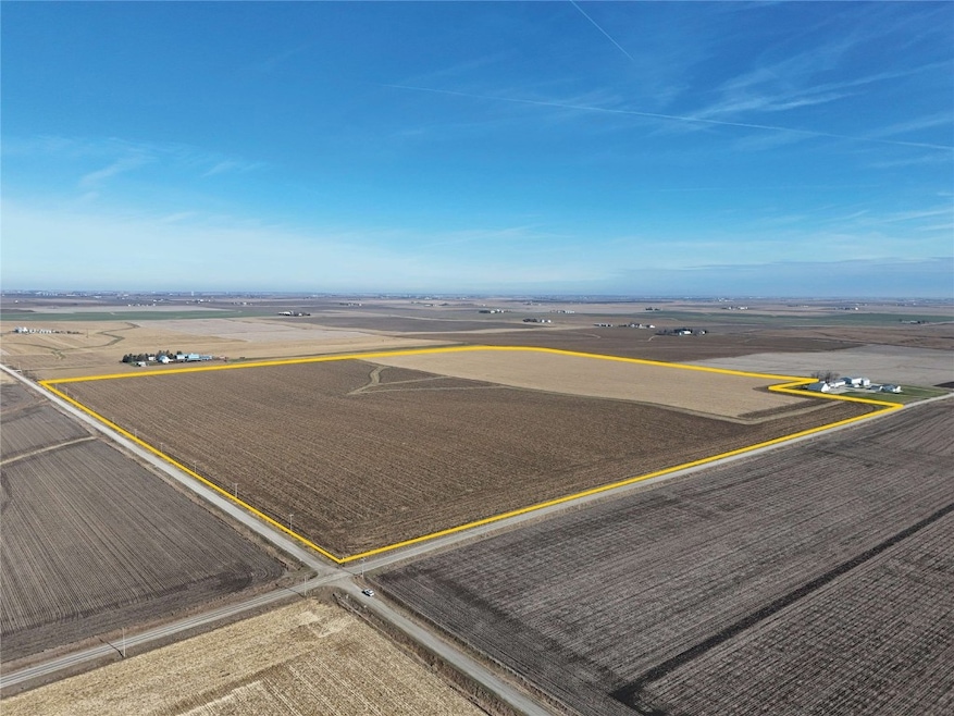
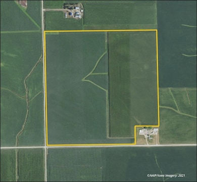
0 75th Street Dr Blairstown, IA 52209
Estimated payment $14,510/month
Highlights
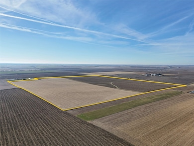
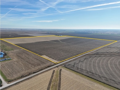
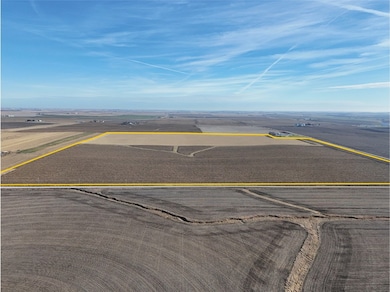
- 149 Acre Lot
- Gentle Sloping Lot
- Farm
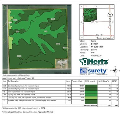
About This Lot
This is a high-quality Benton County farm with an 89.80 CSR2! Primary soils are Dinsdale and Colo-Ely. CSR2 on the 149 crop acres is
89.80. See soil map for detail.
Property Details
Property Type
- Land
Est. Annual Taxes
- $5,598
Lot Details
- 149 Acre Lot
- Gentle Sloping Lot
- Zoning described as Ag
Home Design
- Farm
Listing and Financial Details
- Assessor Parcel Number 77013610
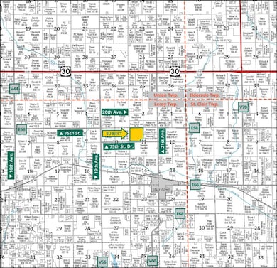
Map
Home Values in the Area
Average Home Value in this Area
Property History
| Date | Event | Price | List to Sale | Price per Sq Ft |
|---|---|---|---|---|
| 12/02/2025 12/02/25 | For Sale | $2,667,100 | -- | -- |
Source: Cedar Rapids Area Association of REALTORS®
MLS Number: 2509670
Disclaimer: Certain information contained herein is derived from information provided by parties other than Homes.com. All information provided is deemed reliable, but is not guaranteed to be accurate and should be independently verified.
![]() IDX information is provided exclusively for personal, non-commercial use, and may not be used for any purpose other than to identify prospective properties consumers may be interested in purchasing.
IDX information is provided exclusively for personal, non-commercial use, and may not be used for any purpose other than to identify prospective properties consumers may be interested in purchasing.
Information is deemed reliable but not guaranteed.
- 610 Commercial Ct
- 3101 Stoney Point Rd SW
- 470 Quail Ct SW
- 5200 16th Ave SW
- 5150 16th Ave SW
- 4900 16th Ave SW
- 110 Jacolyn Dr SW
- 3205 Samuel Ct SW
- 4419 1st Ave SW
- 4227 21st Ave SW
- 2155 Westdale Dr SW
- 1308 Adair Ct SW
- 1210 Auburn Dr SW
- 3320 Queen Dr
- 3404 Queen Dr SW
- 1270 Edgewood Rd NW
- 3200-3201 G Ave NW
- 321 28th St NW
- 2202-2238 River Bluffs Dr
- 1601 30th St NW
