Estimated payment $345/month
Highlights
- 91 Acre Lot
- Brush Vegetation
- Level Lot
- No HOA
About This Lot
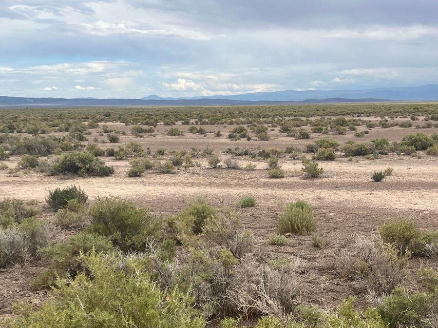
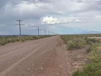
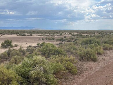
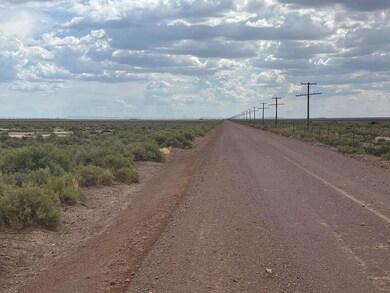
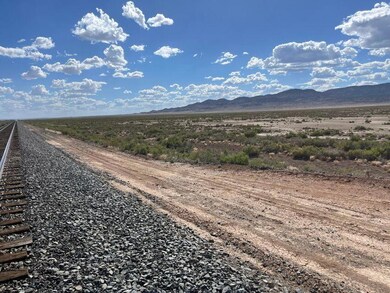
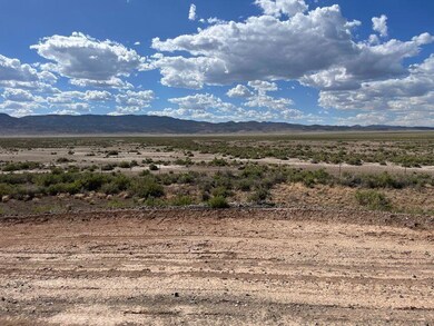
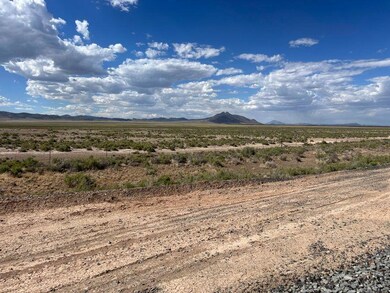
Come purchase 91 acres of rural land near the unincorporated town of Lund, UT. Property is divided by railroad tracks. The large section of the property (68 acres) is on the North side of the railroad tracks and the small section of property (23 acres) is on the South side of the tracks. The 23 acres on the South side has great access and prime road frontage. Only 50 minutes to Cedar City or 45 minutes to Enterprise. 48 minutes to Newcastle Reservoir or 49 Minutes to Minersville Reservoir. Great off grid property could be used for camping, RVing, cattle grazing, or even a great place to build a home. Come check it out today.
Listing Agent
KW ASCEND KELLER WILLIAMS REAL License #5555165-SA00 Listed on: 04/25/2025

Property Details
Property Type
- Land
Est. Annual Taxes
- $346
Lot Details
- 91 Acre Lot
- Brush Vegetation
- Level Lot
- Property is zoned AGRICULTURAL
Utilities
- Electricity Not Available
- Natural Gas Not Available
Community Details
- No Home Owners Association
Listing and Financial Details
- Assessor Parcel Number E-0711-0000-0000
Map
Home Values in the Area
Average Home Value in this Area
Tax History
| Year | Tax Paid | Tax Assessment Tax Assessment Total Assessment is a certain percentage of the fair market value that is determined by local assessors to be the total taxable value of land and additions on the property. | Land | Improvement |
|---|---|---|---|---|
| 2025 | $343 | $43,953 | $43,953 | -- |
| 2023 | $343 | $43,950 | $43,950 | $0 |
| 2022 | $342 | $38,220 | $38,220 | $0 |
| 2021 | $244 | $27,300 | $27,300 | $0 |
| 2020 | $184 | $18,200 | $18,200 | $0 |
| 2019 | $192 | $18,200 | $18,200 | $0 |
| 2018 | $196 | $18,200 | $18,200 | $0 |
| 2017 | $196 | $18,200 | $18,200 | $0 |
| 2016 | $217 | $18,200 | $18,200 | $0 |
Property History
| Date | Event | Price | List to Sale | Price per Sq Ft |
|---|---|---|---|---|
| 04/25/2025 04/25/25 | For Sale | $59,900 | -- | -- |
Source: Iron County Board of REALTORS®
MLS Number: 111050
APN: E-0711-0000-0000
- 0 91 Acre E-0711-0000-0000 Unit 25-260676
- 0 40acres #E-0721-0000-0000 Unit 25-262737
- 0 40acres #E-0721-0000-0000 Unit 112058
- 0 20 Acres Northeast of Unit 109532
- 0 + - 17 50-Acres Unit 25-266556
- 0 160 Acres E-0866-0000-0000 Unit 111778
- 160 ACRES E-0866-0000-0000 + 1 Af Water
- 80 Ac. Shoppmann Rd
- 60 Acres Near Lund
- 0 103 44 Acres E-0549-0002-0000 Unit 108637
- Rd
- 18751 Pine Valley Rd
- 80 Acres (E-0924-0000-0000)
- 0 20 Acres E-1202-0005-0000 Unit 111091
- 0 20 Acres E-1202-0005-0000 Unit 25-260733
- 308 N 41 W
- 320 Ac N of Antelope Rd
- 0 160 Acres + 1 Acft Water Unit 25-263084
- 0 160 Acres + 1acft Water Right Unit 112232
- 0 8000 N
- 1896 W Aaron Tippets Rd
- 2782 N Clark Pkwy
- 4616 N Tumbleweed Dr
- 4349 Half Mile Rd Unit Apartment
- 535 W 2530 N Unit 8
- 535 W 2530 N
- 2620 175 W
- 2014 N 350 W
- 1673 Northfield Rd Unit 1673 Northfield Rd Cedar
- 1260 N 650 W
- 703 W 1225 N
- 780 W 1125 N
- 1177 Northfield Rd
- 576 W 1045 N Unit B12
- 1148 Northfield Rd
- 939 Ironwood Dr
- 1055 W 400 N
- 230 N 700 W
- 333 N 400 W
- 333 N 400 W