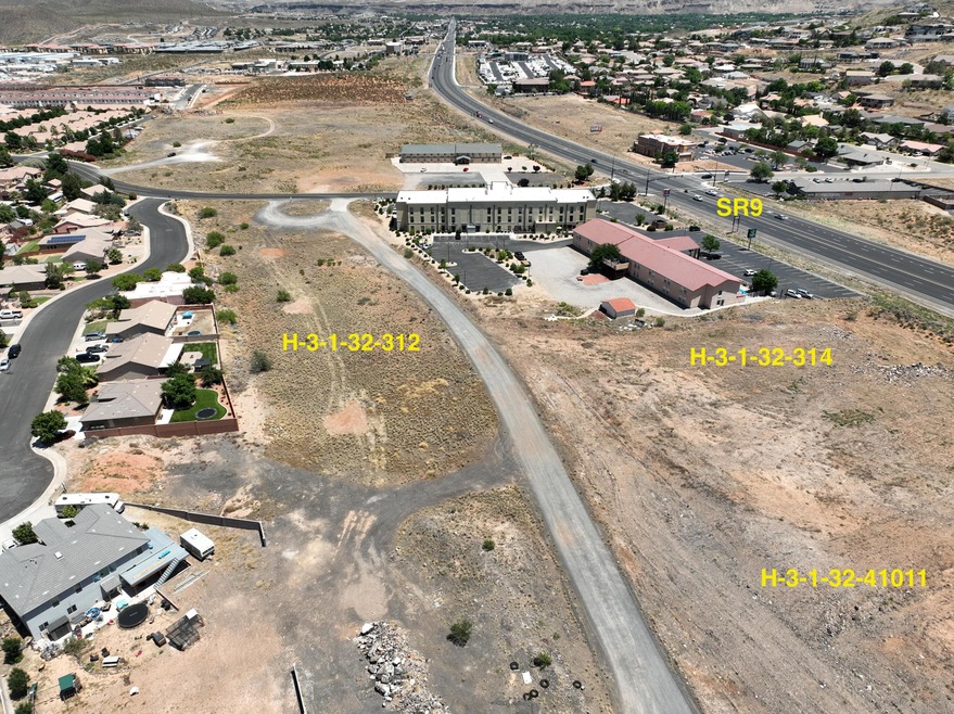

0 Approx 2700 W State St Hurricane, UT 84737
Estimated payment $13,927/month
About This Lot
High Density Residential R-3 Zoning allows for 15 units/lots per acre.
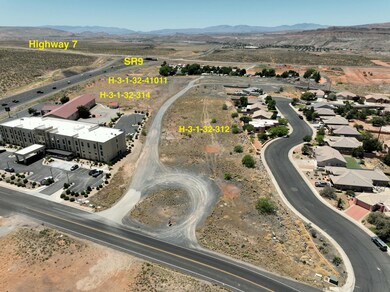
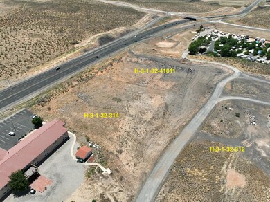
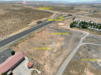
Located on SR-9 and close to SR-7 interchange in Hurricane High Growth and Redevelopment Area. This area has some of the highest ADT in Southern Utah.
Property Details
Property Type
- Land
Est. Annual Taxes
- $8,457
Lot Details
- 4.79 Acre Lot
- Property is zoned RM-3
Home Design
- 208,652 Sq Ft Home
Schools
- Hurricane Elementary School
- Hurricane Middle School
- Hurricane High School
Community Details
- Hurricane Townsite Subdivision
Listing and Financial Details
- Assessor Parcel Number H-3-1-32-3123
Map
Home Values in the Area
Average Home Value in this Area
Property History
| Date | Event | Price | List to Sale | Price per Sq Ft |
|---|---|---|---|---|
| 01/31/2025 01/31/25 | For Sale | $2,503,828 | +148.8% | $12 / Sq Ft |
| 01/31/2025 01/31/25 | For Sale | $1,006,236 | -13.5% | $15 / Sq Ft |
| 01/31/2025 01/31/25 | For Sale | $1,163,052 | -- | $15 / Sq Ft |
Source: Washington County Board of REALTORS®
MLS Number: 25-257737
Disclaimer: Certain information contained herein is derived from information provided by parties other than Homes.com. All information provided is deemed reliable, but is not guaranteed to be accurate and should be independently verified.
![]() All information should be verified by the recipient and none is guaranteed as accurate by ARMLS
All information should be verified by the recipient and none is guaranteed as accurate by ARMLS
Listing Information presented by local MLS brokerage: Ten-X, local REALTOR®- Arlene Richardson - (888)-952-6393
- 144 Ash St
- 2631 W 190 N
- 2640 W 200 N
- 2571 W 100 S
- 2634 W 230 N
- 2800 W Sr-9 (State Street)
- Lot # 3 Located On Spilsbury Ct
- 2523 W Spilsbury Ct
- Mesa Plan at Canyon Villas
- Bluff Plan at Canyon Villas
- Sierra Plan at Canyon Villas
- Summit Plan at Canyon Villas
- Vista Plan at Canyon Villas
- Ridgeline Plan at Canyon Villas
- 6.26 Acres State Route 9
- 0 6 26 Acres Sr9
- 2615 W 250 N
- 306 N 2815 W
- 314 N 2815 W
- 0 3 Acres Sr9
- 508 N 2480 W
- 485 N 2170 W
- 310 S 1930 W
- 1517 W 470 N
- 983 W State St
- 3364 W 2490 S Unit ID1250633P
- 3273 W 2530 S Unit ID1250638P
- 4077 Gritton St
- 3212 S 4900 W
- 3252 S 4900 W
- 128 N Lone Rock Dr Unit A-303
- 3020 Silver Reef Dr
- 3937 E Razor Dr
- 1 Rainbow Ln
- 1358 S Pole Creek Ln
- 190 N Red Stone Rd
- 1165 E Bulloch St
- 45 N Red Trail Ln
- 626 N 1100 E
- 845 E Desert Cactus Dr
