NOT LISTED FOR SALE

0 Boston Branch Cir Unit 1247390 Signal Mountain, TN 37377

Mowbray Neighborhood

Estimated Value: $266,739

8 Acres
$32,411 Price per Acre
358,499 Sq Ft Lot

Last Sold September 15, 2016

Last sale price $129,500

Est. 106% increase in value since last sale

Current estimated payment $1,565/month

67 Days on Market

Highlights

  • 8.23 Acre Lot
  • Wooded Lot
  • Rectangular Lot
  • Nolan Elementary School Rated A-
  • No HOA

About This Lot

As of September 2016

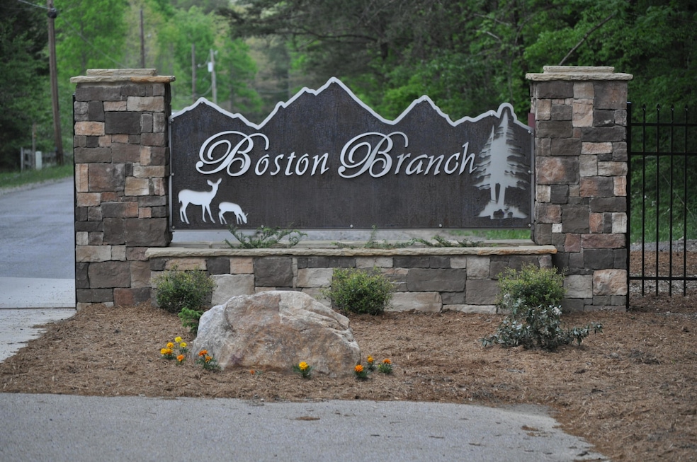
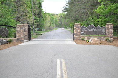
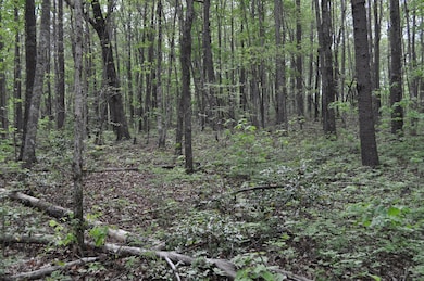
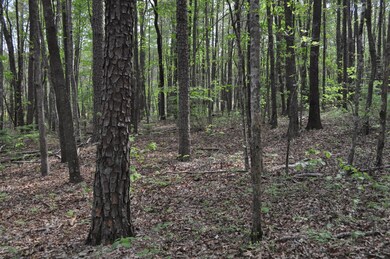
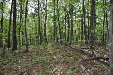
One of a kind 8.2 acre property is available and ready for your dream home. Located within the gated Boston Branch Community, this 8.2 acres has the privacy and high ground over the water. All the fishing, swimming and paddling hearts can handle is just steps away. The 8.2 acres tract is mostly square in shape and affords privacy in all directions. This land is priced to sell and is ready to develop. Zoned for award-winning schools, Boston Branch offers a 24 acre lake, miles of hiking trails, and surrounded by 7000 state owned acres. Please call listing agent with questions or to set an appointment for a private showing.

Last Agent to Sell the Property

Matt McDonald

Real Estate Brokers Listed on: 06/07/2016

Last Buyer's Agent

Guy Ferro

Keller Williams Realty

Property Details

Property Type

  • Land

Est. Annual Taxes

  • $561

Lot Details

  • 8.23 Acre Lot
  • Lot Dimensions are 590x540
  • Property fronts a county road
  • Rectangular Lot
  • Wooded Lot

Schools

  • Nolan Elementary School
  • Signal Mountain Middle School
  • Signal Mtn High School

Utilities

  • Gas Available
  • Phone Available
  • Cable TV Available

Community Details

  • No Home Owners Association
  • Rodwell Association
  • Boston Branch Subdivision

Listing and Financial Details

  • Assessor Parcel Number 064g C 004.02

Property Details

Property Type

Land

Est. Annual Taxes

$561

Lot Details

0

Listing Details

  • Property Sub Type: Unimproved Land
  • Prop. Type: Land
  • Lot Size Acres: 8.23
  • Lot Size: 590x540
  • Road Frontage Type: County Road
  • Road Surface Type: Paved
  • Subdivision Name: Boston Branch
  • Directions: Taft Hwy to right on Corral Rd for 2.8 miles, left on Sawyer Pike for 2.4 miles, to left onto Hixson Springs Rd to Boston Branch community.
  • Location Tax and Legal Parcel Number2: 064g C 004.02
  • Location Tax and Legal Elementary School: Nolan Elementary
  • Location Tax and Legal High School: Signal Mtn
  • Location Tax and Legal:Tax Annual Amount: 561.34
  • General Property Information Lot Size Acres: 8.23
  • General Property Information Lot Size Square Feet2: 358498.8
  • General Property Information Lot Size Dimensions: 590x540
  • General Property Information View YN2: No
  • General Property Information Waterfront YN: No
  • Utilities:Cable Available: Yes
  • Utilities:Electricity Available: Yes
  • Water Source:Public: Yes
  • Location Tax and Legal Middle or Junior School: Signal Mountain Middle
  • Utilities Phone Available: Yes
  • General Property Information Flood Zone YN2: No
  • Utilities:Water Available: Yes
  • Utilities Natural Gas Available: Yes
  • Road Frontage Type County Road: Yes
  • Status Change Information Association Name 2: Rodwell
  • Special Features: None

Interior Features

  • Possible Use: Single Family

Exterior Features

  • Lot Features: Rectangular Lot, Wooded, Will Not Divide
  • View: No
  • Waterfront: No
  • Other Structures: None
  • Lot Features:Rectangular Lot: Yes
  • Lot Features:Wooded: Yes

Utilities

  • Utilities: Cable Available, Electricity Available, Natural Gas Available, Phone Available, Water Available
  • Water Source: Public

Condo/Co-op/Association

  • Community Features: Other
  • Association: No

Association/Amenities

  • General Property Information:Association YN: No

Schools

  • Elementary School: Nolan Elementary
  • High School: Signal Mtn
  • Middle Or Junior School: Signal Mountain Middle

Lot Info

  • Current Use: Residential
  • Lot Size Sq Ft: 358498.8
  • Parcel #: 064g C 004.02
  • ResoLotSizeUnits: Acres

Tax Info

  • Tax Annual Amount: 561.34

Ownership History

Date Name Owned For Owner Type

Purchase Details

Listed on
Jun 7, 2016
Closed on
Sep 15, 2016
Sold by
Brooks Eric D and Brooks Rebecca L
Bought by
Rodwell Jason and Rodwell Deborah
Seller's Agent
Matt McDonald
Real Estate Brokers
Buyer's Agent
Guy Ferro
Keller Williams Realty
List Price
$139,000
Sold Price
$129,500
Premium/Discount to List
-$9,500
-6.83%
Total Days on Market
67
Current Estimated Value
$266,739

Home Financials for this Owner

Home Financials are based on the most recent Mortgage that was taken out on this home.
Estimated Appreciation
$137,239
Original Mortgage
$97,125
Outstanding Balance
$19,484
Interest Rate
3.43%
Mortgage Type
Unknown
Source: Public Records

Similar Properties in Signal Mountain, TN

  • 8981 Big Bend Tract Rd E, Signal Mountain, TN 37377

    $315,000

    • Land
    • 6 Acres
    • $50,481 per Acre
    • 8981 Big Bend Tract Rd E
    • Signal Mountain, TN

    Secluded 6.24-Acre Lot in Gated Community - Backs to 6,000+ Acres of Protected State Land Drone Video- Homes, INC, a prominent Signal Mountain Builder, is the seller of this lot and has availability to build on the lots that are sold. Welcome to your private slice of paradise! Nestled within a secure, gated community surrounded by towering trees and pristine wilderness, this rare 6.24-acre

    Elise Baker Keller Williams Realty

    Section Image
  • 8981 Rd, Signal Mountain, TN 37377

    $315,000

    • Land
    • 6 Acres
    • $49,451 per Acre
    • 8981 Rd
    • Signal Mountain, TN

    Secluded 6.37-Acre Lot in Gated Community - Backs to 6,000+ Acres of Protected State Land Drone Video- Homes, INC, a prominent Signal Mountain Builder, is the seller of this lot and has availability to build on the lots that are sold. Welcome to your private slice of paradise! Nestled within a secure, gated community surrounded by towering trees and pristine wilderness, this rare 6.37-acre

    Elise Baker Keller Williams Realty

    Section Image
  • 0 Grandview Rd Unit 1386742, Signal Mountain, TN 37377

    $310,000

    • Land
    • 10 Acres
    • $32,461 per Acre
    • 0 Grandview Rd
    • Unit 1386742
    • Signal Mountain, TN

    This 9.55 acre lot is within a gated subdivision and offers scenic bluff views looking west towards the Sequatchie Valley. You'll find tranquility and serenity here that is hard to come by. The property is a blank canvas ready for you to build your custom home, create a serene sanctuary, or use it as an extension of the property next door which is also available for purchase (601 Grandview Rd,

    Eleanor Dobson Crye-Leike, REALTORS

    Section Image

Range of Values:

Collateral Analytics

Collateral Analytics Collateral Analytics AVMs (Automated Valuation Model) employ a number of statistical approaches combined with neighborhood-specific comparable selection guarantees the most up-to-date and precise valuations.

Not Available

Collateral Analytics does not have data for the current month. Please view the chart for historical values.

ICE

ICE Mortgage Technology ICE Mortgage Technology’s AVM (Automated Valuation Model) is a state-of-the-art online residential property valuation tool that provides a quick and accurate estimate of the value of almost any home in the U.S.

Not Available

ICE Mortgage Technology does not have data for the current month. Please view the chart for historical values.

First American

First American First American Data & Analytics’ next-generation AVM combines unrivaled data assets with a blended ensemble of valuation models to produce highly accurate, reliable valuations you can trust.

Not Available

First American does not have data for the current month. Please view the chart for historical values.

Quantarium

Quantarium Quantarium’s valuation service, repeatedly proven the industry’s most accurate and comprehensive, is supercharged with a self-learning and auto-tuning AI engine that continually becomes smarter and more accurate as it processes daily inputs from the industry’s leading RE data lake.

Not Available

Quantarium does not have data for the current month. Please view the chart for historical values.

Average Value
Not Available
List Price
Sold Price
Create a Home Valuation Report for This Property
The Home Valuation Report is an in-depth analysis detailing your home's value as well as a comparison with similar homes in the area

Home Values in the Area

Source: Public Records

Average Home Value in this Area


Source: Public Records

Purchase History

Date Buyer Sale Price Title Company
Rodwell Jason $129,500 Cumberland Title & Guranty C
Source: Public Records

Mortgage History

Date Status Borrower Loan Amount
Open Rodwell Jason $97,125
Source: Public Records

Property History

Date Event Price Change Sq Ft Price
09/15/2016 09/15/16 Sold $129,500 -6.8% --
08/13/2016 08/13/16 Pending -- -- --
06/07/2016 06/07/16 For Sale $139,000 -- --
Source: Greater Chattanooga REALTORS®

Tax History Compared to Growth

Source: Public Records

Tax History

Year Tax Paid Tax Assessment Tax Assessment Total Assessment is a certain percentage of the fair market value that is determined by local assessors to be the total taxable value of land and additions on the property. Land Improvement
2024 $812 $36,275 $0 $0
2023 $812 $36,275 $0 $0
2022 $812 $36,275 $0 $0
2021 $812 $36,275 $0 $0
2020 $802 $29,000 $0 $0
2019 $802 $29,000 $0 $0
2018 $802 $29,000 $0 $0
2017 $802 $29,000 $0 $0
2016 $561 $0 $0 $0
2015 $561 $20,300 $0 $0
2014 -- $0 $0 $0
Source: Public Records

Agents Affiliated with this Home

See All Agents

Map

Source: Greater Chattanooga REALTORS®

MLS Number: 1247390

Greater Chattanooga REALTORS®

APN: 064G-C-004.02