0 Branston Cir Unit 737643 Bella Vista, AR 72714
Estimated Value: $391,000 - $545,000
--
Bed
--
Bath
2,070
Sq Ft
$218/Sq Ft
Est. Value
About This Home
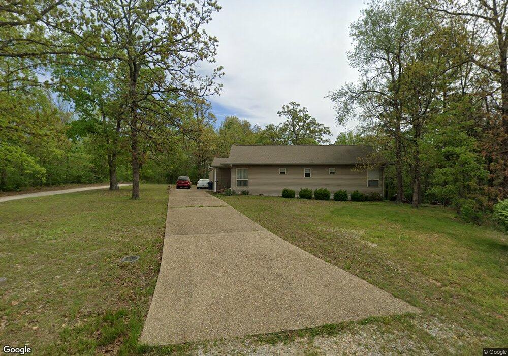
This home is located at 0 Branston Cir Unit 737643, Bella Vista, AR 72714 and is currently estimated at $450,503, approximately $217 per square foot. 0 Branston Cir Unit 737643 is a home located in Benton County with nearby schools including Cooper Elementary School, Old High Middle School, and Washington Junior High School.
Ownership History
Date
Name
Owned For
Owner Type
Purchase Details
Closed on
Jul 19, 2023
Sold by
Equity Trust Co
Bought by
Wright Roger L and Wright Jo M
Current Estimated Value
Purchase Details
Closed on
Mar 22, 2022
Sold by
Commissioner Of State Lands
Bought by
Menuri Llc
Purchase Details
Closed on
Mar 24, 2021
Sold by
Kevin Mary and Kevin G
Bought by
Menuri Llc
Purchase Details
Closed on
Jul 29, 2015
Sold by
Commissioner Of State Lands
Bought by
F/V Jetta D Employee Profit Sharing Plan
Purchase Details
Closed on
Apr 27, 2001
Bought by
Larson Tr
Purchase Details
Closed on
Dec 12, 1988
Bought by
Mm Black
Purchase Details
Closed on
Feb 9, 1982
Bought by
Black
Create a Home Valuation Report for This Property
The Home Valuation Report is an in-depth analysis detailing your home's value as well as a comparison with similar homes in the area
Home Values in the Area
Average Home Value in this Area
Purchase History
| Date | Buyer | Sale Price | Title Company |
|---|---|---|---|
| Wright Roger L | $430,000 | None Listed On Document | |
| Menuri Llc | $309 | None Listed On Document | |
| Menuri Llc | -- | None Available | |
| F/V Jetta D Employee Profit Sharing Plan | $247 | None Available | |
| Larson Tr | -- | -- | |
| Mm Black | -- | -- | |
| Black | $6,000 | -- |
Source: Public Records
Tax History Compared to Growth
Tax History
| Year | Tax Paid | Tax Assessment Tax Assessment Total Assessment is a certain percentage of the fair market value that is determined by local assessors to be the total taxable value of land and additions on the property. | Land | Improvement |
|---|---|---|---|---|
| 2025 | $5,023 | $81,104 | $1,600 | $79,504 |
| 2024 | $4,972 | $81,104 | $1,600 | $79,504 |
| 2023 | $49 | $800 | $800 | $0 |
| 2022 | $46 | $800 | $800 | $0 |
| 2021 | $42 | $800 | $800 | $0 |
| 2020 | $38 | $600 | $600 | $0 |
| 2019 | $38 | $600 | $600 | $0 |
| 2018 | $38 | $600 | $600 | $0 |
| 2017 | $37 | $600 | $600 | $0 |
| 2016 | $37 | $600 | $600 | $0 |
| 2015 | $31 | $1,000 | $1,000 | $0 |
| 2014 | $31 | $1,000 | $1,000 | $0 |
Source: Public Records
Map
Nearby Homes
- 0 Branston Cir Unit 290004
- 0 Branston Cir Unit 347873
- 0 Branston Cir Unit 348333
- 0 Branston Cir Unit 352186
- 0 Branston Cir Unit 295533
- 0 Branston Cir Unit 1182182
- 0 Branston Cir Unit 1180854
- 18 Branston Cir
- 7 Branston Cir
- 2209 Branston Cir
- 707 Branston Cir
- 5 Branston Cir
- 0 Hanover St
- 0 Hanover Dr
- 1 Holcombe Ln
- 2 Holcombe Ln
- 0 Hanover & Branston Cir
- 10 Branston Cir
- 3 Holcombe Ln
- 2 Holborn Ln