$122,500
SOLD OCT 14, 2025

0 Cave Ridge Rd Hinton, WV 25951

47.51 Acres
$2,578 Price per Acre
2,069,536 Sq Ft Lot

Recently Sold

12% Below List Price

17 Days on Market

Highlights

  • 47.51 Acre Lot
  • Steep Slope
  • Natural State Vegetation
  • Wooded Lot

About This Lot

As of October 2025

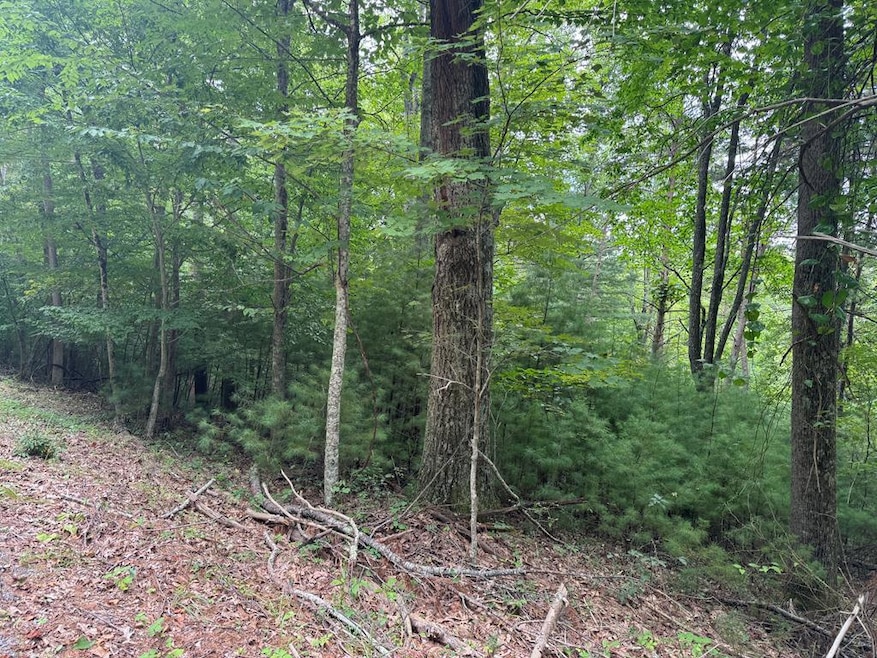
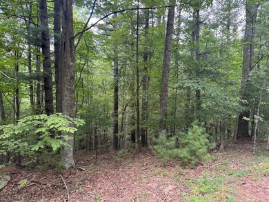
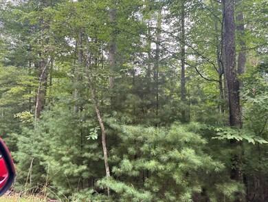
Over 47 acres of untouched wooded mountain land awaits you in wild wonderful West Virginia. Located close to Bluestone Lake and Bluestone State Park this property is easily accessible.-State road frontage. 15-20 minutes to Pipestem State Park, and a short drive to charming Historical Hinton. This property has mature timber and endless possibilities.

Last Agent to Sell the Property

Tracy Kessinger

BERKSHIRE HATHAWAY HOMESERVICES FOUR SEASONS SELECT PROP Brokerage Phone: 3044257563 License #WV0030106 Listed on: 08/23/2025

BERKSHIRE HATHAWAY HOMESERVICES FOUR SEASONS SELECT PROP

Last Buyer's Agent

Tracy Kessinger

BERKSHIRE HATHAWAY HOMESERVICES FOUR SEASONS SELECT PROP Brokerage Phone: 3044257563 License #WV0030106 Listed on: 08/23/2025

BERKSHIRE HATHAWAY HOMESERVICES FOUR SEASONS SELECT PROP

Property Details

Property Type

  • Land

Lot Details

  • 47.51 Acre Lot
  • Natural State Vegetation
  • Steep Slope
  • Wooded Lot
  • Property is zoned None known

Listing and Financial Details

  • Assessor Parcel Number 15/61.5, 16/1.2, 16/1.1

Property Details

Property Type

Land

Lot Details

0

Listing Details

  • Property Sub Type: Acreage
  • Prop. Type: Land
  • Lot Size Acres: 47.51
  • Lot Size: 47.51
  • Subdivision Name: None
  • Directions: Take Route 20 N to Bluestone Park Entrance. Turn left into park. Drive 1.5 miles and make a right on Surveyor Branch Road. Continue for 2.6 miles then make a right on Cave Ridge Road. See signs
  • Attribution Contact: 3044257563
  • Special Features: None

Interior Features

  • Possible Use: Residential, Timber

Exterior Features

  • Fencing: None
  • Lot Features: Wooded
  • Topography: Sloping,Steep
  • Other Structures: None

Utilities

  • Sewer: None
  • Utilities: None
  • Water Source: None

Lot Info

  • Current Use: Unimproved, Undeveloped Land & Water Areas
  • Lot Size Sq Ft: 2069535.6
  • Farm Land Area Units: Square Feet
  • Parcel #: 15/61.5, 16/1.2, 16/1.1
  • Zoning: None known

Multi Family

  • Above Grade Finished Area Units: Square Feet
Create a Home Valuation Report for This Property
The Home Valuation Report is an in-depth analysis detailing your home's value as well as a comparison with similar homes in the area

Property History

Date Event Price List to Sale Price per Sq Ft
10/14/2025 10/14/25 Sold $122,500 -12.5% --
08/23/2025 08/23/25 For Sale $140,000 -- --
Source: Mercer-Tazewell County Board of REALTORS®

Tax History Compared to Growth

Source: Public Records

Agents Affiliated with this Home

  • Section Image
See All Agents

Map

Source: Mercer-Tazewell County Board of REALTORS®

MLS Number: 55473