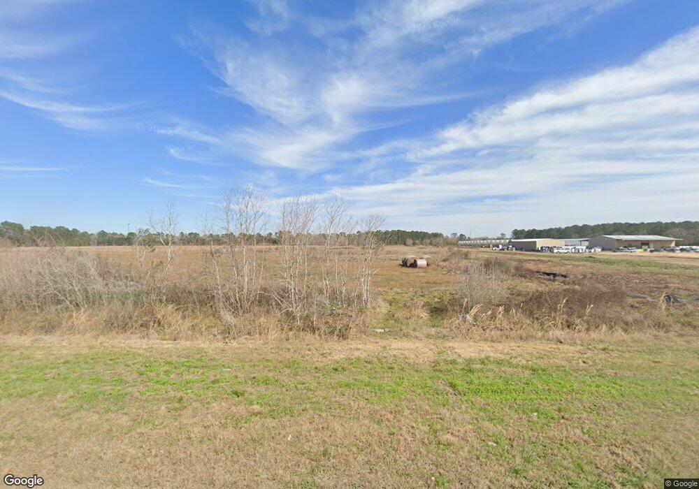
0 Cr 203 Unit 41681632 Liverpool, TX 77577
Estimated Value: $500,000 - $652,000
--
Bed
1
Bath
2,139
Sq Ft
$285/Sq Ft
Est. Value
About This Home
This home is located at 0 Cr 203 Unit 41681632, Liverpool, TX 77577 and is currently estimated at $609,044, approximately $284 per square foot. 0 Cr 203 Unit 41681632 is a home located in Brazoria County with nearby schools including R.L. Stevenson Primary School, Alvin Junior High School, and Alvin High School.
Ownership History
Date
Name
Owned For
Owner Type
Purchase Details
Closed on
Jul 9, 2020
Sold by
Rennison Richard Clark and Rennison Harriet Elaine
Bought by
Garber Sandra
Current Estimated Value
Home Financials for this Owner
Home Financials are based on the most recent Mortgage that was taken out on this home.
Original Mortgage
$310,002
Outstanding Balance
$274,889
Interest Rate
3.1%
Mortgage Type
New Conventional
Estimated Equity
$334,155
Purchase Details
Closed on
Feb 7, 2003
Sold by
Sowell Property Partners Walnut Bend Lp
Bought by
Kimball Hill Homes Texas Inc
Home Financials for this Owner
Home Financials are based on the most recent Mortgage that was taken out on this home.
Original Mortgage
$554,250
Interest Rate
5.93%
Purchase Details
Closed on
Sep 11, 2001
Sold by
Va
Bought by
Rennison Richard Clark
Create a Home Valuation Report for This Property
The Home Valuation Report is an in-depth analysis detailing your home's value as well as a comparison with similar homes in the area
Home Values in the Area
Average Home Value in this Area
Purchase History
| Date | Buyer | Sale Price | Title Company |
|---|---|---|---|
| Garber Sandra | -- | Texas American Title Co | |
| Kimball Hill Homes Texas Inc | -- | Premier Title Co | |
| Rennison Richard Clark | $55,000 | -- |
Source: Public Records
Mortgage History
| Date | Status | Borrower | Loan Amount |
|---|---|---|---|
| Open | Garber Sandra | $310,002 | |
| Previous Owner | Kimball Hill Homes Texas Inc | $554,250 |
Source: Public Records
Tax History Compared to Growth
Tax History
| Year | Tax Paid | Tax Assessment Tax Assessment Total Assessment is a certain percentage of the fair market value that is determined by local assessors to be the total taxable value of land and additions on the property. | Land | Improvement |
|---|---|---|---|---|
| 2025 | $8,843 | $460,540 | $268,140 | $192,400 |
| 2023 | $8,843 | $526,350 | $387,600 | $218,620 |
| 2022 | $10,238 | $478,500 | $339,150 | $236,430 |
| 2021 | $9,814 | $435,000 | $314,920 | $120,080 |
| 2020 | $9,621 | $475,660 | $290,700 | $184,960 |
| 2019 | $9,013 | $453,170 | $242,250 | $210,920 |
| 2018 | $8,198 | $390,900 | $181,030 | $209,870 |
| 2017 | $7,561 | $368,970 | $181,030 | $187,940 |
| 2016 | $6,874 | $368,970 | $181,030 | $187,940 |
| 2015 | $3,400 | $320,960 | $150,860 | $170,100 |
| 2014 | $3,400 | $237,150 | $68,710 | $168,440 |
Source: Public Records
Map
Nearby Homes
- 405 Snug Harbor Dr
- 10624 County Road 200
- 525 Shady Oaks Harbor
- 0000 County Road 203
- 000 County Road 203
- 6909 County Road 203
- 3303 Saint Anne St
- 00 County Road 203
- 0 County Road 203 Unit 37561736
- 2615 Main St
- 0 Cr 210 Unit 68898
- TBD Cr 200
- 9203 Avenue G
- 231 Dehart St Unit CR653
- 314 Dehart St
- TBD Scott St
- 6719 Windhaven Cr-775 Rd
- 2830 Saint Anne St
- 197 Avenue C
- 0 County Road 171
- 0 Cr 203 Unit 20982
- 0 Cr 203 Unit 32799
- 0 Cr 203 Unit 32798
- 0 Cr 203 Unit 1068980
- 0 Cr 203 Unit 1471707
- 0 Cr 203 Unit 6017091
- 0 Cr 203 Unit 50161
- 0 Cr 203 Unit 1173347
- 0 Cr 203 Unit 2329544
- 0 Cr 203 Unit 36490240
- 4302 County Road 203
- 4444 County Road 203
- 4220 County Road 203
- 4220 C R 203
- 4702 County Road 203
- 4222 Port Rd
- 4710 County Road 203
- 206 Fathom
- 0 Snug Harbor Dr Unit 43740
- 0 Snug Harbor Dr Unit 45069
