NOT LISTED FOR SALE

0 Davis Ave Moss Point, MS 39563

Estimated Value: $206,000

0.22 Acre
$936,364 Price per Acre
9,583 Sq Ft Lot

Last Sold January 27, 2022

Current estimated payment $1,152/month

76 Days on Market

About This Lot

As of January 2022

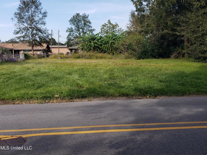
Cleared lot near Moss Point High School.

Last Listed By

Randy Whitley

Coldwell Banker Alfonso Realty-Pascag License #S56882 Listed on: 11/10/2021

Coldwell Banker Alfonso Realty-Pascag

Property Details

Property Type

  • Land

Est. Annual Taxes

  • $143

Lot Details

  • 9,583 Sq Ft Lot
  • Lot Dimensions are 118' x 82'
  • Partially Fenced Property
  • Cleared Lot
  • Few Trees

Location

  • City Lot

Community Details

  • No Home Owners Association
  • Metes And Bounds Subdivision

Listing and Financial Details

  • Assessor Parcel Number 2-12-20-026.000

Property Details

Property Type

Land

Est. Annual Taxes

$143

Lot Details

0

Listing Details

  • Lot Size: 118' x 82'
  • Property Sub Type: Acreage (10 acres or less)
  • Prop. Type: Land
  • Road Frontage Type: City Street
  • Road Surface Type: Asphalt
  • Lot Size Acres: 0.22
  • Subdivision Name: Metes And Bounds
  • Directions: From Highway 613 in downtown Moss Point, turn West on Dantzler Street. Turn South on Weems Street. Turn West on Davis Avenue. Property is located next to Moss Point School fence line.
  • New Construction: No
  • Special Features: None

Interior Features

  • Possible Use: Residential
  • ResoLivingAreaSource: PublicRecords

Exterior Features

  • Exterior Features: None
  • Fencing: Partial
  • Lot Features: City Lot, Cleared, Few Trees
  • Other Structures: None
  • WaterfrontFeaturesWaterfront: No
  • Lot Features:Few Trees: Yes
  • Exterior Features:None11: Yes
  • Lot Features:Cleared: Yes
  • Lot Features:City Lot: Yes

Utilities

  • Sewer: Public Sewer
  • Utilities: Electricity Available, Sewer Available, Water Available
  • Water Source: Public

Association/Amenities

  • HorseAmenitiesHorseAmenities: No
  • Tax and Financial Information:Association: No

Lot Info

  • Current Use: Vacant
  • Parcel #: 2-12-20-026.000
  • Lot Size Sq Ft: 9583.2
  • ResoLotSizeUnits: Acres

Tax Info

  • Tax Annual Amount: 143.0
  • Tax Year: 2020

Ownership History

Date Name Owned For Owner Type

Purchase Details

Closed on
Oct 7, 2016
Sold by
Mcdonald Gerald and Mcdonald Raymond
Bought by
Randall Rodney
Total Days on Market
76
Current Estimated Value
$206,000

Range of Values:

Collateral Analytics

Collateral Analytics Collateral Analytics AVMs (Automated Valuation Model) employ a number of statistical approaches combined with neighborhood-specific comparable selection guarantees the most up-to-date and precise valuations.

Not Available

Collateral Analytics does not have data for the current month. Please view the chart for historical values.

ICE

ICE Mortgage Technology ICE Mortgage Technology’s AVM (Automated Valuation Model) is a state-of-the-art online residential property valuation tool that provides a quick and accurate estimate of the value of almost any home in the U.S.

Not Available

ICE Mortgage Technology does not have data for the current month. Please view the chart for historical values.

First American

First American First American Data & Analytics’ next-generation AVM combines unrivaled data assets with a blended ensemble of valuation models to produce highly accurate, reliable valuations you can trust.

Not Available

First American does not have data for the current month. Please view the chart for historical values.

Quantarium

Quantarium Quantarium’s valuation service, repeatedly proven the industry’s most accurate and comprehensive, is supercharged with a self-learning and auto-tuning AI engine that continually becomes smarter and more accurate as it processes daily inputs from the industry’s leading RE data lake.

Not Available

Quantarium does not have data for the current month. Please view the chart for historical values.

Average Value
Not Available
List Price
Sold Price
Create a Home Valuation Report for This Property
The Home Valuation Report is an in-depth analysis detailing your home's value as well as a comparison with similar homes in the area

Home Values in the Area

Source: Public Records

Average Home Value in this Area


Source: Public Records

Purchase History

Date Buyer Sale Price Title Company
Randall Rodney -- None Available
Source: Public Records

Property History

Date Event Price Change Sq Ft Price
01/27/2022 01/27/22 Sold -- -- --
01/26/2022 01/26/22 Pending -- -- --
11/10/2021 11/10/21 For Sale $10,500 -- --
Source: MLS United

Tax History Compared to Growth

Source: Public Records

Tax History

Year Tax Paid Tax Assessment Tax Assessment Total Assessment is a certain percentage of the fair market value that is determined by local assessors to be the total taxable value of land and additions on the property. Land Improvement
2024 -- $0 $0 $0
2023 $120 $0 $0 $0
2022 $120 $737 $737 $0
2021 $120 $737 $737 $0
2020 $143 $867 $867 $0
2019 $143 $867 $867 $0
2018 $143 $867 $867 $0
2017 $142 $867 $867 $0
2016 $45 $867 $867 $0
2015 $45 $5,780 $5,780 $0
2014 $87 $1,691 $1,691 $0
2013 $87 $1,691 $1,691 $0
Source: Public Records

Agents Affiliated with this Home

  • Section Image
See All Agents

Map

Source: MLS United

MLS Number: 4002529

MLS United

APN: 2-12-20-026.000