
Seller's Agent in 2021
Sheryl Fleming
Butler Real Estate
(918) 782-9304
108 Total Sales
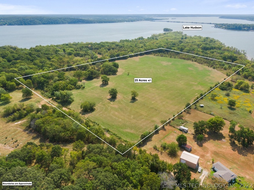
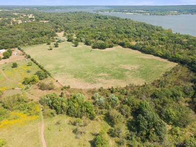
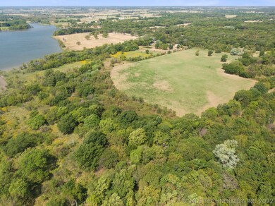
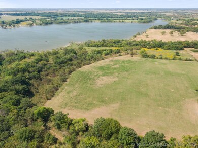

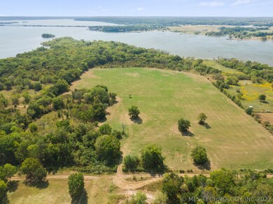
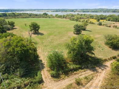
25 acres m/l ready to build your dream house on or use for livestock. Waterfront is owned by GRDA but you would have a great view of Lake Hudson! Close to Pryor and Salina area conveniences. Aerial pictures give you an idea of boundary line but is not a survey line.
Last Agent to Sell the Property
Butler Real Estate License #154991 Listed on: 09/14/2021
| Date | Buyer | Sale Price | Title Company |
|---|---|---|---|
| Newton Mcbayne | $25,000 | -- | |
| Rice Rhonda Kay | $11,500 | -- |
| Date | Event | Price | List to Sale | Price per Sq Ft |
|---|---|---|---|---|
| 12/31/2021 12/31/21 | Sold | $165,000 | -5.7% | -- |
| 09/14/2021 09/14/21 | Pending | -- | -- | -- |
| 09/14/2021 09/14/21 | For Sale | $175,000 | -- | -- |
| Year | Tax Paid | Tax Assessment Tax Assessment Total Assessment is a certain percentage of the fair market value that is determined by local assessors to be the total taxable value of land and additions on the property. | Land | Improvement |
|---|---|---|---|---|
| 2025 | $62 | $740 | $740 | $0 |
| 2024 | $62 | $740 | $740 | $0 |
| 2023 | $62 | $740 | $740 | $0 |
| 2022 | $62 | $740 | $740 | $0 |
| 2021 | $62 | $740 | $740 | $0 |
| 2020 | $61 | $738 | $738 | $0 |
| 2019 | $63 | $738 | $738 | $0 |
| 2018 | $63 | $738 | $738 | $0 |
| 2017 | $58 | $738 | $738 | $0 |
| 2016 | $59 | $738 | $738 | $0 |
| 2015 | $60 | $738 | $738 | $0 |
| 2014 | $60 | $738 | $738 | $0 |
Seller's Agent in 2021
Sheryl Fleming
Butler Real Estate
(918) 782-9304
108 Total Sales
Buyer's Agent in 2021
Larry Barry
Lakeland Real Estate NEOK
(918) 697-8122
75 Total Sales
Source: MLS Technology
MLS Number: 2132276
APN: 0000-09-21N-20E-2-020-00
Disclaimer: Certain information contained herein is derived from information provided by parties other than Homes.com. All information provided is deemed reliable, but is not guaranteed to be accurate and should be independently verified.
![]() IDX information is provided exclusively for personal, non-commercial use, and may not be used for any purpose other than to identify prospective properties consumers may be interested in purchasing.
IDX information is provided exclusively for personal, non-commercial use, and may not be used for any purpose other than to identify prospective properties consumers may be interested in purchasing.
Information is deemed reliable but not guaranteed.
Ask me questions while you tour the home.