
Seller's Agent in 2024
Curt Allred
ERA Realty Center
(435) 691-9195
64 Total Sales


Estimated Value: $69,000 - $107,000
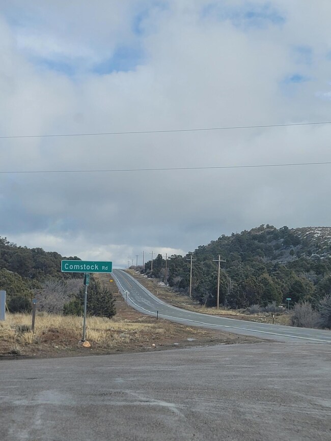
Nestled in the heart of nature, this 20 acre property is ready for your dream home. Enjoy breathtaking views of the mountains with plenty of room and privacy between neighbors and only 16 minutes to downtown Cedar City. The school bus conveniently picks up on Comstock Road. The main road is plowed by the Iron mine when it snows. No HOA.
There is 1 acre foot of water included upon closing (71-5092).
Last Agent to Sell the Property
ERA Realty Center License #5463065-SA00 Listed on: 03/13/2024
Last Buyer's Agent
Stratum Real Estate Group PLLC South Branch Office License #5485395SA00
| Date | Buyer | Sale Price | Title Company |
|---|---|---|---|
| Jones Brandon N | -- | Security Escrow & Title | |
| Florez Roman A | -- | Inwest Title | |
| Sapp Leland E | -- | Security Escrow & Title Insu |
| Date | Status | Borrower | Loan Amount |
|---|---|---|---|
| Open | Jones Brandon N | $204,000 | |
| Previous Owner | Florez Roman A | $84,000 |
| Date | Event | Price | List to Sale | Price per Sq Ft |
|---|---|---|---|---|
| 05/22/2024 05/22/24 | Sold | -- | -- | -- |
| 04/19/2024 04/19/24 | Pending | -- | -- | -- |
| 03/13/2024 03/13/24 | For Sale | $265,000 | -- | -- |
| Year | Tax Paid | Tax Assessment Tax Assessment Total Assessment is a certain percentage of the fair market value that is determined by local assessors to be the total taxable value of land and additions on the property. | Land | Improvement |
|---|---|---|---|---|
| 2025 | $524 | $67,158 | $67,158 | -- |
| 2023 | $499 | $63,960 | $63,960 | $0 |
| 2022 | $477 | $53,300 | $53,300 | $0 |
| 2021 | $455 | $50,900 | $50,900 | $0 |
| 2020 | $514 | $50,900 | $50,900 | $0 |
| 2019 | $536 | $50,900 | $50,900 | $0 |
| 2018 | $549 | $50,900 | $50,900 | $0 |
| 2017 | $548 | $50,900 | $50,900 | $0 |
| 2016 | $406 | $34,020 | $34,020 | $0 |
| 2015 | $425 | $34,020 | $0 | $0 |
| 2014 | $451 | $34,020 | $0 | $0 |
Seller's Agent in 2024
Curt Allred
ERA Realty Center
(435) 691-9195
64 Total Sales
Buyer's Agent in 2024
Jason Spencer
Stratum Real Estate Group PLLC South Branch Office
(435) 590-7070
177 Total Sales
Source: Iron County Board of REALTORS®
MLS Number: 105977
APN: E-0678-0001-0002