R
Seller's Agent in 2018
Rich Burgett
Land Company
(509) 449-0687
29 Total Sales
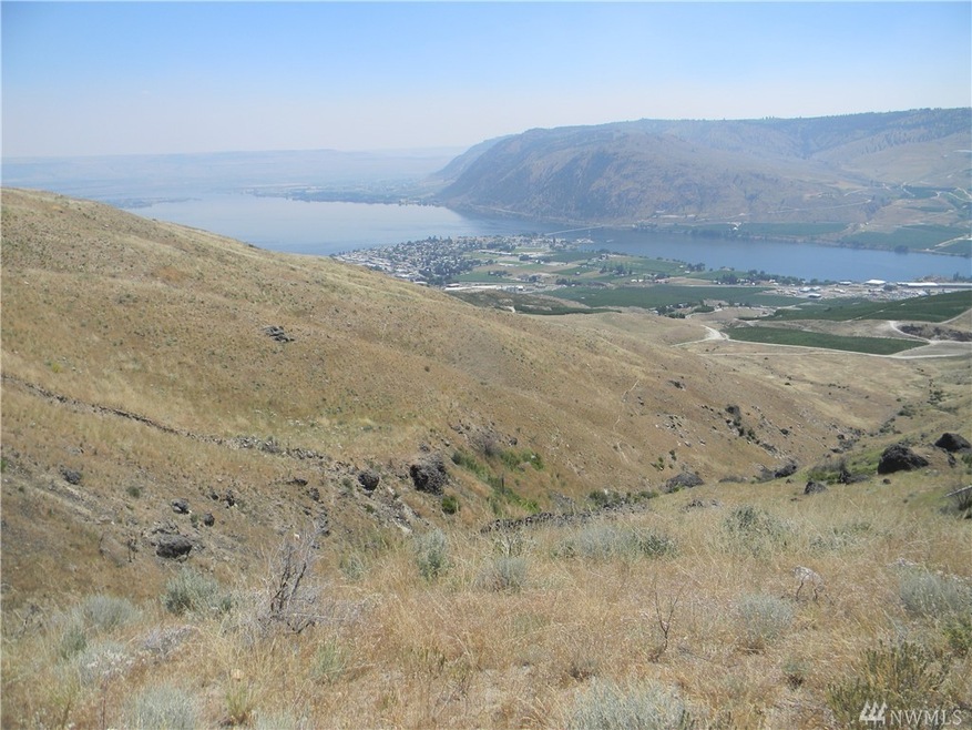
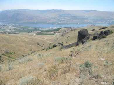
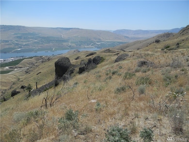
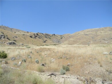
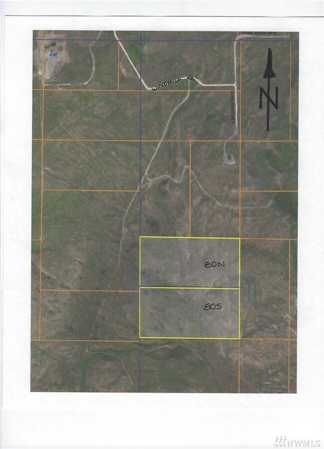
Great Columbia River Valley views from this 20 acre parcel. The majority of Lot 80 South, like it's counterpart, Lot 80N to the immediate North, lies within a steep-sloped canyon. Legal, recorded access is via dirt road running Southerly off Windmill Rd. for approximately 0.6 mi., then a 60' wide easement runs East to the West rim near the NW corner of 80S. There is evidence of water at the canyon bottom, noting the green foliage there. 4WD vehicle recommended. Make an offer on both!
Source: Northwest Multiple Listing Service (NWMLS)
MLS#: NWM1180461
| Date | Buyer | Sale Price | Title Company |
|---|---|---|---|
| Wright Thomas | $35,000 | Inland Professional Title Ll | |
| Rutherford Katherine H | -- | None Available |
| Date | Event | Price | Change | Sq Ft Price |
|---|---|---|---|---|
| 05/31/2018 05/31/18 | Sold | $13,000 | -13.3% | -- |
| 05/13/2018 05/13/18 | Pending | -- | -- | -- |
| 08/17/2017 08/17/17 | For Sale | $15,000 | -- | -- |
| Year | Tax Paid | Tax Assessment Tax Assessment Total Assessment is a certain percentage of the fair market value that is determined by local assessors to be the total taxable value of land and additions on the property. | Land | Improvement |
|---|---|---|---|---|
| 2025 | $519 | $45,000 | $45,000 | -- |
| 2024 | $519 | $45,000 | $45,000 | -- |
| 2023 | $395 | $30,000 | $30,000 | $0 |
| 2022 | $440 | $30,000 | $30,000 | $0 |
| 2021 | $430 | $30,000 | $30,000 | $0 |
| 2020 | $408 | $30,000 | $30,000 | $0 |
| 2019 | $395 | $30,000 | $30,000 | $0 |
| 2018 | $440 | $30,000 | $30,000 | $0 |
| 2017 | $318 | $22,500 | $22,500 | $0 |
| 2016 | $257 | $22,500 | $22,500 | $0 |
| 2015 | $263 | $22,500 | $22,500 | $0 |
| 2013 | -- | $30,000 | $30,000 | $0 |
R
Seller's Agent in 2018
Rich Burgett
Land Company
(509) 449-0687
29 Total Sales
Source: Northwest Multiple Listing Service (NWMLS)
MLS Number: NWM1180461
APN: 3024103006
Disclaimer: Certain information contained herein is derived from information provided by parties other than Homes.com. All information provided is deemed reliable, but is not guaranteed to be accurate and should be independently verified.
![]() All data is obtained from various sources and may not have been verified by broker or MLS GRID. Supplied Open House Information is subject to change without notice. All information should be independently reviewed and verified for accuracy. Properties may or may not be listed by the office/agent presenting the information. Listing information is provided by the Northwest Multiple Listing Service (NWMLS). Property information is based on available data that may include MLS information, county records, and other sources. Listings marked with the 3 tree icon and provided by NWMLS. All properties are subject to prior sale or withdrawal. IDX information is provided exclusively for consumers’ personal noncommercial use, that it may not be used for any purpose other than to identify prospective properties consumers may be interested in purchasing, that the data is deemed reliable but is not guaranteed by MLS GRID. ©2025 NWMLS.
All data is obtained from various sources and may not have been verified by broker or MLS GRID. Supplied Open House Information is subject to change without notice. All information should be independently reviewed and verified for accuracy. Properties may or may not be listed by the office/agent presenting the information. Listing information is provided by the Northwest Multiple Listing Service (NWMLS). Property information is based on available data that may include MLS information, county records, and other sources. Listings marked with the 3 tree icon and provided by NWMLS. All properties are subject to prior sale or withdrawal. IDX information is provided exclusively for consumers’ personal noncommercial use, that it may not be used for any purpose other than to identify prospective properties consumers may be interested in purchasing, that the data is deemed reliable but is not guaranteed by MLS GRID. ©2025 NWMLS.
Based on information submitted to the MLS GRID
