Estimated payment $1,537/month
Total Views
14,618
4.68
Acres
$52,361
Price per Acre
203,861
Sq Ft Lot
About This Lot
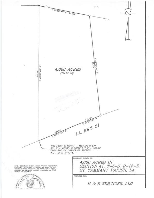
Tract 10 is 4.68 acres, zoned C2.
Property Details
Property Type
- Land
Lot Details
- 4.68 Acre Lot
- Lot Dimensions are 368x775x238x563
- May Be Possible The Lot Can Be Split Into 2+ Parcels
- Zoning described as C2
Location
- Outside City Limits
Utilities
- Water Not Available
- Sewer Not Available
Community Details
- Not A Subdivision
Listing and Financial Details
- Assessor Parcel Number 70431Highway21HY-
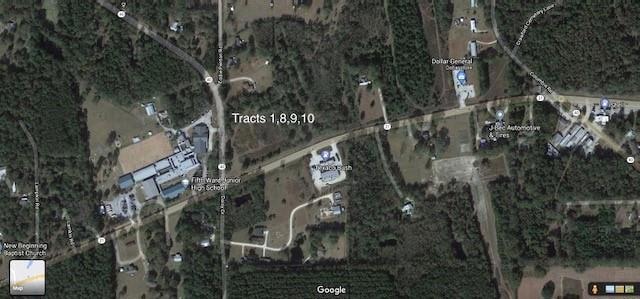
Map
Create a Home Valuation Report for This Property
The Home Valuation Report is an in-depth analysis detailing your home's value as well as a comparison with similar homes in the area
Home Values in the Area
Average Home Value in this Area
Property History
| Date | Event | Price | List to Sale | Price per Sq Ft |
|---|---|---|---|---|
| 02/01/2024 02/01/24 | For Sale | $245,051 | 0.0% | -- |
| 12/31/2023 12/31/23 | Off Market | -- | -- | -- |
| 06/12/2023 06/12/23 | For Sale | $245,051 | 0.0% | -- |
| 05/20/2023 05/20/23 | Off Market | -- | -- | -- |
| 05/21/2021 05/21/21 | For Sale | $245,051 | -- | -- |
Source: ROAM MLS
Source: ROAM MLS
MLS Number: 2301028
Nearby Homes
- 0 Highway 40 Hwy Unit 2498942
- D-4 Daisy Dr
- D-5 Daisy Dr
- D-3 Daisy Dr
- 29235 Highway 40
- 29303 Louisiana 40
- 82181 Charles Kelly Rd
- 81042 Ward Rd
- Lot 14 Hwy 40 Hwy
- 5 Acres Elliot Rd
- 81688 Hwy 41 Hwy
- 30099 Crawford Cemetery Rd
- TBD Hwy 40 Hwy
- 0 Highway 41 Hwy Unit 2512235
- 0 Watts Thomas Rd Unit 2484827
- 115 Acres Watts Thomas Rd
- 225 Bald Eagle Dr
- 245 Bald Eagle Dr
- 77151 Highway 21 Unit A
- 71212 Highway 21
- 27243 Snead Dr Unit 104
- 15260 Sam George Rd
- 15260 Sam George Rd Unit 3
- 78386 Louisiana 437
- 77405 Saint Joseph St
- 19352 Million Dollar Rd
- 77217 Louisiana 437
- 20110 Tammany Ave
- 73157 Louisiana 59
- 20318 Palm Blvd
- 724 Avenue F
- 74453 Gamma Ave
- 646 Avenue E
- 73616 Military Rd
- 22294 Grover St
- 72405 59 Hwy
