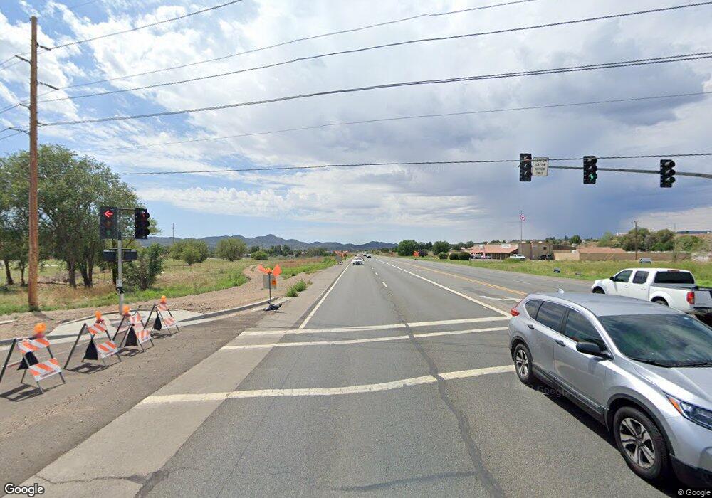
0 Highway 69 Unit PAR906384 Prescott Valley, AZ 86314
Estimated Value: $1,182,000
--
Bed
--
Bath
--
Sq Ft
1.3
Acres
About This Home
This home is located at 0 Highway 69 Unit PAR906384, Prescott Valley, AZ 86314 and is currently priced at $1,182,000. 0 Highway 69 Unit PAR906384 is a home located in Yavapai County with nearby schools including Taylor Hicks School, Granite Mountain Middle School, and Prescott Mile High Middle School.
Ownership History
Date
Name
Owned For
Owner Type
Purchase Details
Closed on
Oct 18, 2021
Sold by
Coury Timothy J and Camber Marie Furman Revocable
Bought by
Tc Land Management Llc
Current Estimated Value
Purchase Details
Closed on
Aug 15, 2020
Sold by
Tc Land Management Llc
Bought by
Coury Timothy J and Emmalin Marie Coury Revocable
Purchase Details
Closed on
Jun 15, 2005
Sold by
Resource Holdings Lp
Bought by
Tc Land Management Llc
Purchase Details
Closed on
Jun 13, 2005
Sold by
Timothy J Coury Revocable Management Tru
Bought by
Resource Holdings Lp
Purchase Details
Closed on
Jun 6, 2005
Sold by
Coury Timothy J
Bought by
Timothy J Coury Revocable Management Tr
Create a Home Valuation Report for This Property
The Home Valuation Report is an in-depth analysis detailing your home's value as well as a comparison with similar homes in the area
Home Values in the Area
Average Home Value in this Area
Purchase History
| Date | Buyer | Sale Price | Title Company |
|---|---|---|---|
| Tc Land Management Llc | -- | None Available | |
| Coury Timothy J | -- | None Available | |
| Tc Land Management Llc | -- | -- | |
| Resource Holdings Lp | -- | -- | |
| Timothy J Coury Revocable Management Tr | -- | -- |
Source: Public Records
Tax History Compared to Growth
Tax History
| Year | Tax Paid | Tax Assessment Tax Assessment Total Assessment is a certain percentage of the fair market value that is determined by local assessors to be the total taxable value of land and additions on the property. | Land | Improvement |
|---|---|---|---|---|
| 2026 | $2,548 | -- | -- | -- |
| 2024 | $2,363 | -- | -- | -- |
| 2023 | $2,363 | $33,118 | $33,118 | $0 |
| 2022 | $2,325 | $30,518 | $30,518 | $0 |
| 2021 | $2,387 | $35,904 | $35,904 | $0 |
| 2020 | $2,303 | $0 | $0 | $0 |
| 2019 | $2,273 | $0 | $0 | $0 |
| 2018 | $2,174 | $0 | $0 | $0 |
| 2017 | $2,131 | $0 | $0 | $0 |
| 2016 | $2,063 | $0 | $0 | $0 |
| 2015 | -- | $0 | $0 | $0 |
| 2014 | -- | $0 | $0 | $0 |
Source: Public Records
Map
Nearby Homes
- 5498 E Sapphire Dr
- 1920 N Baker St
- 1995 N Mulberry
- 1816 Bond Cir
- 1800 E Mulberry
- 1651 Emerald Dr
- 1616 N Rose Quartz Dr
- 1633 N Emerald Dr Unit 306
- 1633 N Emerald Dr
- 1610 N Emerald Dr Unit 386
- 1610 N Emerald Dr
- 1627 N Emerald Dr Unit 307
- 1627 N Emerald Dr
- 1601 N Emerald Dr Unit 310
- 1601 N Emerald Dr
- 1581 N Emerald Dr Unit 311
- 1581 N Emerald Dr
- 1441 N Rose Quartz Dr
- 1401 N Rose Quartz Dr
- 1636 N Elaine Way
- 0 Highway 69 Unit PAR917484
- 0 Highway 69 Unit PAR357453
- 0 Highway 69 Unit PAR900650
- 0 Hwy 69 (2 Acres)
- 0 Highway 69 Unit PAR909463
- 0 Highway 69 Unit PAR890292
- 0 Highway 69 Unit PAR894635
- 0 Highway 69 Unit 946410
- 11891 Highway 69
- 1891 N Regent
- 1903 N Regent
- 5489 E Sapphire Dr
- 5484 E Sapphire Dr
- 1957 N Mulberry
- 1943 N Mulberry
- 1969 N Mulberry
- 1940 N Baker St
- 1940 E Baker St
- 5476 E Sapphire Dr
- 5481 E Saphire Dr
