NOT LISTED FOR SALE

0 Highways 189 Unit 19-1012 Daniel, WY 83115

21 Acres
-- Price per Acre
906,048 Sq Ft Lot

Last Sold July 02, 2019

40 Days on Market

Highlights

  • Horses Allowed On Property
  • Valley View
  • Open Space
  • 20.8 Acre Lot
  • No HOA
  • Lot Has A Rolling Slope

About This Lot

As of July 2019

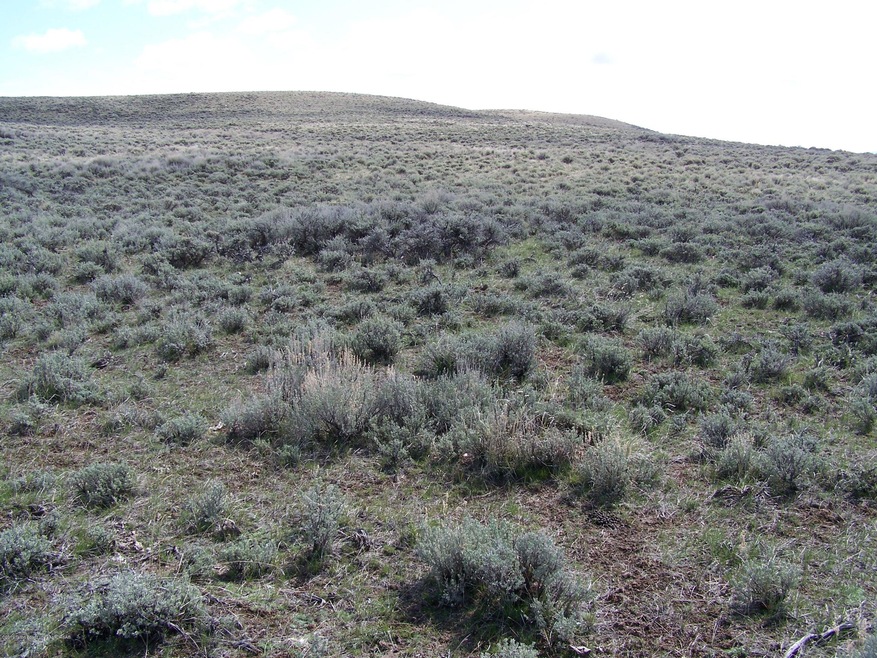
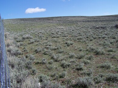
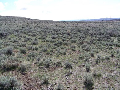
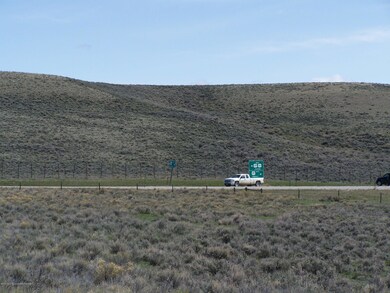
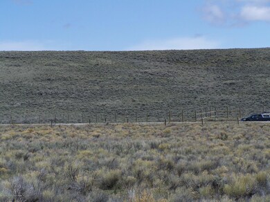
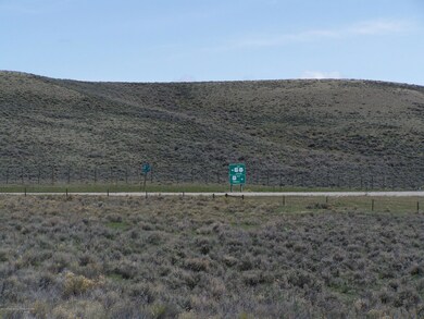
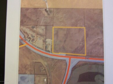
Great location to build a dream home over looking the Green River Valley or maybe do a zone change and have a commercial business where two highways come together. Property borders Highway 191 and is a candidate for re-zoning if the new owner wished. Located at the Daniel Junction and only ten miles from Pinedale or 65 miles to Jackson. This parcel offer true county living.

Last Listed By

Jay Fear

Jay Fear Real Estate License #1492 Listed on: 05/10/2019

Property Details

Property Type

  • Land

Est. Annual Taxes

  • $11

Lot Details

  • 20.8 Acre Lot
  • Open Space
  • Year Round Access
  • Lot Has A Rolling Slope
  • Zoning described as Agricultural

Additional Features

  • Valley Views
  • Horses Allowed On Property

Community Details

  • No Home Owners Association

Listing and Financial Details

  • Assessor Parcel Number 34112620007100

Property Details

Property Type

Land

Est. Annual Taxes

$11

Lot Details

0

Listing Details

  • Prop. Type: Building Site
  • Horses: Yes
  • Lot Size Acres: 20.8
  • Lot Size: 20.80 acres
  • Road Surface Type: Paved
  • Subdivision Name: None
  • Directions: Daniel Junction
  • Property Info:Horses Allowed: Yes
  • Property Features:Adjacent Open Space: Yes
  • Property Features:Year Round Access: Yes
  • Property Info:_pound_ Horses Allowed: 10+
  • View:Valley View: Yes
  • Property Features:Rolling: Yes
  • Special Features: None
  • Property Sub Type: LotsLands

Exterior Features

  • Lot Features: Year Round Access, Adjacent Open Space, Rolling Slope
  • View: Wyoming Range Views, Valley, Wind River Mtn Views

Utilities

  • Sewer: Septic Needed
  • Water Source: Well (not existing)

Condo/Co-op/Association

  • Association: No

Lot Info

  • Lot Size Sq Ft: 906048.0
  • Parcel #: 34112620007100
  • Zoning Description: Agricultural
  • ResoLotSizeUnits: Acres

Tax Info

  • Tax Annual Amount: 9.0
  • Tax Year: 2018

Range of Values:

Collateral Analytics

Collateral Analytics Collateral Analytics AVMs (Automated Valuation Model) employ a number of statistical approaches combined with neighborhood-specific comparable selection guarantees the most up-to-date and precise valuations.

Not Available

Collateral Analytics does not have data for the current month. Please view the chart for historical values.

ICE

ICE Mortgage Technology ICE Mortgage Technology’s AVM (Automated Valuation Model) is a state-of-the-art online residential property valuation tool that provides a quick and accurate estimate of the value of almost any home in the U.S.

Not Available

ICE Mortgage Technology does not have data for the current month. Please view the chart for historical values.

First American

First American First American Data & Analytics’ next-generation AVM combines unrivaled data assets with a blended ensemble of valuation models to produce highly accurate, reliable valuations you can trust.

Not Available

First American does not have data for the current month. Please view the chart for historical values.

Quantarium

Quantarium Quantarium’s valuation service, repeatedly proven the industry’s most accurate and comprehensive, is supercharged with a self-learning and auto-tuning AI engine that continually becomes smarter and more accurate as it processes daily inputs from the industry’s leading RE data lake.

Not Available

Quantarium does not have data for the current month. Please view the chart for historical values.

Average Value
Not Available
List Price
Sold Price
Create a Home Valuation Report for This Property
The Home Valuation Report is an in-depth analysis detailing your home's value as well as a comparison with similar homes in the area

Home Values in the Area

Source: Public Records

Average Home Value in this Area


Source: Public Records

Property History

Date Event Price Change Sq Ft Price
07/02/2019 07/02/19 Sold -- -- --
06/20/2019 06/20/19 Pending -- -- --
05/10/2019 05/10/19 For Sale $81,120 -- --
Source: Teton Board of REALTORS®

Tax History Compared to Growth

Source: Public Records

Tax History

Year Tax Paid Tax Assessment Tax Assessment Total Assessment is a certain percentage of the fair market value that is determined by local assessors to be the total taxable value of land and additions on the property. Land Improvement
2024 $11 $180 $180 $0
2023 $10 $172 $172 $0
2022 $10 $156 $156 $0
2021 $341 $150 $150 $0
2020 $341 $5,681 $5,681 $0
2019 $9 $154 $154 $0
2018 $9 $152 $152 $0
Source: Public Records

Agents Affiliated with this Home

  • Section Image
See All Agents

Map

Source: Teton Board of REALTORS®

MLS Number: 19-1012

APN: 010016030