0 Missouri Gulch Rd Pendleton, OR 97801
Estimated payment $4,115/month
About This Lot
-Missouri Gulch CRP Property-
Pendleton, Oregon
$660,000.00
Property:
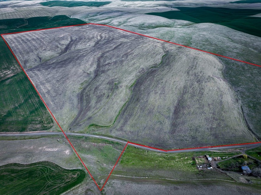
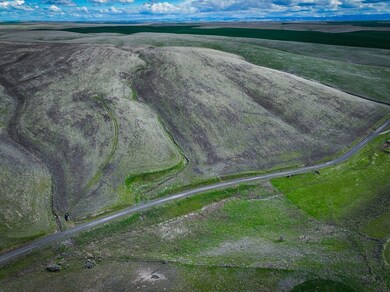
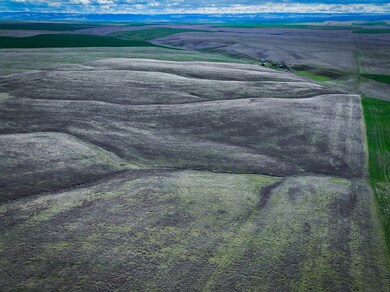
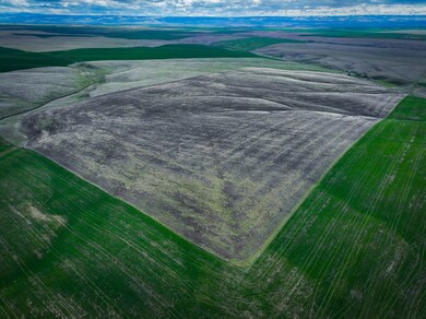
The Missouri Gulch CRP Property spans approximately 318.89+/- deeded county acres located near Pendleton, OR. Of these, 323.74+/- FSA acres are enrolled in the Conservation Reserve Program (CRP) through September 30, 2031, with an annual payment of $24,281. The entire farmable portion is in CRP, making this a stable investment property with income through the USDA program. The property is zoned Exclusive Farm Use (EFU) and has been historically used for dryland farming. No buildings are currently on-site, and fencing is limited. Draws run through parts of the property, and it offers habitat for wildlife, including upland birds and mule deer. The tract is eligible for Landowner Preference (LOP) tags within the Columbia Basin Unit, providing opportunity for hunting and recreational use.
Homesite Potential-
A potential buildable homesite may be on the property. Buyer to conduct their own due diligence with Umatilla County Planning to confirm all zoning, permitting, and development potential.
Location:
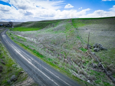
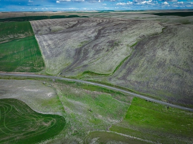
The Missouri Gulch CRP is situated in Umatilla County, OR, Northwest of Pendleton and along Missouri Gulch road. The property is mapped as Tax Lot 4N3100-00-04600 and is accessed via county roads. Please refer to the aerial maps for specific entry points and layout.
Access:
The property can be accessed from Pendleton-Heading North on Hwy OR-37 for 4.7 miles then West (turn left) onto S Cold Spring Rd. Continue straight onto Missouri Gulch Rd. The property is approximately 6 miles from when you turn left on S Cold Spring Rd.
Distances To Other Cities:
Pendleton, OR 13+/- Miles Approx. 21 Minute Drive
Hermiston, OR 19 +/- Miles Approx. 28 Minute Drive
Portland, OR 203 +/- Miles Approx. 3 Hour Drive
Boise, ID 236 +/- Miles Approx. 3.5 Hour Drive
Legal Identification of Subject Property:
Tax Lot 4N3100-00-04600
Acreage Breakdown:
Total County Deeded Acres: 318.89
Tillable / CRP Acres: 323.74 (FSA Reported)
CRP Acres: 323.74
(Note: FSA acreages may exceed deeded acres due to programmatic inclusion of adjacent areas.)
Leases:
Currently-USDA-CRP Contract. No other known leases.
United States Department of Agriculture Farm Service Agency:
Farm 8827
Tract 1168
Crop Ground:
According to the FSA mapping, the property has a total of 323.74 +/- tillable production acres. Of the 323.74 acres, currently, 323.74+/- acres are enrolled in Conservation Reserve Program (CRP) through 9/30/2031. The annual rental rate per acre for 323.74+/- acres is $75.00 The annual contract payment is $24,281.00+/-. Ownership: Cherylin S. Bell & Gargan Investments LLC (equal shares)
Soils:
The soils consist predominantly of Walla Walla silt loam series across multiple slope categories:
- 114B 1 to 7% slopes: 140.29 acres (37.67%)
- 116D 12 to 25% south slopes: 116.77 acres (31.35%)
- 114C 7 to 12% slopes: 105.02 acres (28.2%)
- 115D 12 to 25% north slopes: 10.34 acres (2.78%)
A small portion includes Hermiston silt loam (39A): 2.8 acres. Overall productivity values (NCCPI) average between 3640 across soil classes, well-suited for dryland crops and conservation uses.
Elevation ranges from approximately 1,300 to 1,400 feet above sea level.
Improvements:
Currently the property has no building improvements. The property does have some fencing. Buyer to do their own inspection for satisfaction of fencing. Seller makes no representation as to the condition of the fencing.
Water:
No developed Wells/Springs or Irrigation Rights Known.
Taxes:
- 2024 Tax Amount: $1,752.38
- Parcel ID: 116303 (Umatilla County)
Recreation:
The subject property qualifies for two (2) Landowner Preference (LOP) tags within the Columbia Basin Unit under the Oregon Department of Fish and Wildlife guidelines. Deer and upland game birds are the primary hunting recreation aspect. (Additional rules may apply, see the ODFW Big Game Hunting Regulations book or call the local Oregon Department of Fish and Wildlife located in Pendleton, Oregon, at 541-276-2344 .)
Topography:
The tilled portions of the property are gently sloping to sloping farm ground, which is typical of the area. Draws and slope make up the main portion of the property, which is estimated to be approximately 1,300 to 1,400 feet above sea level.
Mineral Rights:
The owner does not warrant there are any mineral rights available. However, any mineral or geothermal rights owned by the seller are included as part of the property being offered for sale.
Zoning:
Property is zoned EFU, exclusive farm use. For complete zoning information, contact the Umatilla County Planning Department at 541-278-6252 .
152.055 DESCRIPTION AND PURPOSE.
The purposes of the EFU, Exclusive Farm Use Zone, are to preserve and maintain agricultural lands for farm use, including range and grazing uses, consistent with existing and future needs for agricultural products, forest and open spaces; to conserve and protect scenic resources; to maintain and improve the quality of air, water and land resources of the county and to establish criteria and standards for farm uses and related and supportive uses which are deemed appropriate. It is also the purpose of this use zone to provide the automatic farm use valuation for farms, which qualify under the provisions of ORS Chapter 308. The provisions in this use zone are subject to automatic legislative amendments as described in 152.004. (Ord. 2005=02, passed 1-5-2005)
Ownership & Title:
The property is currently held by Roger & Cherylin Bell (50%) and Gargan Investments, LLC (50%).
Contact Information:
Whitney Land Company
101 SE 3rd St, Pendleton, OR 97801
(541) 278-4444
Disclaimer:
Information is deemed reliable but not guaranteed. Buyer to perform their own due diligence. CRP and FSA details provided from USDA forms and subject to verification.
Umatilla County:
Umatilla County was created on September 27, 1862, out of a portion of Wasco County. Umatilla is an Indian term meaning "rippling water" or "water rippling over sand" and has provided the name both for the county and its major river. Lewis and Clark and pioneers traveling the Oregon Trail passed through the area. The gold rush of 1862 brought miners and stock raisers to the mountains and grasslands of Umatilla County. The county expanded after the coming of the railroad in 1881 and the area was open to the development of dry land wheat farming. The fertile land of Umatilla County gives a strongly agricultural base to the county's economy. Fruit, grain, timber, cattle, and sheep are important agricultural products. Recreation, primarily in the Blue Mountains, and tourism, most notably for the annual Pendleton Round-Up rodeo, are also important to the local economy.

Property Details
Property Type
- Land
Lot Details
- Mountainous Lot
- Current uses include hunting/fishing, row crop, timber
- Potential uses include for development
Map
Home Values in the Area
Average Home Value in this Area
Property History
| Date | Event | Price | List to Sale | Price per Sq Ft |
|---|---|---|---|---|
| 04/21/2025 04/21/25 | For Sale | $660,000 | -- | -- |
- 0 Stage Gulch Rd
- 1407 NW Horn Ave
- 2262 NW Horn Place
- 2249 NW Furnish Ave
- 464 NW 22nd St
- 402 NW 21st St
- 3112 SW River View Dr
- 510 NW 11th St
- 712 NW 6th St
- 513 NW 9th St
- 901 NW Furnish Ave
- 210 NW 14th St
- 206 NW 14th St
- 311 NW 11th St
- 202 NW 14th St
- 913 NW Ellis Ave
- 732 N Main St
- 802 N Main St
- 744 N Main St
- 740 N Main St
