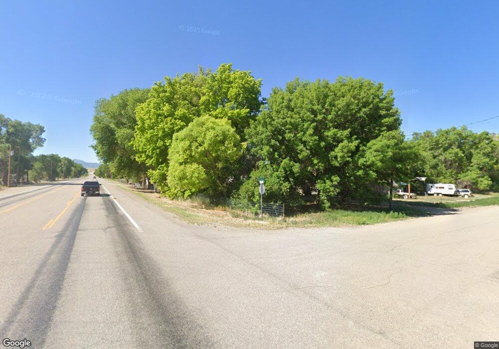
Estimated Value: $34,000
--
Bed
--
Bath
--
Sq Ft
10.12
Acres
About This Home
This home is located at 0 N Sawblade Cir Unit 2594767, Lund, NV 89317 and is currently estimated at $34,000. 0 N Sawblade Cir Unit 2594767 is a home located in White Pine County with nearby schools including Lund High School.
Ownership History
Date
Name
Owned For
Owner Type
Purchase Details
Closed on
Mar 23, 2025
Sold by
Pierce Daniel R and Pierce Megan M
Bought by
Kelly Kezia and Kelly Nathan
Current Estimated Value
Home Financials for this Owner
Home Financials are based on the most recent Mortgage that was taken out on this home.
Original Mortgage
$28,000
Outstanding Balance
$26,402
Interest Rate
6.65%
Mortgage Type
Balloon
Estimated Equity
$7,598
Purchase Details
Closed on
Oct 6, 2022
Sold by
Northern Nevada High Sierra Llc
Bought by
Pierce Daniel R and Pierce Megan M
Purchase Details
Closed on
Sep 12, 2022
Sold by
Nevada Trust Deed Services
Bought by
Northern Nevada High Sierra Llc
Purchase Details
Closed on
Jul 17, 2020
Sold by
Wade Finkenbinder-Gardner and Wade Robert
Bought by
Gardner Robert Wade
Home Financials for this Owner
Home Financials are based on the most recent Mortgage that was taken out on this home.
Original Mortgage
$23,600
Interest Rate
3.1%
Mortgage Type
New Conventional
Create a Home Valuation Report for This Property
The Home Valuation Report is an in-depth analysis detailing your home's value as well as a comparison with similar homes in the area
Home Values in the Area
Average Home Value in this Area
Purchase History
| Date | Buyer | Sale Price | Title Company |
|---|---|---|---|
| Kelly Kezia | $35,000 | Stewart Title | |
| Pierce Daniel R | $26,000 | Stewart Title | |
| Northern Nevada High Sierra Llc | $23,590 | -- | |
| Gardner Robert Wade | $29,500 | Stewart Title |
Source: Public Records
Mortgage History
| Date | Status | Borrower | Loan Amount |
|---|---|---|---|
| Open | Kelly Kezia | $28,000 | |
| Previous Owner | Gardner Robert Wade | $23,600 |
Source: Public Records
Tax History Compared to Growth
Tax History
| Year | Tax Paid | Tax Assessment Tax Assessment Total Assessment is a certain percentage of the fair market value that is determined by local assessors to be the total taxable value of land and additions on the property. | Land | Improvement |
|---|---|---|---|---|
| 2025 | $234 | $9,716 | $9,716 | -- |
| 2024 | $234 | $9,662 | $9,662 | $0 |
| 2023 | $234 | $8,479 | $8,479 | $0 |
| 2022 | $200 | $8,479 | $8,479 | $0 |
| 2021 | $186 | $8,479 | $8,479 | $0 |
| 2020 | $176 | $8,479 | $8,479 | $0 |
| 2019 | $163 | $8,600 | $8,600 | $0 |
| 2018 | $152 | $8,600 | $8,600 | $0 |
| 2017 | $142 | $8,600 | $8,600 | $0 |
| 2016 | $138 | $9,350 | $9,350 | $0 |
| 2015 | $132 | $3,602 | $3,602 | $0 |
| 2014 | $132 | $3,602 | $3,602 | $0 |
Source: Public Records
Map
Nearby Homes
- 855 N East 1st St
- 840 N. 1st St E
- 229 S 1st St E
- 45 N Elm
- 5029 Ellison Rd
- 10 E Ward Mountain Dr
- 175 E Ward Mountain Dr
- 252 Bergara Ave
- 10 S 10th St E
- 0 Blue Diamond Unit 2689876
- 0 Mosier View Road Area
- 0 Pinyon Pine Ln
- 2460 Mineral Dr
- 2345 Opal Dr
- 2327 Iron Dr
- 1142 Murry St
- 1001 Mill St
- 786 Mill St
- 623 Murry St
- 39 Connors Ct
- 0 N Sawblade Cir Unit 2643432
- 921 N Sawblade Cir
- 920 N Sawblade Cir
- 910 N Sawblade Cir
- 860 N 1st West St W
- 931 N Lone Pine Cir
- 855 N 1st St
- 840 N 1st West St E
- 860 N 1st East St E
- 815 N 1st East St E
- 930 N Lone Pine Cir
- 840 N 1st East St E
- 970 N 1st W
- 201 W 8th St
- 920 E Saw Cir
- 12 E 900th North St N
- 12 N. 62 E Apn 01134026
- 12 N 62 E
- 160 W 9th St N
- 1001 N Highway 318
