0 Nsa (Holst Rd ) Unit 10086369 Boring, OR 97009
Estimated Value: $894,000
--
Bed
--
Bath
--
Sq Ft
29.32
Acres
About This Home
This home is located at 0 Nsa (Holst Rd ) Unit 10086369, Boring, OR 97009 and is currently estimated at $894,000. 0 Nsa (Holst Rd ) Unit 10086369 is a home located in Clackamas County with nearby schools including Naas Elementary School, Boring Middle School, and Sandy High School.
Ownership History
Date
Name
Owned For
Owner Type
Purchase Details
Closed on
Mar 22, 2011
Sold by
Pacific West Bank
Bought by
Townsend Enterprises Llc
Current Estimated Value
Purchase Details
Closed on
Sep 16, 2004
Sold by
Federal National Mortgage Association
Bought by
Kilstrom Lonn K
Home Financials for this Owner
Home Financials are based on the most recent Mortgage that was taken out on this home.
Original Mortgage
$206,050
Interest Rate
6.25%
Mortgage Type
Purchase Money Mortgage
Create a Home Valuation Report for This Property
The Home Valuation Report is an in-depth analysis detailing your home's value as well as a comparison with similar homes in the area
Home Values in the Area
Average Home Value in this Area
Purchase History
| Date | Buyer | Sale Price | Title Company |
|---|---|---|---|
| Townsend Enterprises Llc | $170,000 | First Amer Title Ins Co Or | |
| Kilstrom Lonn K | $257,599 | Fidelity National Title Co |
Source: Public Records
Mortgage History
| Date | Status | Borrower | Loan Amount |
|---|---|---|---|
| Previous Owner | Kilstrom Lonn K | $206,050 |
Source: Public Records
Tax History Compared to Growth
Tax History
| Year | Tax Paid | Tax Assessment Tax Assessment Total Assessment is a certain percentage of the fair market value that is determined by local assessors to be the total taxable value of land and additions on the property. | Land | Improvement |
|---|---|---|---|---|
| 2025 | $696 | $48,206 | -- | -- |
| 2024 | $665 | $46,818 | -- | -- |
| 2023 | $665 | $45,462 | $0 | $0 |
| 2022 | $608 | $44,160 | $0 | $0 |
| 2021 | $587 | $42,888 | $0 | $0 |
| 2020 | $572 | $41,647 | $0 | $0 |
| 2019 | $569 | $40,438 | $0 | $0 |
| 2018 | $553 | $39,281 | $0 | $0 |
| 2017 | $541 | $38,131 | $0 | $0 |
| 2016 | $517 | $37,038 | $0 | $0 |
| 2015 | $501 | $35,839 | $0 | $0 |
| 2014 | $486 | $34,605 | $0 | $0 |
Source: Public Records
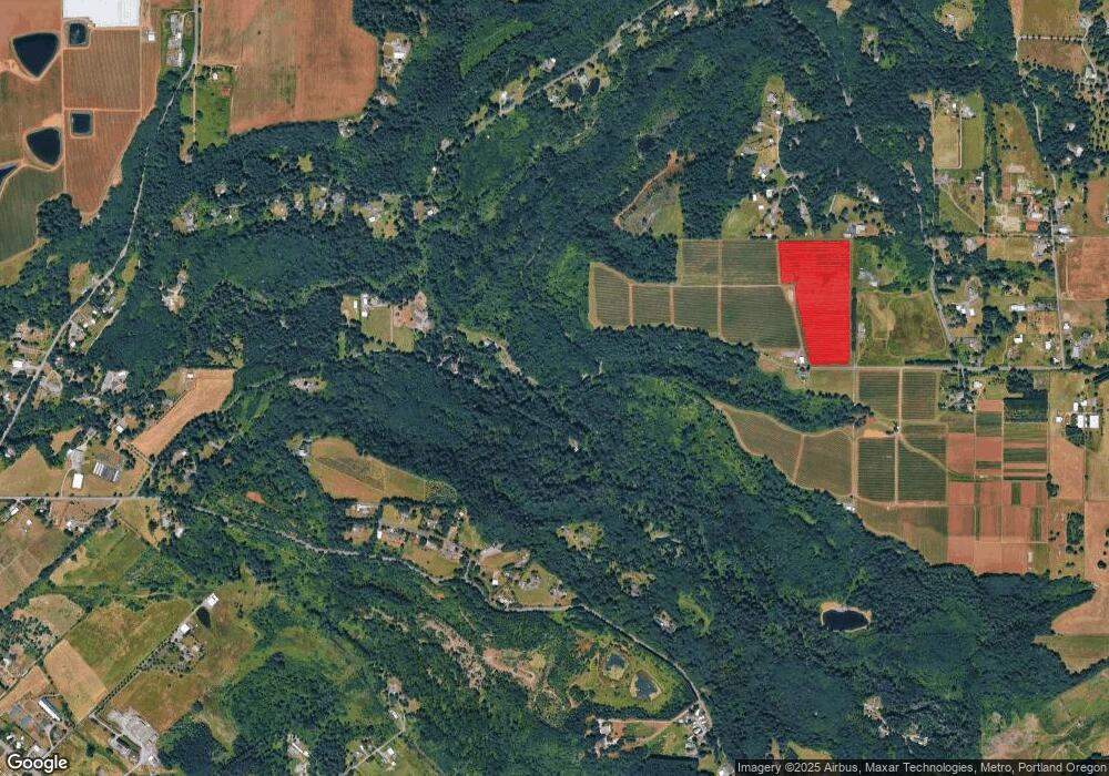
Map
Nearby Homes
- 17222 SE Tickle Creek Rd
- 29254 SE Hillyard Dr
- 17501 SE Fosberg Rd
- 29201 SE Hillyard Dr
- 29990 SE Knox Rd
- 18949 SE Tickle Creek Rd
- 30444 SE Judd Rd
- 32700 SE Leewood (#53) Ln Unit 53
- 15550 SE Tickle Creek Rd
- 28080 SE Highway 224
- 26475 SE Highway 224
- 32700 SE Leewood Ln Unit 53
- 32700 SE Leewood Ln Unit 29
- 32700 SE Leewood Ln Unit 108
- 32700 SE Leewood Ln Unit 71
- 32700 SE Leewood Ln Unit 41
- 34000 SE Colorado Rd
- 31909 SE Highway 211
- 26190 SE Highway 224
- 32370 SE Judd Rd
- 17825 SE Tickle Creek Rd
- 17820 SE Tickle Creek Rd
- 29777 SE Holst Rd
- 17800 SE Tickle Creek Rd
- 17650 SE Tickle Creek Rd
- 29630 SE Holst Rd
- 17755 SE Decker Rd
- 17835 SE Tickle Creek Rd
- 17835 SE Tickle Creek Rd
- 29525 SE Holst Rd
- 17860 SE Tickle Creek Rd
- 17733 SE Decker Rd
- 17507 SE Tickle Creek Rd
- 17600 SE Tickle Creek Rd
- 17890 SE Tickle Creek Rd
- 17905 SE Tickle Creek Rd
- 17447 SE Tickle Creek Rd
- 29600 SE Hillyard Dr
- 17525 SE Decker Rd
- 29622 SE Hillyard Dr