0 S Highway 61 Muscatine, IA 52761
Estimated payment $3,769/month
About This Lot
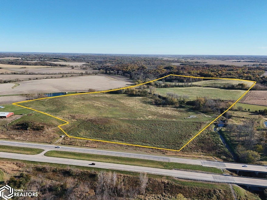
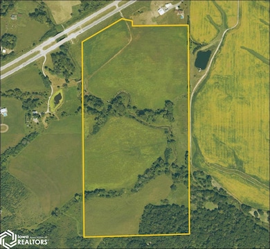
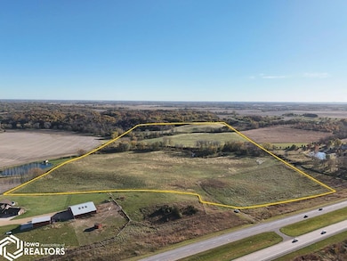
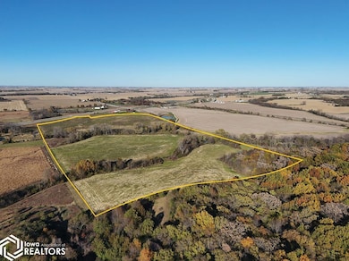
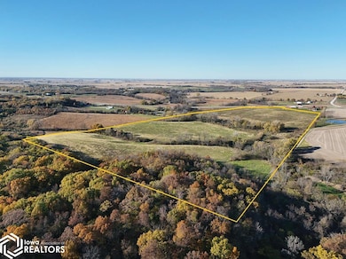
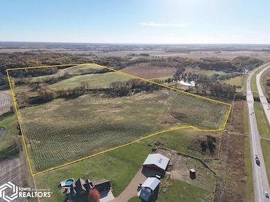
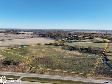
80.15 acres, m/l, located 6 miles northeast of Muscatine, Iowa, on the south side of US Hwy 61. This gently rolling farm has an estimated 59.06 FSA/Eff. crop acres. This is a well-maintained pasture farm with newly constructed fences around the boundaries. This farm would work well for a cow/calf or cattle operation.
Property Details
Property Type
- Land
Lot Details
- Lot Has A Rolling Slope
- Property is zoned Agriculture
Map
Home Values in the Area
Average Home Value in this Area
Property History
| Date | Event | Price | List to Sale | Price per Sq Ft |
|---|---|---|---|---|
| 11/14/2025 11/14/25 | For Sale | $601,125 | -- | -- |
Source: NoCoast MLS
MLS Number: NOC6333706
Disclaimer: Certain information contained herein is derived from information provided by parties other than Homes.com. All information provided is deemed reliable, but is not guaranteed to be accurate and should be independently verified.
![]() IDX information is provided exclusively for personal, non-commercial use, and may not be used for any purpose other than to identify prospective properties consumers may be interested in purchasing.
IDX information is provided exclusively for personal, non-commercial use, and may not be used for any purpose other than to identify prospective properties consumers may be interested in purchasing.
Information is deemed reliable but not guaranteed.
- 3250 S Highway 61
- 2216 New Hampshire St
- 3120 Linden Ln
- 208 Fletcher Ave
- 1410 Duncan Dr
- 1416 Duncan Dr
- 1421 Duncan Dr
- 1503 Duncan Dr
- 1507 Duncan Dr
- 3103 Ginkgo Ln
- 219 Pond St
- 1604 Duncan Dr
- 111 Gilbert St
- 3010 W Fulliam Ave
- 1055 Climer St
- 2006 Angle St
- 1903 Hershey Ave
- 1827 Hershey Ave
- 1617 W Acre Dr
- 2109 Americana Ave
- 2442 Mittman Rd
- 1816 Logan St Unit K-2
- 612 Chestnut St Unit 4
- 307 W 3rd St
- 326 W 2nd St
- 301 2nd St W Unit 4
- 220 Iowa Ave
- 3407 Steamboat Way
- 806 Oak St
- 1220 Kirstin Ct Unit Kirstin 1
- 611 Fairview Ave
- 158 Colorado St Unit 306
- 2301 University Dr
- 801 W 5th St
- 14401 134th Ave W
- 18 Elmwood Dr
- 333-337 S Parker St
- 125 E Bryant St Unit 125.5
- 38 Grant Ave Unit GR38
- 320 Historic Dr
