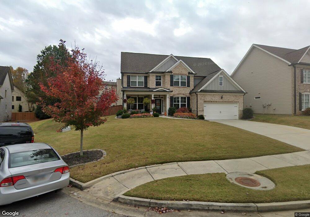
0 Silvertop Rd Unit 170 7637131 Grayson, GA 30017
Estimated Value: $504,000 - $544,000
4
Beds
4
Baths
3,140
Sq Ft
$165/Sq Ft
Est. Value
About This Home
This home is located at 0 Silvertop Rd Unit 170 7637131, Grayson, GA 30017 and is currently estimated at $516,798, approximately $164 per square foot. 0 Silvertop Rd Unit 170 7637131 is a home located in Gwinnett County with nearby schools including Starling Elementary School, Couch Middle School, and Grayson High School.
Ownership History
Date
Name
Owned For
Owner Type
Purchase Details
Closed on
Nov 17, 2020
Sold by
Hpa Us1 Llc
Bought by
Hpa Ii Borrower 2020 2 Llc
Current Estimated Value
Home Financials for this Owner
Home Financials are based on the most recent Mortgage that was taken out on this home.
Original Mortgage
$235,536,992
Outstanding Balance
$94,553,476
Interest Rate
2.8%
Mortgage Type
Commercial
Estimated Equity
-$94,036,678
Purchase Details
Closed on
Jan 28, 2020
Sold by
Livingston Dorian Elizabeth
Bought by
Hpa Us1 Llc
Purchase Details
Closed on
Dec 20, 2006
Sold by
Delta Ents Inc
Bought by
Livingston Dorian E
Home Financials for this Owner
Home Financials are based on the most recent Mortgage that was taken out on this home.
Original Mortgage
$323,413
Interest Rate
6.31%
Mortgage Type
New Conventional
Create a Home Valuation Report for This Property
The Home Valuation Report is an in-depth analysis detailing your home's value as well as a comparison with similar homes in the area
Home Values in the Area
Average Home Value in this Area
Purchase History
We collect this data history from publicly available records. To have your information removed, we recommend requesting removal directly through your county’s website.
| Date | Buyer | Sale Price | Title Company |
|---|---|---|---|
| Hpa Ii Borrower 2020 2 Llc | -- | -- | |
| Hpa Ii Borrower 2020 2 Llc | -- | -- | |
| Hpa Us1 Llc | $292,900 | -- | |
| Hpa Us1 Llc | $292,900 | -- | |
| Livingston Dorian E | $323,500 | -- | |
| Livingston Dorian E | $323,500 | -- |
Source: Public Records
Mortgage History
We collect this data history from publicly available records. To have your information removed, we recommend requesting removal directly through your county’s website.
| Date | Status | Borrower | Loan Amount |
|---|---|---|---|
| Open | Hpa Ii Borrower 2020 2 Llc | $235,536,992 | |
| Previous Owner | Livingston Dorian E | $323,413 |
Source: Public Records
Tax History
| Year | Tax Paid | Tax Assessment Tax Assessment Total Assessment is a certain percentage of the fair market value that is determined by local assessors to be the total taxable value of land and additions on the property. | Land | Improvement |
|---|---|---|---|---|
| 2025 | $7,507 | $203,280 | $46,800 | $156,480 |
| 2024 | $7,586 | $203,280 | $46,800 | $156,480 |
| 2023 | $7,586 | $203,280 | $46,800 | $156,480 |
| 2022 | $4,490 | $117,160 | $28,000 | $89,160 |
| 2021 | $4,551 | $117,160 | $28,000 | $89,160 |
| 2020 | $4,577 | $131,160 | $28,000 | $103,160 |
| 2019 | $4,589 | $122,320 | $26,000 | $96,320 |
| 2018 | $4,596 | $122,320 | $26,000 | $96,320 |
| 2016 | $4,244 | $111,960 | $26,000 | $85,960 |
| 2015 | $3,589 | $98,040 | $20,000 | $78,040 |
| 2014 | -- | $102,560 | $20,000 | $82,560 |
Source: Public Records
Map
Nearby Homes
- 176 Cypress Cove Ct
- 536 Sageton Ct
- 339 Oatgrass Dr
- 1345 Chandler Rd Unit 1
- 298 Ryston Way
- 295 Helens Manor Dr
- 338 Ryston Way
- 12 Wild Oat Ct
- 1495 Bowman Rd
- 394 Easley Dr
- 1215 Donington Cir
- 21 Wild Oat Ct
- 413 Easley Dr SE
- 1393 Sutters Walk
- 1098 Leybourne Cove
- 1729 Chandler Rd
- 1169 Leybourne Cove
- 145 Millennial Ct
- 1328 Avington Glen Dr
- 1214 Little Hampton Dr
- 104 Silver Top Dr SE
- 104 Silvertop Dr Unit 104
- 104 Silvertop Dr Unit 170
- 104 Silvertop Dr
- 94 Silvertop Dr
- 94 Silver Top Dr SE
- 114 Silver Top Dr SE
- 114 Silvertop Dr
- 114 Silvertop Dr Unit 114
- 84 Silvertop Dr
- 103 Silvertop Dr
- 124 Silvertop Dr
- 113 Silvertop Dr
- 93 Silvertop Dr
- 1474 Wild Rye Ln
- 1464 Wild Rye Ln
- 364 Silvertop Dr Unit 2
- 374 Silvertop Dr
- 123 Silvertop Dr
- 123 Silvertop Dr Unit 207
Your Personal Tour Guide
Ask me questions while you tour the home.