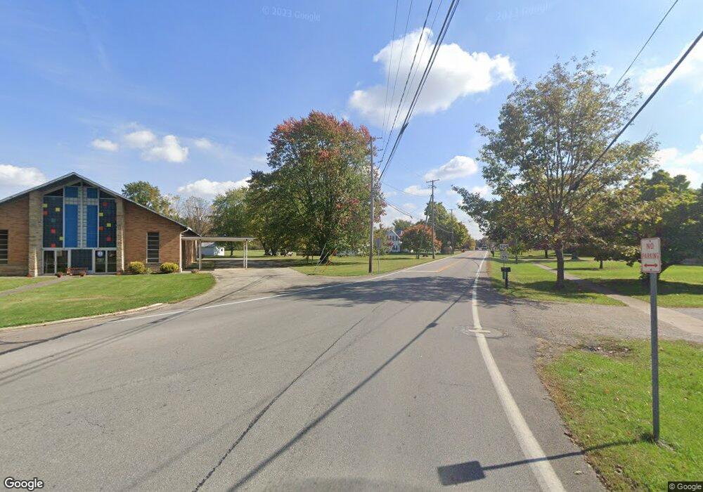
0 State Route 529 Unit 9032765 Cardington, OH 43315
--
Bed
--
Bath
--
Sq Ft
32.91
Acres
About This Home
This home is located at 0 State Route 529 Unit 9032765, Cardington, OH 43315. 0 State Route 529 Unit 9032765 is a home located in Morrow County with nearby schools including Cardington-Lincoln Elementary School, Cardington Intermediate School, and Cardington-Lincoln High School.
Ownership History
Date
Name
Owned For
Owner Type
Purchase Details
Closed on
Jan 15, 2020
Sold by
Treadway Connie F
Bought by
Treadway Connie F
Home Financials for this Owner
Home Financials are based on the most recent Mortgage that was taken out on this home.
Interest Rate
3.64%
Purchase Details
Closed on
Jul 7, 2016
Sold by
Treadway Connie F
Bought by
Connie F Treadway
Home Financials for this Owner
Home Financials are based on the most recent Mortgage that was taken out on this home.
Interest Rate
3.41%
Purchase Details
Closed on
Feb 18, 2015
Sold by
Treadway Roger M
Bought by
Treadway Connie F
Home Financials for this Owner
Home Financials are based on the most recent Mortgage that was taken out on this home.
Interest Rate
3.69%
Purchase Details
Closed on
May 12, 1994
Bought by
Treadway Roger M
Create a Home Valuation Report for This Property
The Home Valuation Report is an in-depth analysis detailing your home's value as well as a comparison with similar homes in the area
Home Values in the Area
Average Home Value in this Area
Purchase History
| Date | Buyer | Sale Price | Title Company |
|---|---|---|---|
| Treadway Connie F | -- | -- | |
| Connie F Treadway | -- | -- | |
| Treadway Connie F | -- | -- | |
| Treadway Roger M | -- | -- |
Source: Public Records
Mortgage History
| Date | Status | Borrower | Loan Amount |
|---|---|---|---|
| Closed | Treadway Connie F | -- | |
| Previous Owner | Treadway Connie F | -- | |
| Previous Owner | Treadway Connie F | -- |
Source: Public Records
Tax History Compared to Growth
Tax History
| Year | Tax Paid | Tax Assessment Tax Assessment Total Assessment is a certain percentage of the fair market value that is determined by local assessors to be the total taxable value of land and additions on the property. | Land | Improvement |
|---|---|---|---|---|
| 2024 | $1,304 | $45,190 | $45,190 | $0 |
| 2023 | $1,304 | $45,190 | $45,190 | $0 |
| 2022 | $761 | $47,460 | $47,460 | $0 |
| 2021 | $753 | $47,460 | $47,460 | $0 |
| 2020 | $743 | $47,460 | $47,460 | $0 |
| 2019 | $1,275 | $46,590 | $46,590 | $0 |
| 2018 | $1,273 | $46,590 | $46,590 | $0 |
| 2017 | $1,269 | $46,590 | $46,590 | $0 |
| 2016 | $1,277 | $33,290 | $33,290 | $0 |
| 2015 | $1,260 | $35,280 | $35,280 | $0 |
| 2014 | $1,283 | $35,280 | $35,280 | $0 |
| 2013 | $742 | $32,270 | $32,270 | $0 |
Source: Public Records
Map
Nearby Homes
- 3085 County Road 24
- 0 County Road 124 Unit 9069214
- 0 County Road 124 Unit 225033978
- 2837 State Route 529
- 0 State Route 61
- 001 State Route 61
- Lot 0 Chesterville Ave
- 4014 State Route 61
- 221 Nichols St
- 3845 Township Road 26
- 3635 Township Road 26
- 128 Gilead St
- 4511 U S 42
- 327 S Marion St
- 134 E Main St
- 343 E Williams St
- 329 N Marion St
- 332 W Main St
- 423 Douglas St
- Lot 3 County Road 25
- 0 State Route 529 Unit 3930892
- 0 State Route 529 Unit 1034158
- 0 State Route 529 Unit 221042271
- 0 State Route 529 Unit 10049609
- 0 State Route 529 Unit 215001403
- 0 State Route 529 Unit 216009580
- 0 State Route 529 Unit 217028902
- 0 State Route 529 Unit 219009822
- 0 State Route 529 Unit REAR 215038018
- 0 State Route 529 Unit 218037903
- 0 State Route 529 Unit 3678909
- 3485 Ohio 529
- 3485 State Route 529
- 3492 State Route 529
- 3492 State Route 529
- 3446 State Highway 529
- 3446 State Route 529
- 3487 State Route 529
- 3494 State Route 529
- 3496 State Route 529
