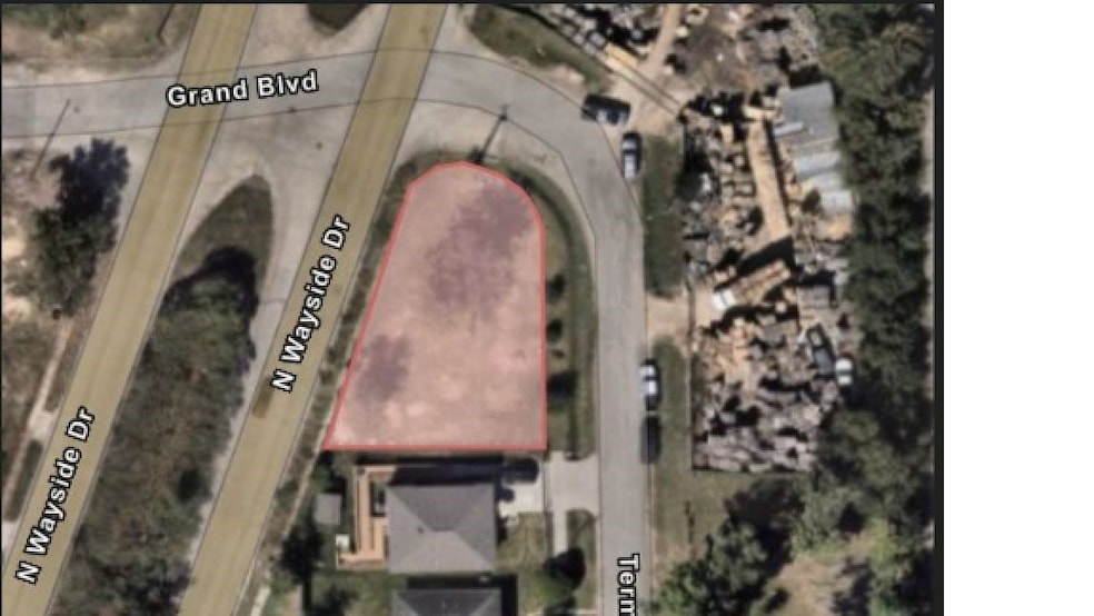
0 Terminal St Houston, TX 77020
Denver Harbor/Port Houston NeighborhoodEstimated payment $327/month
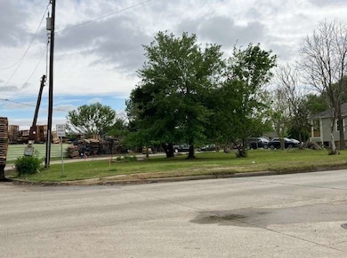
About This Lot
±0.1652-acre (7,197 sq. ft.) tract of land being out of Lots 17, & 18, Block 11, in the Royal Terrace Section 2 subdivision, out of the W.M. Black Survey, A-114, Harris County, TX. This is a City of Houston Bid Sale that will close/end on 12/11/2025 @ 10:30 am.
Property Details
Property Type
- Land
Lot Details
- 7,197 Sq Ft Lot
- Corner Lot
Schools
- Scroggins Elementary School
- Mcreynolds Middle School
- Wheatley High School
Utilities
- Phone Not Available
- Cable TV Not Available
Community Details
- Royal Terrace Subdivision
Map
Home Values in the Area
Average Home Value in this Area
Property History
| Date | Event | Price | List to Sale | Price per Sq Ft |
|---|---|---|---|---|
| 11/06/2025 11/06/25 | For Sale | $52,178 | -- | -- |
Source: Houston Association of REALTORS®
MLS Number: 27280774
Disclaimer: Certain information contained herein is derived from information provided by parties other than Homes.com. All information provided is deemed reliable, but is not guaranteed to be accurate and should be independently verified.
![]() Copyright 2025, Houston REALTORS® Information Service, Inc.
Copyright 2025, Houston REALTORS® Information Service, Inc.
The information provided is exclusively for consumers’ personal, non-commercial use, and may not be used for any purpose other than to identify prospective properties consumers may be interested in purchasing.
Information is deemed reliable but not guaranteed.
- 407 Terminal St
- 7528 Gainesville St
- 0 Hershe Unit 20442971
- 7312 Victoria St
- 0 Harbor
- 2919 N Weyside Divide
- 0 Exchange St
- 7930 Hershe St
- 0 Laredo St Unit 37332894
- 7322 Laredo St
- 7215 Victoria St
- 0 Port St
- 7007 Eagle Pass St
- 7216 Wallisville Rd
- 7201 Force St
- 7120 Brownwood St
- 7205 Hershe St
- 0 Hewrick
- 3415 Hewrick St
- TBD Hewrick St
- 1800 N Wayside Dr Unit 7
- 1800 N Wayside Dr Unit 3
- 1800 N Wayside Dr Unit 23
- 7410 Longview St
- 7322 Laredo St
- 7212 Corpus Christi St Unit A
- 7207 Force St
- 6603 Victoria St
- 6507 Longview St
- 714 Zoe St
- 6208 Force St
- 7214 Corsicana St Unit C
- 441 Hahlo St
- 443 Hahlo St
- 6214 Granton St
- 711 Hahlo St
- 711 Hahlo St Unit Studio
- 6905 Palestine St Unit B
- 6905 Palestine St
- 5906 Hillsboro St
