
00 Cater (East) Rd Warren, OR 97053
Estimated payment $7,290/month
Highlights
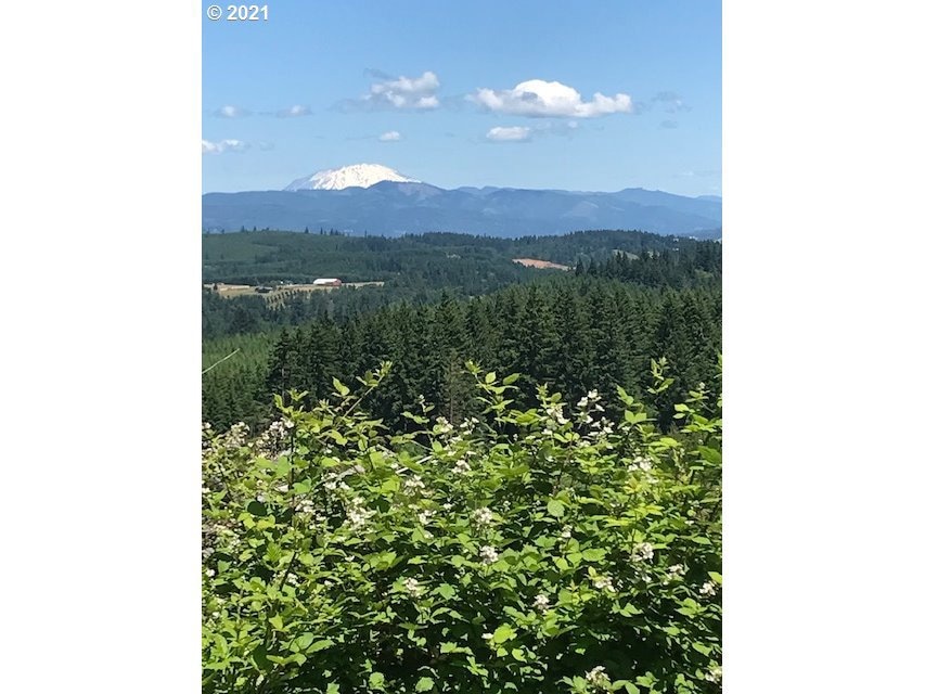
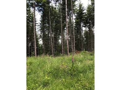
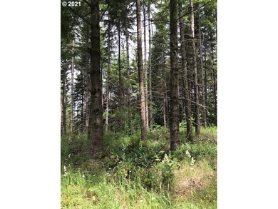
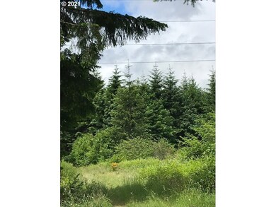
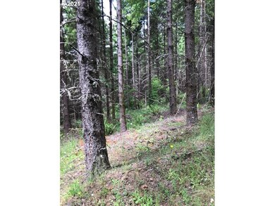
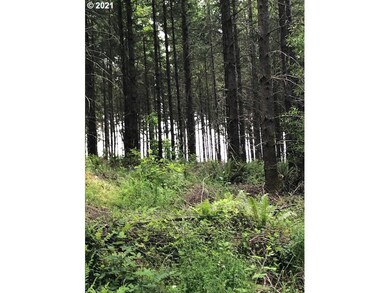
- View of Trees or Woods
- Wooded Lot
- Gentle Sloping Lot
- 80 Acre Lot
- No HOA
- No Heating
About This Lot
80 +/- acre w/COUNTY APPROVED CUP FOR (1) DWELLING located West of the City of St. Helens. There are approx. (49 acres) of 33 yr old Douglas fir, (29 acres) of 8 yr old Douglas fir, and (1.5 acres) Douglas fir in the RMA. Power is nearby. The access easement has recently been paved and a dirt road to the home site has been recently constructed. Buyer to conduct own research/due diligence whether lot(s) buildable per Oregon law. Acreage is approx. Seller retains minerals.
Property Details
Property Type
- Land
Est. Annual Taxes
- $682
Lot Details
- 80 Acre Lot
- Gentle Sloping Lot
- Wooded Lot
- Landscaped with Trees
- Property is zoned PF-80
Property Views
- Woods
- Mountain
Schools
- Warren Elementary School
- St Helens Middle School
- St Helens High School
Utilities
- Phone Available
Community Details
- No Home Owners Association
Listing and Financial Details
- Assessor Parcel Number 15324
Map
Home Values in the Area
Average Home Value in this Area
Tax History
| Year | Tax Paid | Tax Assessment Tax Assessment Total Assessment is a certain percentage of the fair market value that is determined by local assessors to be the total taxable value of land and additions on the property. | Land | Improvement |
|---|---|---|---|---|
| 2025 | $733 | $54,714 | $54,714 | -- |
| 2024 | $745 | $53,120 | $53,120 | -- |
| 2023 | $721 | $51,573 | $51,573 | $0 |
| 2022 | $682 | $50,072 | $50,072 | $0 |
| 2021 | $592 | $48,613 | $48,613 | $0 |
| 2020 | $562 | $47,198 | $47,198 | $0 |
| 2019 | $567 | $45,824 | $45,824 | $0 |
| 2018 | $561 | $44,489 | $44,489 | $0 |
| 2017 | $549 | $43,194 | $43,194 | $0 |
| 2016 | $544 | $41,936 | $41,936 | $0 |
| 2015 | $529 | $40,715 | $40,715 | $0 |
| 2014 | $509 | $39,530 | $39,530 | $0 |
Property History
| Date | Event | Price | List to Sale | Price per Sq Ft |
|---|---|---|---|---|
| 05/01/2025 05/01/25 | Price Changed | $1,379,000 | +15.0% | -- |
| 01/24/2025 01/24/25 | Price Changed | $1,199,000 | +9.5% | -- |
| 04/05/2023 04/05/23 | Price Changed | $1,095,000 | +10.1% | -- |
| 10/14/2022 10/14/22 | For Sale | $995,000 | -- | -- |
Purchase History
| Date | Type | Sale Price | Title Company |
|---|---|---|---|
| Special Warranty Deed | $475,385 | None Available | |
| Special Warranty Deed | $475,385 | None Available |
Source: Regional Multiple Listing Service (RMLS)
MLS Number: 22250767
APN: 0208042110000010000
Disclaimer: Certain information contained herein is derived from information provided by parties other than Homes.com. All information provided is deemed reliable, but is not guaranteed to be accurate and should be independently verified.
![]() The content relating to real estate for sale on this web site comes in part from the IDX program of the RMLS™ of Portland, Oregon. Real estate listings held by brokerage firms other than Ten-X are marked with the RMLS™ logo, and detailed information about these properties includes the names of the listing brokers. Listing content is copyright © 2025 RMLS™, Portland, Oregon. Some properties which appear for sale on this web site may subsequently have sold or may no longer be available. All information provided is deemed reliable but is not guaranteed and should be independently verified.
The content relating to real estate for sale on this web site comes in part from the IDX program of the RMLS™ of Portland, Oregon. Real estate listings held by brokerage firms other than Ten-X are marked with the RMLS™ logo, and detailed information about these properties includes the names of the listing brokers. Listing content is copyright © 2025 RMLS™, Portland, Oregon. Some properties which appear for sale on this web site may subsequently have sold or may no longer be available. All information provided is deemed reliable but is not guaranteed and should be independently verified.
- 0 Cater (East) Rd Unit 798882
- 0 Sunny Hill Ln
- 32084 Brooks Rd
- 33336 Crown Point Dr
- 31917 Brooks Rd
- 58845 Hovland Way
- 33306 Freds Row Ln
- 57827 S Bachelor Flat Rd
- 34198 E Kappler Rd
- 58694 Noble Rd
- 32673 Pittsburg Rd
- 0 Ross Rd
- 58348 Ross Rd
- 0 Wight Dr Unit Lot 3 675106164
- 59255 Lucy Ln
- 59787 Kimmell Ln
- 59666 Kimmell Ln
- 0 Bennett Rd
- 61004 Gensman Rd
- 34941 Bachelor Flat Rd
- 34230 Pittsburg Rd
- 34607 Rocky Ct
- 2600 Gable Rd
- 700 Matzen St
- 515 S 8th St Unit 1
- 52793 NE 1st St Unit 52773
- 52588 NE Sawyer St
- 1473 N Goerig St
- 4125 S Settler Dr
- 1724 W 15th St
- 441 S 69th Place
- 1920 NE 179th St
- 16501 NE 15th St
- 17617 NW Sauvie Island Rd
- 2406 NE 139th St
- 642 Weed Ave
- 1119 Maple St Unit 1137 Maple St
- 13414 NE 23rd Ave
- 13914 NE Salmon Creek Ave
- 10223 NE Notchlog Dr
